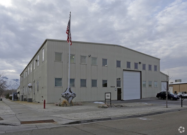
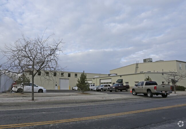
Property Record
1964 Ironton Blvd, Provo, UT 84606
Save to a Folder
{{folder.Name}}
{{folder.ListingIds.length}} Properties
{{folder.ListingIds.length}} Property
Create a New Folder
Property Detail
1964 Ironton Blvd
Provo-Orem-Lehi, UT
LOT 1, PLAT D, NOVATEK AMD SUB AREA 1.076 AC.
47-306-0001
Utah
Lightindustrial
Utah
2025
1
2026
1.08 AC
980500
Utah County
27,848 SF
Salt Lake City
NEARBY LISTINGS FOR SALE OR LEASE
DEMOGRAPHICS near 1964 Ironton Blvd
1 mile
3 mile
5 mile
2025 Total Population
1,921
49,709
155,495
2030 Population
2,125
54,490
171,288
Pop Growth 2025-2030
+ 10.62%
+ 9.62%
+ 10.16%
Average Age
29
31
30
2025 Total Households
524
15,973
47,180
HH Growth 2025-2030
+ 11.45%
+ 10.37%
+ 11.30%
Median Household Inc
$93,375
$73,577
$68,962
Avg Household Size
3.50
3.00
3.00
2025 Avg HH Vehicles
2.00
2.00
2.00
Median Home Value
$464,583
$455,253
$489,725
Median Year Built
1998
1990
1990
Nearby Places
Map Layers
Map Styles
 Street
 Aerial
Layers
 Traffic
 Biking
Places
Listings with unknown addresses are not visible on the map
- Restaurants
- Banks
- Shops
- Fitness
- Groceries
PUBLIC TRANSPORTATION
COMMUTER RAIL
Drive
Walk
Distance
6 min
3.2 mi
Drive
Walk
Distance
7 min
3.4 mi
AIRPORT
Provo Municipal
Drive
Walk
Distance
Provo Municipal
11 min
5.9 mi
Nearby Properties
Address
Land Use
TOTAL SIZE
Lot Size
Zoning
Address
Land Use
TOTAL SIZE
Lot Size
Zoning
442,598 SF
22.94 AC
Address
Land Use
TOTAL SIZE
Lot Size
Zoning
138,990 SF
2.87 AC
Address
Land Use
TOTAL SIZE
Lot Size
Zoning
140,416 SF
30.28 AC
Address
Land Use
TOTAL SIZE
Lot Size
Zoning
297,467 SF
16.87 AC
Address
Land Use
TOTAL SIZE
Lot Size
Zoning
286,188 SF
13.63 AC
Address
Land Use
TOTAL SIZE
Lot Size
Zoning
269,742 SF
16.30 AC
Address
Land Use
TOTAL SIZE
Lot Size
Zoning
672,579 SF
59.02 AC
Address
Land Use
TOTAL SIZE
Lot Size
Zoning
370,735 SF
18.54 AC
Address
Land Use
TOTAL SIZE
Lot Size
Zoning
222,848 SF
11.14 AC
Address
Land Use
TOTAL SIZE
Lot Size
Zoning
174,883 SF
17.42 AC
Address
Land Use
TOTAL SIZE
Lot Size
Zoning
422,224 SF
128.19 AC
Address
Land Use
TOTAL SIZE
Lot Size
Zoning
68,681 SF
4.75 AC
Address
Land Use
TOTAL SIZE
Lot Size
Zoning
208,492 SF
12.49 AC
Address
Land Use
TOTAL SIZE
Lot Size
Zoning
177,428 SF
9.83 AC
Address
Land Use
TOTAL SIZE
Lot Size
Zoning
240,674 SF
19.41 AC
Address
Land Use
TOTAL SIZE
Lot Size
Zoning
151,447 SF
16.14 AC
Address
Land Use
TOTAL SIZE
Lot Size
Zoning
238,651 SF
14.45 AC
Address
Land Use
TOTAL SIZE
Lot Size
Zoning
125,729 SF
12.84 AC
Address
Land Use
TOTAL SIZE
Lot Size
Zoning
170,273 SF
9.19 AC
Address
Land Use
TOTAL SIZE
Lot Size
Zoning
233,451 SF
1.73 AC
Address
Land Use
TOTAL SIZE
Lot Size
Zoning
141,566 SF
7.89 AC
Address
Land Use
TOTAL SIZE
Lot Size
Zoning
231,991 SF
13.76 AC
Address
Land Use
TOTAL SIZE
Lot Size
Zoning
151,447 SF
8.61 AC
Address
Land Use
TOTAL SIZE
Lot Size
Zoning
124,986 SF
8.67 AC
Address
Land Use
TOTAL SIZE
Lot Size
Zoning
128,650 SF
10 AC
Address
Land Use
TOTAL SIZE
Lot Size
Zoning
195,248 SF
13.20 AC
Address
Land Use
TOTAL SIZE
Lot Size
Zoning
120,613 SF
5.13 AC
Address
Land Use
TOTAL SIZE
Lot Size
Zoning
265,411 SF
19.28 AC
Address
Land Use
TOTAL SIZE
Lot Size
Zoning
136,548 SF
7.67 AC
Address
Land Use
TOTAL SIZE
Lot Size
Zoning
112,709 SF
8.10 AC
The World's #1 Commercial Real Estate Marketplace
Connect with us
© 2026 CoStar Group
The information above has been obtained from sources believed reliable. While we do not doubt its accuracy we have not verified it and make no guarantee, warranty or representation about it. It is your responsibility to independently confirm its accuracy and completeness. Any projections, opinions, assumptions, or estimates used are for example only and do not represent the current or future performance of the property. The value of this transaction to you depends on tax and other factors which should be evaluated by your tax, financial, and legal advisors. You and your advisors should conduct a careful, independent investigation of the property to determine to your satisfaction the suitability of the property for your needs.