Property Record
2003 Bunker Hill Rd Ne, Washington, DC 20018


NEARBY LISTINGS FOR SALE OR LEASE
Property Detail
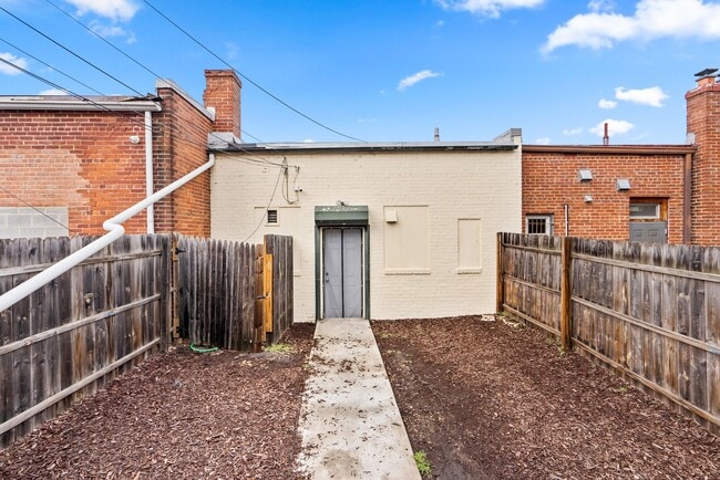
2003 Bunker Hill Rd Ne
Washington-Arlington-Alexandria, DC-VA-MD-WV
Michigan Park
4230-0031
SQUARE 4230 LOT 0031 NBHD: MICHIGAN PARK
Storemultistory
District of Columbia
X
District of Columbia
24033C0128E
31
2025
0.05 AC
2025
Northeast
009400
Washington, DC
1,547 SF
DEMOGRAPHICS near 2003 Bunker Hill Rd Ne
1 Mile
3 Mile
5 Mile
2024 Total Population
23,441
258,448
770,121
2029 Population
21,791
242,634
722,474
Pop Growth 2024-2029
(7.04%)
(6.12%)
(6.19%)
Average Age
40
37
37
2024 Total Households
9,050
102,380
325,752
HH Growth 2024-2029
(7.41%)
(6.70%)
(7.23%)
Median Household Inc
$78,102
$82,981
$90,237
Avg Household Size
2.40
2.40
2.20
2024 Avg HH Vehicles
1.00
1.00
1.00
Median Home Value
$614,487
$585,103
$580,685
Median Year Built
1947
1954
1959
Nearby Places
Map Layers
Map Styles
 Street
 Aerial
- Restaurants
- Banks
- Shops
- Fitness
- Groceries
PUBLIC TRANSPORTATION
COMMUTER RAIL
Riverdale (Camden Line - Maryland Area Regional Commuter Trains (The MARC))
DRIVE
WALK
Distance
Riverdale (Camden Line - Maryland Area Regional Commuter Trains (The MARC))
8 min
3.6 mi
DRIVE
WALK
Distance
8 min
4.4 mi
AIRPORT
Ronald Reagan Washington Ntl
DRIVE
WALK
Distance
Ronald Reagan Washington Ntl
19 min
9.9 mi
Baltimore/Washington International Thurgood Marshall
DRIVE
WALK
Distance
Baltimore/Washington International Thurgood Marshall
43 min
28.0 mi
Washington Dulles International
DRIVE
WALK
Distance
Washington Dulles International
53 min
32.6 mi
Freight Ports
Port of Baltimore
DRIVE
WALK
Distance
Port of Baltimore
51 min
35.6 mi
SALE & LEASE HISTORY
LISTING DATE
SALE/LEASE

Sep 08, 2017
For Lease
May 01, 2024
For Sale
Jun 13, 2023
For Lease
Aug 17, 2023
For Sale
Aug 12, 2024
For Sale
Nearby Properties
Address
Land Use
TOTAL SIZE
Lot Size
Zoning
Address
Land Use
TOTAL SIZE
Lot Size
Zoning
58,289 SF
418.97 AC
MU-4;PDR-1
Address
Land Use
TOTAL SIZE
Lot Size
Zoning
1,583,364 SF
276.66 AC
UNZONED
Address
Land Use
TOTAL SIZE
Lot Size
Zoning
1,562,988 SF
15.33 AC
MU-10 (IZ+
Address
Land Use
TOTAL SIZE
Lot Size
Zoning
1,642,951 SF
95.12 AC
RF-1
Address
Land Use
TOTAL SIZE
Lot Size
Zoning
95.32 AC
RA-1
Address
Land Use
TOTAL SIZE
Lot Size
Zoning
314,995 SF
5.83 AC
D-5
Address
Land Use
TOTAL SIZE
Lot Size
Zoning
1,835,827 SF
34.66 AC
UNZONED
Address
Land Use
TOTAL SIZE
Lot Size
Zoning
589,000 SF
1.39 AC
D-5
Address
Land Use
TOTAL SIZE
Lot Size
Zoning
791,730 SF
37.44 AC
RA-1
Address
Land Use
TOTAL SIZE
Lot Size
Zoning
1,095,275 SF
30.70 AC
MU-4;RA-2
Address
Land Use
TOTAL SIZE
Lot Size
Zoning
823,802 SF
7.30 AC
MU-2
Address
Land Use
TOTAL SIZE
Lot Size
Zoning
2,985,682 SF
4.33 AC
RSF65
Address
Land Use
TOTAL SIZE
Lot Size
Zoning
186,952 SF
9.46 AC
RA-2;RF-1
Address
Land Use
TOTAL SIZE
Lot Size
Zoning
538,974 SF
1.26 AC
PDR-3
Address
Land Use
TOTAL SIZE
Lot Size
Zoning
503,872 SF
1.24 AC
D-5
Address
Land Use
TOTAL SIZE
Lot Size
Zoning
280,000 SF
D-5
Address
Land Use
TOTAL SIZE
Lot Size
Zoning
520,000 SF
2.65 AC
MU-10;RA-5
Address
Land Use
TOTAL SIZE
Lot Size
Zoning
356,114 SF
2.97 AC
D-5
Address
Land Use
TOTAL SIZE
Lot Size
Zoning
360,000 SF
0.86 AC
D-5
Address
Land Use
TOTAL SIZE
Lot Size
Zoning
407,850 SF
Address
Land Use
TOTAL SIZE
Lot Size
Zoning
248,643 SF
8.66 AC
RA-1
Address
Land Use
TOTAL SIZE
Lot Size
Zoning
338,258 SF
1.94 AC
PDR-1;PDR-
Address
Land Use
TOTAL SIZE
Lot Size
Zoning
299,722 SF
0.79 AC
D-5
Address
Land Use
TOTAL SIZE
Lot Size
Zoning
281,204 SF
PDR-1;PDR-
Address
Land Use
TOTAL SIZE
Lot Size
Zoning
280,000 SF
1.55 AC
PDR-1
Address
Land Use
TOTAL SIZE
Lot Size
Zoning
376,766 SF
0.93 AC
D-5
Address
Land Use
TOTAL SIZE
Lot Size
Zoning
1,201,133 SF
41.56 AC
RTOHC
Address
Land Use
TOTAL SIZE
Lot Size
Zoning
402,057 SF
0.58 AC
D-5
Address
Land Use
TOTAL SIZE
Lot Size
Zoning
307,692 SF
0.58 AC
D-5
Address
Land Use
TOTAL SIZE
Lot Size
Zoning
348,844 SF
0.94 AC
D-5
The World's #1 Commercial Real Estate Marketplace
Connect with us
© 2026 CoStar Group
The information above has been obtained from sources believed reliable. While we do not doubt its accuracy we have not verified it and make no guarantee, warranty or representation about it. It is your responsibility to independently confirm its accuracy and completeness. Any projections, opinions, assumptions, or estimates used are for example only and do not represent the current or future performance of the property. The value of this transaction to you depends on tax and other factors which should be evaluated by your tax, financial, and legal advisors. You and your advisors should conduct a careful, independent investigation of the property to determine to your satisfaction the suitability of the property for your needs.