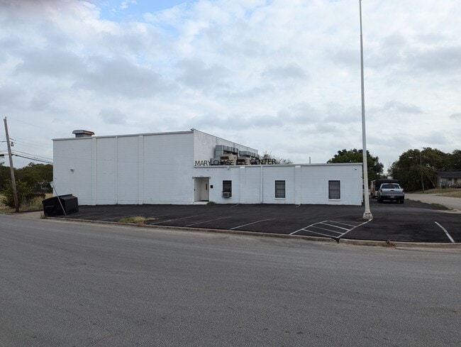
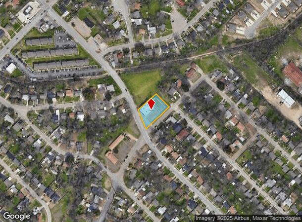
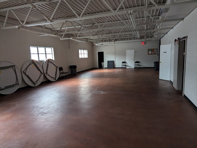
Property Record
2020 Richter Ave, Waco, TX 76711
NEARBY LISTINGS FOR SALE OR LEASE
Property Detail
2020 Richter Ave
Waco, TX
Bush-Carroll
48-006502-008700-0
BUSH-CARROLL LOT 1 2 3 BLOCK B ACRES .4701
Commercialnec
Mclennan
X
Texas
48309C0369D
1
0
0.47 AC
2025
Waco & Killeen
004300
Other Market Areas
8,800 SF
DEMOGRAPHICS near 2020 Richter Ave
1 Mile
3 Mile
5 Mile
2024 Total Population
10,924
75,229
141,147
2029 Population
11,722
79,825
149,449
Pop Growth 2024-2029
+ 7.31%
+ 6.11%
+ 5.88%
Average Age
35
33
36
2024 Total Households
4,035
27,796
53,109
HH Growth 2024-2029
+ 7.66%
+ 6.61%
+ 6.21%
Median Household Inc
$44,505
$40,551
$46,737
Avg Household Size
2.60
2.40
2.40
2024 Avg HH Vehicles
2.00
2.00
2.00
Median Home Value
$67,543
$121,602
$161,478
Median Year Built
1969
1976
1974
Nearby Places
Map Layers
Map Styles
 Street
 Aerial
- Restaurants
- Banks
- Shops
- Fitness
- Groceries
PUBLIC TRANSPORTATION
AIRPORT
Waco Regional
DRIVE
WALK
Distance
Waco Regional
23 min
11.0 mi
Freight Ports
Port of Houston
DRIVE
WALK
Distance
Port of Houston
217 min
188.9 mi
SALE & LEASE HISTORY
LISTING DATE
SALE/LEASE

Dec 10, 2024
For Lease
Nearby Properties
Address
Land Use
TOTAL SIZE
Lot Size
Zoning
Address
Land Use
TOTAL SIZE
Lot Size
Zoning
Address
Land Use
TOTAL SIZE
Lot Size
Zoning
549,274 SF
34.05 AC
O2
Address
Land Use
TOTAL SIZE
Lot Size
Zoning
347,331 SF
50.71 AC
C2
Address
Land Use
TOTAL SIZE
Lot Size
Zoning
120,623 SF
55.15 AC
2007 TIF
Address
Land Use
TOTAL SIZE
Lot Size
Zoning
693,933 SF
57.98 AC
M2
Address
Land Use
TOTAL SIZE
Lot Size
Zoning
78.95 AC
Address
Land Use
TOTAL SIZE
Lot Size
Zoning
560,620 SF
3.70 AC
O2
Address
Land Use
TOTAL SIZE
Lot Size
Zoning
576,501 SF
4.21 AC
Address
Land Use
TOTAL SIZE
Lot Size
Zoning
452,498 SF
39.43 AC
C-2
Address
Land Use
TOTAL SIZE
Lot Size
Zoning
394,674 SF
21.31 AC
O2
Address
Land Use
TOTAL SIZE
Lot Size
Zoning
285,829 SF
17.35 AC
Address
Land Use
TOTAL SIZE
Lot Size
Zoning
206,452 SF
11.97 AC
2007 TIF
Address
Land Use
TOTAL SIZE
Lot Size
Zoning
339,476 SF
Address
Land Use
TOTAL SIZE
Lot Size
Zoning
255,615 SF
18.58 AC
Address
Land Use
TOTAL SIZE
Lot Size
Zoning
250,924 SF
17.73 AC
O-2
Address
Land Use
TOTAL SIZE
Lot Size
Zoning
248,132 SF
11.51 AC
R3C
Address
Land Use
TOTAL SIZE
Lot Size
Zoning
27.28 AC
C
Address
Land Use
TOTAL SIZE
Lot Size
Zoning
289,245 SF
18.02 AC
C1
Address
Land Use
TOTAL SIZE
Lot Size
Zoning
263,557 SF
12 AC
Address
Land Use
TOTAL SIZE
Lot Size
Zoning
291,167 SF
13.61 AC
R
Address
Land Use
TOTAL SIZE
Lot Size
Zoning
399,747 SF
2.86 AC
C-3,C
Address
Land Use
TOTAL SIZE
Lot Size
Zoning
674,900 SF
87.44 AC
M2
Address
Land Use
TOTAL SIZE
Lot Size
Zoning
106,633 SF
1.98 AC
C2
Address
Land Use
TOTAL SIZE
Lot Size
Zoning
462,987 SF
36.18 AC
C-3
Address
Land Use
TOTAL SIZE
Lot Size
Zoning
24.75 AC
O2
Address
Land Use
TOTAL SIZE
Lot Size
Zoning
213,814 SF
7.05 AC
2007 TIF
Address
Land Use
TOTAL SIZE
Lot Size
Zoning
34,723 SF
0.72 AC
Address
Land Use
TOTAL SIZE
Lot Size
Zoning
405,640 SF
64.46 AC
Address
Land Use
TOTAL SIZE
Lot Size
Zoning
219,869 SF
11.13 AC
C2
Address
Land Use
TOTAL SIZE
Lot Size
Zoning
459,747 SF
36.13 AC
M2
The World's #1 Commercial Real Estate Marketplace
Connect with us
© 2026 CoStar Group
The information above has been obtained from sources believed reliable. While we do not doubt its accuracy we have not verified it and make no guarantee, warranty or representation about it. It is your responsibility to independently confirm its accuracy and completeness. Any projections, opinions, assumptions, or estimates used are for example only and do not represent the current or future performance of the property. The value of this transaction to you depends on tax and other factors which should be evaluated by your tax, financial, and legal advisors. You and your advisors should conduct a careful, independent investigation of the property to determine to your satisfaction the suitability of the property for your needs.