Property Record
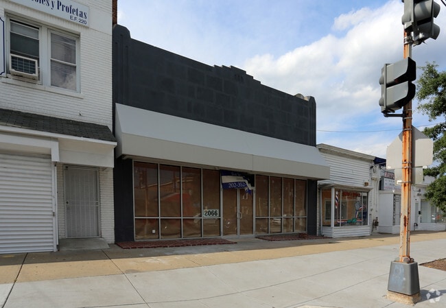
2066 Rhode Island Ave Ne, Washington, DC 20018

NEARBY LISTINGS FOR SALE OR LEASE
Property Detail
2066 Rhode Island Ave Ne
Washington-Arlington-Alexandria, DC-VA-MD-WV
Woodridge
4219-0823
SQUARE 4219 LOT 0823 NBHD: WOODRIDGE
Storemultistory
District of Columbia
X
District of Columbia
1100010036C
823
2025
0.08 AC
2025
Northeast
009400
Washington, DC
2,609 SF
DEMOGRAPHICS near 2066 Rhode Island Ave Ne
1 Mile
3 Mile
5 Mile
2024 Total Population
22,298
276,823
755,787
2029 Population
20,403
257,815
707,111
Pop Growth 2024-2029
(8.50%)
(6.87%)
(6.44%)
Average Age
40
37
37
2024 Total Households
8,640
116,573
321,575
HH Growth 2024-2029
(9.18%)
(7.53%)
(7.52%)
Median Household Inc
$79,702
$86,435
$88,766
Avg Household Size
2.30
2.20
2.20
2024 Avg HH Vehicles
1.00
1.00
1.00
Median Home Value
$659,759
$621,080
$556,904
Median Year Built
1947
1955
1959
Nearby Places
Map Layers
Map Styles
 Street
 Aerial
- Restaurants
- Banks
- Shops
- Fitness
- Groceries
PUBLIC TRANSPORTATION
COMMUTER RAIL
DRIVE
WALK
Distance
7 min
3.2 mi
Union Station (Red Line - Washington Metropolitan Area Transit Authority Metrorail (Metrorail))
DRIVE
WALK
Distance
Union Station (Red Line - Washington Metropolitan Area Transit Authority Metrorail (Metrorail))
8 min
3.4 mi
AIRPORT
Ronald Reagan Washington Ntl
DRIVE
WALK
Distance
Ronald Reagan Washington Ntl
17 min
9.1 mi
Baltimore/Washington International Thurgood Marshall
DRIVE
WALK
Distance
Baltimore/Washington International Thurgood Marshall
43 min
28.0 mi
Washington Dulles International
DRIVE
WALK
Distance
Washington Dulles International
51 min
31.9 mi
Freight Ports
Port of Baltimore
DRIVE
WALK
Distance
Port of Baltimore
51 min
34.3 mi
SALE & LEASE HISTORY
LISTING DATE
SALE/LEASE

Sep 25, 2016
For Lease
Dec 14, 2016
For Sale
Apr 03, 2018
For Lease
Nearby Properties
Address
Land Use
TOTAL SIZE
Lot Size
Zoning
Address
Land Use
TOTAL SIZE
Lot Size
Zoning
58,289 SF
418.97 AC
MU-4;PDR-1
Address
Land Use
TOTAL SIZE
Lot Size
Zoning
1,583,364 SF
276.66 AC
UNZONED
Address
Land Use
TOTAL SIZE
Lot Size
Zoning
1,043,058 SF
4.03 AC
UNZONED
Address
Land Use
TOTAL SIZE
Lot Size
Zoning
607,735 SF
8.94 AC
PDR-3;UNZO
Address
Land Use
TOTAL SIZE
Lot Size
Zoning
1,562,988 SF
15.33 AC
MU-10 (IZ+
Address
Land Use
TOTAL SIZE
Lot Size
Zoning
1,642,951 SF
95.12 AC
RF-1
Address
Land Use
TOTAL SIZE
Lot Size
Zoning
95.32 AC
RA-1
Address
Land Use
TOTAL SIZE
Lot Size
Zoning
314,995 SF
5.83 AC
D-5
Address
Land Use
TOTAL SIZE
Lot Size
Zoning
1,323,000 SF
3.36 AC
RA-2
Address
Land Use
TOTAL SIZE
Lot Size
Zoning
21.28 AC
GOV
Address
Land Use
TOTAL SIZE
Lot Size
Zoning
1,835,827 SF
34.66 AC
UNZONED
Address
Land Use
TOTAL SIZE
Lot Size
Zoning
589,000 SF
1.39 AC
D-5
Address
Land Use
TOTAL SIZE
Lot Size
Zoning
791,730 SF
37.44 AC
RA-1
Address
Land Use
TOTAL SIZE
Lot Size
Zoning
1,095,275 SF
30.70 AC
MU-4;RA-2
Address
Land Use
TOTAL SIZE
Lot Size
Zoning
6.54 AC
MU-4;RF-1
Address
Land Use
TOTAL SIZE
Lot Size
Zoning
823,802 SF
7.30 AC
MU-2
Address
Land Use
TOTAL SIZE
Lot Size
Zoning
1,408,414 SF
4.19 AC
D-4
Address
Land Use
TOTAL SIZE
Lot Size
Zoning
572,916 SF
1.26 AC
UNZONED
Address
Land Use
TOTAL SIZE
Lot Size
Zoning
2,985,682 SF
4.33 AC
RSF65
Address
Land Use
TOTAL SIZE
Lot Size
Zoning
186,952 SF
9.46 AC
RA-2;RF-1
Address
Land Use
TOTAL SIZE
Lot Size
Zoning
256,187 SF
8.97 AC
RA-2
Address
Land Use
TOTAL SIZE
Lot Size
Zoning
1,059,397 SF
2.51 AC
PDR-3;USN
Address
Land Use
TOTAL SIZE
Lot Size
Zoning
545,000 SF
0.81 AC
D-5
Address
Land Use
TOTAL SIZE
Lot Size
Zoning
416,764 SF
1.56 AC
D-5
Address
Land Use
TOTAL SIZE
Lot Size
Zoning
538,974 SF
1.26 AC
PDR-3
Address
Land Use
TOTAL SIZE
Lot Size
Zoning
705,255 SF
1.22 AC
D-3
Address
Land Use
TOTAL SIZE
Lot Size
Zoning
355,650 SF
0.66 AC
D-3
Address
Land Use
TOTAL SIZE
Lot Size
Zoning
503,872 SF
1.24 AC
D-5
Address
Land Use
TOTAL SIZE
Lot Size
Zoning
755,499 SF
1.75 AC
PDR-3;USN
Address
Land Use
TOTAL SIZE
Lot Size
Zoning
280,000 SF
D-5
The World's #1 Commercial Real Estate Marketplace
Connect with us
© 2025 CoStar Group
The information above has been obtained from sources believed reliable. While we do not doubt its accuracy we have not verified it and make no guarantee, warranty or representation about it. It is your responsibility to independently confirm its accuracy and completeness. Any projections, opinions, assumptions, or estimates used are for example only and do not represent the current or future performance of the property. The value of this transaction to you depends on tax and other factors which should be evaluated by your tax, financial, and legal advisors. You and your advisors should conduct a careful, independent investigation of the property to determine to your satisfaction the suitability of the property for your needs.