Property Record
210 Stolle Ave, Sidney, OH 45365
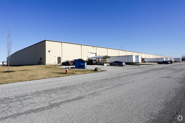


Property Detail
210 Stolle Ave
Sidney, OH
LOT 5661 STOLLE PARK REPLAT CITY OF SIDNEY 020-18-34-202-012PLAT V20 P131
01-18-34-202-012
Shelby
Publicstorage
Ohio
B and X Area of moderate flood hazard, usually the area between the limits of the 100-year and 500-year floods.
5661
2025
13.87 AC
2025
Ohio South Area
971900
Other Market Areas
44,640 SF
NEARBY LISTINGS FOR SALE OR LEASE
DEMOGRAPHICS near 210 Stolle Ave
1 mile
3 mile
5 mile
2025 Total Population
1,253
20,227
26,393
2030 Population
1,251
20,374
26,514
Pop Growth 2025-2030
(0.16%)
+ 0.73%
+ 0.46%
Average Age
44
40
41
2025 Total Households
520
8,309
10,721
HH Growth 2025-2030
(0.19%)
+ 0.70%
+ 0.45%
Median Household Inc
$77,644
$59,598
$64,929
Avg Household Size
2.30
2.30
2.40
2025 Avg HH Vehicles
2.00
2.00
2.00
Median Home Value
$162,378
$164,120
$180,592
Median Year Built
1977
1969
1972
Nearby Places
Map Layers
Map Styles
 Street
 Aerial
Layers
 Traffic
 Biking
Places
Listings with unknown addresses are not visible on the map
- Restaurants
- Banks
- Shops
- Fitness
- Groceries
PUBLIC TRANSPORTATION
AIRPORT
James M Cox Dayton International
Drive
Walk
Distance
James M Cox Dayton International
42 min
33.5 mi
SALE & LEASE HISTORY
LISTING DATE
SALE/LEASE

Oct 10, 2022
For Lease
May 17, 2019
For Lease
Feb 26, 2024
For Lease
Aug 09, 2023
For Lease
Apr 20, 2023
For Lease
Nearby Properties
Address
Land Use
TOTAL SIZE
Lot Size
Zoning
Address
Land Use
TOTAL SIZE
Lot Size
Zoning
16,176 SF
15.25 AC
Address
Land Use
TOTAL SIZE
Lot Size
Zoning
157,714 SF
104.95 AC
Address
Land Use
TOTAL SIZE
Lot Size
Zoning
194,696 SF
83.59 AC
Address
Land Use
TOTAL SIZE
Lot Size
Zoning
149,316 SF
72.17 AC
Address
Land Use
TOTAL SIZE
Lot Size
Zoning
80,000 SF
25.41 AC
Address
Land Use
TOTAL SIZE
Lot Size
Zoning
23,808 SF
25.14 AC
Address
Land Use
TOTAL SIZE
Lot Size
Zoning
246,360 SF
37 AC
Address
Land Use
TOTAL SIZE
Lot Size
Zoning
61,885 SF
20.55 AC
Address
Land Use
TOTAL SIZE
Lot Size
Zoning
2,511 SF
48.24 AC
Address
Land Use
TOTAL SIZE
Lot Size
Zoning
81,258 SF
22.90 AC
Address
Land Use
TOTAL SIZE
Lot Size
Zoning
82,861 SF
7.18 AC
Address
Land Use
TOTAL SIZE
Lot Size
Zoning
63,442 SF
17.80 AC
Address
Land Use
TOTAL SIZE
Lot Size
Zoning
13.48 AC
Address
Land Use
TOTAL SIZE
Lot Size
Zoning
12,440 SF
26.39 AC
Address
Land Use
TOTAL SIZE
Lot Size
Zoning
4,774 SF
15.76 AC
Address
Land Use
TOTAL SIZE
Lot Size
Zoning
4,866 SF
16.23 AC
Address
Land Use
TOTAL SIZE
Lot Size
Zoning
82,095 SF
18.99 AC
Address
Land Use
TOTAL SIZE
Lot Size
Zoning
42,270 SF
2.23 AC
Address
Land Use
TOTAL SIZE
Lot Size
Zoning
920 SF
26.81 AC
Address
Land Use
TOTAL SIZE
Lot Size
Zoning
31,814 SF
10.64 AC
Address
Land Use
TOTAL SIZE
Lot Size
Zoning
109,100 SF
12.61 AC
Address
Land Use
TOTAL SIZE
Lot Size
Zoning
35,625 SF
13.36 AC
Address
Land Use
TOTAL SIZE
Lot Size
Zoning
9,746 SF
12.82 AC
Address
Land Use
TOTAL SIZE
Lot Size
Zoning
27.63 AC
Address
Land Use
TOTAL SIZE
Lot Size
Zoning
88,814 SF
7.44 AC
Address
Land Use
TOTAL SIZE
Lot Size
Zoning
222,695 SF
23.46 AC
Address
Land Use
TOTAL SIZE
Lot Size
Zoning
86,893 SF
19.10 AC
Address
Land Use
TOTAL SIZE
Lot Size
Zoning
14.71 AC
Address
Land Use
TOTAL SIZE
Lot Size
Zoning
51,984 SF
2.86 AC
The World's #1 Commercial Real Estate Marketplace
Connect with us
© 2026 CoStar Group
The information above has been obtained from sources believed reliable. While we do not doubt its accuracy we have not verified it and make no guarantee, warranty or representation about it. It is your responsibility to independently confirm its accuracy and completeness. Any projections, opinions, assumptions, or estimates used are for example only and do not represent the current or future performance of the property. The value of this transaction to you depends on tax and other factors which should be evaluated by your tax, financial, and legal advisors. You and your advisors should conduct a careful, independent investigation of the property to determine to your satisfaction the suitability of the property for your needs.