Property Record
21400 Hoover Rd, Warren, MI 48089


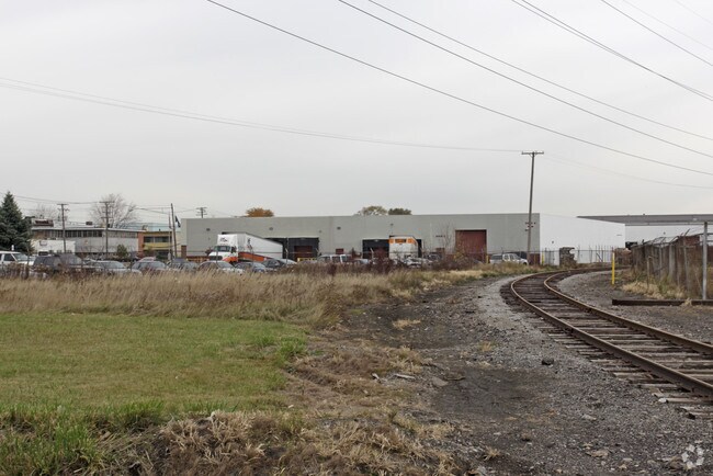

Property Detail
21400 Hoover Rd
12-13-35-301-009
T1N,R12E SEC 35 COMM AT W 1/4 POST SEC 35; TH E 33 FT; TH S 748.7 FT TO PT OF BEG; TH E 476.36 FT; TH SWLY 954.42 FT PARA TO
Lightindustrial
Macomb
M-3
Michigan
B and X Area of moderate flood hazard, usually the area between the limits of the 100-year and 500-year floods.
4.46 AC
2025
Groesbeck South
2025
Detroit
268400
Detroit-Warren-Dearborn, MI
107,177 SF
NEARBY LISTINGS FOR SALE OR LEASE
DEMOGRAPHICS near 21400 Hoover Rd
1 mile
3 mile
5 mile
2025 Total Population
12,967
137,889
398,577
2030 Population
13,361
141,297
404,790
Pop Growth 2025-2030
+ 3.04%
+ 2.47%
+ 1.56%
Average Age
34
37
38
2025 Total Households
4,487
51,169
150,170
HH Growth 2025-2030
+ 2.99%
+ 2.39%
+ 1.59%
Median Household Inc
$47,353
$48,246
$50,922
Avg Household Size
2.80
2.60
2.60
2025 Avg HH Vehicles
1.00
1.00
1.00
Median Home Value
$66,412
$91,270
$124,290
Median Year Built
1954
1954
1955
Nearby Places
Map Layers
Map Styles
 Street
 Aerial
Layers
 Traffic
 Biking
Places
Listings with unknown addresses are not visible on the map
- Restaurants
- Banks
- Shops
- Fitness
- Groceries
PUBLIC TRANSPORTATION
COMMUTER RAIL
Detroit (Wolverine - Amtrak)
Drive
Walk
Distance
Detroit (Wolverine - Amtrak)
19 min
9.1 mi
AIRPORT
Windsor International
Drive
Walk
Distance
Windsor International
44 min
23.2 mi
Detroit Metro Wayne County
Drive
Walk
Distance
Detroit Metro Wayne County
48 min
30.0 mi
Freight Ports
Port of Toledo
Drive
Walk
Distance
Port of Toledo
94 min
70.8 mi
Nearby Properties
Address
Land Use
TOTAL SIZE
Lot Size
Zoning
Address
Land Use
TOTAL SIZE
Lot Size
Zoning
419,600 SF
Address
Land Use
TOTAL SIZE
Lot Size
Zoning
3,327,621 SF
130.89 AC
M-4
Address
Land Use
TOTAL SIZE
Lot Size
Zoning
238,144 SF
12.15 AC
MZ
Address
Land Use
TOTAL SIZE
Lot Size
Zoning
450,958 SF
Address
Land Use
TOTAL SIZE
Lot Size
Zoning
661,151 SF
37.28 AC
MZ
Address
Land Use
TOTAL SIZE
Lot Size
Zoning
1,784,888 SF
58.32 AC
M-4
Address
Land Use
TOTAL SIZE
Lot Size
Zoning
455,425 SF
Address
Land Use
TOTAL SIZE
Lot Size
Zoning
182,866 SF
5.08 AC
PD
Address
Land Use
TOTAL SIZE
Lot Size
Zoning
401,671 SF
19.40 AC
MZ
Address
Land Use
TOTAL SIZE
Lot Size
Zoning
198,064 SF
11.11 AC
MZ
Address
Land Use
TOTAL SIZE
Lot Size
Zoning
1,261,658 SF
71.94 AC
M-2
Address
Land Use
TOTAL SIZE
Lot Size
Zoning
362,350 SF
22.39 AC
M-2
Address
Land Use
TOTAL SIZE
Lot Size
Zoning
162,597 SF
17.94 AC
C-2
Address
Land Use
TOTAL SIZE
Lot Size
Zoning
Address
Land Use
TOTAL SIZE
Lot Size
Zoning
362,895 SF
14.85 AC
M-2
Address
Land Use
TOTAL SIZE
Lot Size
Zoning
1,094,075 SF
58.76 AC
M-4
Address
Land Use
TOTAL SIZE
Lot Size
Zoning
426,764 SF
38.46 AC
R-M
Address
Land Use
TOTAL SIZE
Lot Size
Zoning
197,670 SF
42.84 AC
M4
Address
Land Use
TOTAL SIZE
Lot Size
Zoning
166,064 SF
6.33 AC
M-3
Address
Land Use
TOTAL SIZE
Lot Size
Zoning
92,800 SF
6.71 AC
R-3
Address
Land Use
TOTAL SIZE
Lot Size
Zoning
184,986 SF
13.49 AC
MZ
Address
Land Use
TOTAL SIZE
Lot Size
Zoning
410,359 SF
27.52 AC
M4
Address
Land Use
TOTAL SIZE
Lot Size
Zoning
81,072 SF
5.67 AC
M-4
Address
Land Use
TOTAL SIZE
Lot Size
Zoning
63,949 SF
10.41 AC
R-1-C
Address
Land Use
TOTAL SIZE
Lot Size
Zoning
180,834 SF
17.97 AC
M-3
Address
Land Use
TOTAL SIZE
Lot Size
Zoning
40,951 SF
42.61 AC
M-2
Address
Land Use
TOTAL SIZE
Lot Size
Zoning
251,056 SF
17.80 AC
MZ
Address
Land Use
TOTAL SIZE
Lot Size
Zoning
87,890 SF
Address
Land Use
TOTAL SIZE
Lot Size
Zoning
641,836 SF
20.69 AC
M4
Address
Land Use
TOTAL SIZE
Lot Size
Zoning
182,800 SF
7.86 AC
M-3
The World's #1 Commercial Real Estate Marketplace
Connect with us
© 2026 CoStar Group
The information above has been obtained from sources believed reliable. While we do not doubt its accuracy we have not verified it and make no guarantee, warranty or representation about it. It is your responsibility to independently confirm its accuracy and completeness. Any projections, opinions, assumptions, or estimates used are for example only and do not represent the current or future performance of the property. The value of this transaction to you depends on tax and other factors which should be evaluated by your tax, financial, and legal advisors. You and your advisors should conduct a careful, independent investigation of the property to determine to your satisfaction the suitability of the property for your needs.