Property Record
23295 Us Highway 85, La Salle, CO 80645


Save to a Folder
{{folder.Name}}
{{folder.ListingIds.length}} Properties
{{folder.ListingIds.length}} Property
Create a New Folder
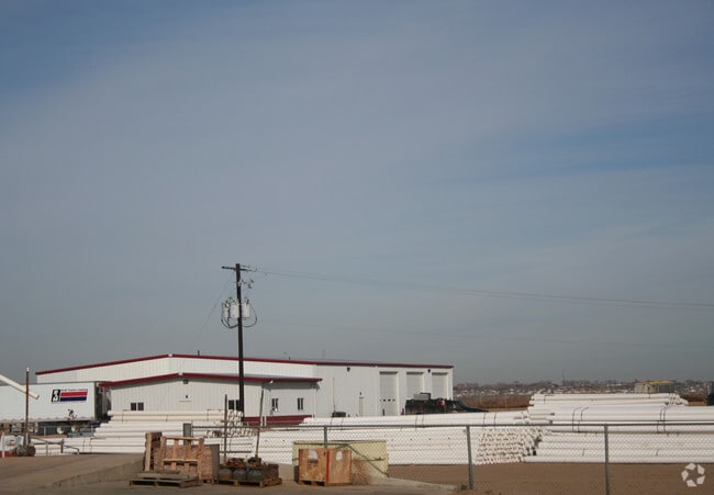
Property Detail
23295 Us Highway 85
Greeley, CO
PT N2SW4 6 4 65 LYING S OF UPRR R/W (DENT BR) & W OF HWY LOT B RE EXEMPT RE-4743
R5297608
Weld
Miscellaneous
Colorado
B and X Area of moderate flood hazard, usually the area between the limits of the 100-year and 500-year floods.
b
2025
8.38 AC
2026
Weld County
001700
Denver
9,200 SF
NEARBY LISTINGS FOR SALE OR LEASE
DEMOGRAPHICS near 23295 Us Highway 85
1 mile
3 mile
5 mile
2025 Total Population
2,008
19,553
80,052
2030 Population
2,187
21,513
88,114
Pop Growth 2025-2030
+ 8.91%
+ 10.02%
+ 10.07%
Average Age
38
36
36
2025 Total Households
694
6,529
28,332
HH Growth 2025-2030
+ 9.22%
+ 10.26%
+ 10.74%
Median Household Inc
$89,705
$71,618
$66,592
Avg Household Size
2.90
2.90
2.70
2025 Avg HH Vehicles
3.00
2.00
2.00
Median Home Value
$413,043
$330,158
$362,129
Median Year Built
1972
1998
1993
Nearby Places
Map Layers
Map Styles
 Street
 Aerial
Layers
 Traffic
 Biking
Places
Listings with unknown addresses are not visible on the map
- Restaurants
- Banks
- Shops
- Fitness
- Groceries
SALE & LEASE HISTORY
LISTING DATE
SALE/LEASE

Sep 23, 2016
For Sale
Nearby Properties
Address
Land Use
TOTAL SIZE
Lot Size
Zoning
Address
Land Use
TOTAL SIZE
Lot Size
Zoning
150,693 SF
20 AC
Address
Land Use
TOTAL SIZE
Lot Size
Zoning
13,704 SF
3.91 AC
Address
Land Use
TOTAL SIZE
Lot Size
Zoning
45,473 SF
5.40 AC
Address
Land Use
TOTAL SIZE
Lot Size
Zoning
46,543 SF
9.70 AC
Address
Land Use
TOTAL SIZE
Lot Size
Zoning
132.20 AC
Address
Land Use
TOTAL SIZE
Lot Size
Zoning
57,663 SF
10 AC
Address
Land Use
TOTAL SIZE
Lot Size
Zoning
31,481 SF
3.59 AC
Address
Land Use
TOTAL SIZE
Lot Size
Zoning
42,605 SF
15 AC
Address
Land Use
TOTAL SIZE
Lot Size
Zoning
125,220 SF
7.30 AC
Address
Land Use
TOTAL SIZE
Lot Size
Zoning
103,568 SF
6.40 AC
Address
Land Use
TOTAL SIZE
Lot Size
Zoning
54,940 SF
2.64 AC
Address
Land Use
TOTAL SIZE
Lot Size
Zoning
40,434 SF
7.33 AC
Address
Land Use
TOTAL SIZE
Lot Size
Zoning
15,256 SF
8.65 AC
Address
Land Use
TOTAL SIZE
Lot Size
Zoning
43,942 SF
5.03 AC
Address
Land Use
TOTAL SIZE
Lot Size
Zoning
Address
Land Use
TOTAL SIZE
Lot Size
Zoning
54,733 SF
6.98 AC
Address
Land Use
TOTAL SIZE
Lot Size
Zoning
20,400 SF
2.70 AC
Address
Land Use
TOTAL SIZE
Lot Size
Zoning
14,744 SF
1.69 AC
Address
Land Use
TOTAL SIZE
Lot Size
Zoning
25,374 SF
4.37 AC
Address
Land Use
TOTAL SIZE
Lot Size
Zoning
16,617 SF
0.44 AC
Address
Land Use
TOTAL SIZE
Lot Size
Zoning
4,140 SF
1.03 AC
Address
Land Use
TOTAL SIZE
Lot Size
Zoning
4,088 SF
1.06 AC
Address
Land Use
TOTAL SIZE
Lot Size
Zoning
58,982 SF
4.09 AC
Address
Land Use
TOTAL SIZE
Lot Size
Zoning
74,430 SF
Address
Land Use
TOTAL SIZE
Lot Size
Zoning
15,000 SF
3.73 AC
Address
Land Use
TOTAL SIZE
Lot Size
Zoning
13,120 SF
1.80 AC
Address
Land Use
TOTAL SIZE
Lot Size
Zoning
15,318 SF
1.61 AC
Address
Land Use
TOTAL SIZE
Lot Size
Zoning
3,431 SF
1.55 AC
Address
Land Use
TOTAL SIZE
Lot Size
Zoning
15,750 SF
1.47 AC
Address
Land Use
TOTAL SIZE
Lot Size
Zoning
81,488 SF
6.83 AC
The World's #1 Commercial Real Estate Marketplace
Connect with us
© 2026 CoStar Group
The information above has been obtained from sources believed reliable. While we do not doubt its accuracy we have not verified it and make no guarantee, warranty or representation about it. It is your responsibility to independently confirm its accuracy and completeness. Any projections, opinions, assumptions, or estimates used are for example only and do not represent the current or future performance of the property. The value of this transaction to you depends on tax and other factors which should be evaluated by your tax, financial, and legal advisors. You and your advisors should conduct a careful, independent investigation of the property to determine to your satisfaction the suitability of the property for your needs.