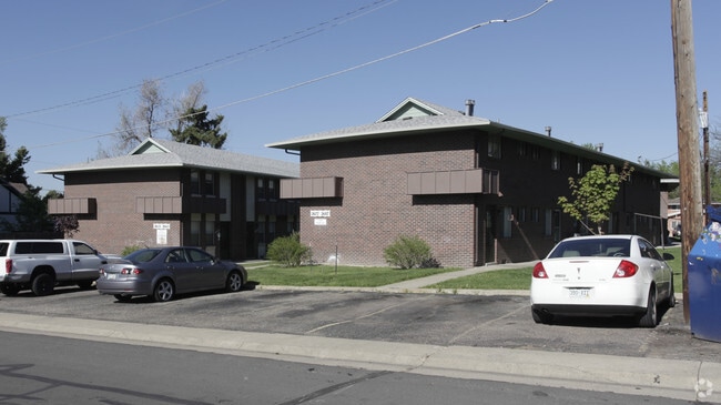
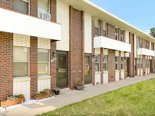
Property Record
2655 Depew St, Denver, CO 80214


NEARBY LISTINGS FOR SALE OR LEASE
Property Detail
2655 Depew St
Denver-Aurora-Centennial, CO
Zerobnick Resub Of Blk 13 Lakeside
39-254-27-002
SECTION 25 TOWNSHIP 03 RANGE 69 QTR SE SUBDIVISIONCD 861200 SUBDIVISIONNAME ZEROBNICK RESUB OF BLK 13 LAKESIDE BLOCK 002 LOT SIZE: 1705 TRACT 0SA VALUE: .039 SECTION 25 TOWNSHIP 03 RANGE 69 SUBDIVISIONCD 861200 SUBDIVISIONNAME ZEROBNICK RESUB OF BLK
Multifamilydwelling
Jefferson
X
Colorado
0800460068H
2-4
2023
0.76 AC
2024
Lakeside
010702
Denver
21,320 SF
DEMOGRAPHICS near 2655 Depew St
1 Mile
3 Mile
5 Mile
2024 Total Population
18,608
157,340
443,919
2029 Population
18,440
158,646
448,062
Pop Growth 2024-2029
(0.90%)
+ 0.83%
+ 0.93%
Average Age
39
38
38
2024 Total Households
8,572
71,621
205,367
HH Growth 2024-2029
(1.06%)
+ 0.85%
+ 1.08%
Median Household Inc
$79,650
$80,690
$77,318
Avg Household Size
2.10
2.10
2.10
2024 Avg HH Vehicles
2.00
2.00
2.00
Median Home Value
$612,039
$602,145
$525,507
Median Year Built
1958
1964
1970
Nearby Places
Map Layers
Map Styles
 Street
 Aerial
- Restaurants
- Banks
- Shops
- Fitness
- Groceries
PUBLIC TRANSPORTATION
COMMUTER RAIL
Union Station: Lodo-Coors Field-16Th Street Mall (C Line - Denver Regional Transportation District Light Rail (TheRide), E Line - Denver Regional Transportation District Light Rail (TheRide), W Line - Denver Regional Transportation District Light Rail (TheRide))
DRIVE
WALK
Distance
Union Station: Lodo-Coors Field-16Th Street Mall (C Line - Denver Regional Transportation District Light Rail (TheRide), E Line - Denver Regional Transportation District Light Rail (TheRide), W Line - Denver Regional Transportation District Light Rail (TheRide))
9 min
3.5 mi
Denver (California Zephyr - Amtrak)
DRIVE
WALK
Distance
Denver (California Zephyr - Amtrak)
9 min
3.5 mi
AIRPORT
Denver International
DRIVE
WALK
Distance
Denver International
37 min
27.9 mi
Freight Ports
Tulsa Port Of Catoosa
DRIVE
WALK
Distance
Tulsa Port Of Catoosa
735 min
713.4 mi
SALE & LEASE HISTORY
LISTING DATE
SALE/LEASE

Jan 15, 2019
For Sale
Nearby Properties
Address
Land Use
TOTAL SIZE
Lot Size
Zoning
Address
Land Use
TOTAL SIZE
Lot Size
Zoning
1,721,086 SF
21.34 AC
C-MU-30
Address
Land Use
TOTAL SIZE
Lot Size
Zoning
611,828 SF
0.94 AC
PUD
Address
Land Use
TOTAL SIZE
Lot Size
Zoning
298,387 SF
0.88 AC
PUD
Address
Land Use
TOTAL SIZE
Lot Size
Zoning
290,821 SF
1.16 AC
PUD
Address
Land Use
TOTAL SIZE
Lot Size
Zoning
860,132 SF
68.50 AC
R-5
Address
Land Use
TOTAL SIZE
Lot Size
Zoning
168,523 SF
44.89 AC
CPV-R
Address
Land Use
TOTAL SIZE
Lot Size
Zoning
424,862 SF
32.28 AC
G-MU-3
Address
Land Use
TOTAL SIZE
Lot Size
Zoning
405,974 SF
1.78 AC
PUD
Address
Land Use
TOTAL SIZE
Lot Size
Zoning
44.93 AC
CPV-C
Address
Land Use
TOTAL SIZE
Lot Size
Zoning
729,679 SF
C-MX
Address
Land Use
TOTAL SIZE
Lot Size
Zoning
265,054 SF
1.39 AC
C-MX-5
Address
Land Use
TOTAL SIZE
Lot Size
Zoning
203,148 SF
1.36 AC
C-MX-5
Address
Land Use
TOTAL SIZE
Lot Size
Zoning
218,176 SF
0.62 AC
T-MU-30
Address
Land Use
TOTAL SIZE
Lot Size
Zoning
33.40 AC
C-MU-30
Address
Land Use
TOTAL SIZE
Lot Size
Zoning
514,899 SF
15.51 AC
CMP-EI
Address
Land Use
TOTAL SIZE
Lot Size
Zoning
268,690 SF
1.23 AC
PUD
Address
Land Use
TOTAL SIZE
Lot Size
Zoning
212,252 SF
0.93 AC
D-LD
Address
Land Use
TOTAL SIZE
Lot Size
Zoning
333,925 SF
3.34 AC
C-MX-5
Address
Land Use
TOTAL SIZE
Lot Size
Zoning
827,707 SF
19 AC
C-MU-30
Address
Land Use
TOTAL SIZE
Lot Size
Zoning
159,202 SF
1.03 AC
C-MX-5
Address
Land Use
TOTAL SIZE
Lot Size
Zoning
8,295 SF
2.57 AC
C-RX
Address
Land Use
TOTAL SIZE
Lot Size
Zoning
58,660 SF
0.88 AC
D-LD
Address
Land Use
TOTAL SIZE
Lot Size
Zoning
89,270 SF
3.02 AC
C-MX-12
Address
Land Use
TOTAL SIZE
Lot Size
Zoning
144,383 SF
10.26 AC
CMP-EI
Address
Land Use
TOTAL SIZE
Lot Size
Zoning
34,642 SF
C-MX-8
Address
Land Use
TOTAL SIZE
Lot Size
Zoning
694,425 SF
1.92 AC
C-MX
Address
Land Use
TOTAL SIZE
Lot Size
Zoning
107,351 SF
5.67 AC
C-MX-5
Address
Land Use
TOTAL SIZE
Lot Size
Zoning
111,673 SF
29.06 AC
Address
Land Use
TOTAL SIZE
Lot Size
Zoning
114,201 SF
0.47 AC
D-LD
Address
Land Use
TOTAL SIZE
Lot Size
Zoning
565,418 SF
4.07 AC
C-RX
The World's #1 Commercial Real Estate Marketplace
Connect with us
© 2026 CoStar Group
The information above has been obtained from sources believed reliable. While we do not doubt its accuracy we have not verified it and make no guarantee, warranty or representation about it. It is your responsibility to independently confirm its accuracy and completeness. Any projections, opinions, assumptions, or estimates used are for example only and do not represent the current or future performance of the property. The value of this transaction to you depends on tax and other factors which should be evaluated by your tax, financial, and legal advisors. You and your advisors should conduct a careful, independent investigation of the property to determine to your satisfaction the suitability of the property for your needs.