Property Record
278 Edwards Dr, Kyle, TX 78640
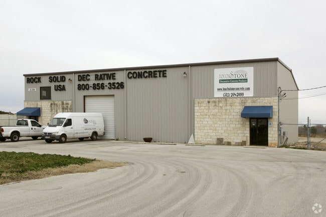

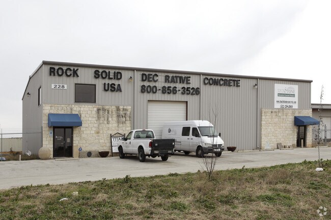
Property Detail
278 Edwards Dr
Austin-Round Rock-San Marcos, TX
EDWARDS BUSINESS PARK, LOT 4, ACRES 1.50
R97575
Hays
Industrialgeneral
Texas
B and X Area of moderate flood hazard, usually the area between the limits of the 100-year and 500-year floods.
4
2024
1.50 AC
2025
Hays County
010917
Austin
10,480 SF
NEARBY LISTINGS FOR SALE OR LEASE
DEMOGRAPHICS near 278 Edwards Dr
1 mile
3 mile
5 mile
2024 Total Population
3,598
35,822
89,260
2029 Population
4,335
42,261
104,178
Pop Growth 2024-2029
+ 20.48%
+ 17.97%
+ 16.71%
Average Age
37
36
35
2024 Total Households
1,229
11,949
32,426
HH Growth 2024-2029
+ 21.40%
+ 19.09%
+ 17.40%
Median Household Inc
$110,539
$95,940
$85,089
Avg Household Size
2.90
2.90
2.70
2024 Avg HH Vehicles
2.00
2.00
2.00
Median Home Value
$405,754
$352,679
$352,067
Median Year Built
2011
2010
2010
Nearby Places
Map Layers
Map Styles
 Street
 Aerial
Transit
 Traffic
 Biking
Places
Listings with unknown addresses are not visible on the map
- Restaurants
- Banks
- Shops
- Fitness
- Groceries
PUBLIC TRANSPORTATION
AIRPORT
Austin-Bergstrom International
Drive
Walk
Distance
Austin-Bergstrom International
39 min
29.1 mi
Freight Ports
Calhoun Port
Drive
Walk
Distance
Calhoun Port
178 min
144.7 mi
SALE & LEASE HISTORY
LISTING DATE
SALE/LEASE

Oct 20, 2025
For Lease
Dec 17, 2025
For Lease
Nearby Properties
Address
Land Use
TOTAL SIZE
Lot Size
Zoning
Address
Land Use
TOTAL SIZE
Lot Size
Zoning
1,647,300 SF
96.81 AC
Address
Land Use
TOTAL SIZE
Lot Size
Zoning
40.48 AC
Address
Land Use
TOTAL SIZE
Lot Size
Zoning
301,745 SF
16.14 AC
Address
Land Use
TOTAL SIZE
Lot Size
Zoning
354,670 SF
13 AC
Address
Land Use
TOTAL SIZE
Lot Size
Zoning
300,779 SF
10.84 AC
Address
Land Use
TOTAL SIZE
Lot Size
Zoning
234,794 SF
10.07 AC
Address
Land Use
TOTAL SIZE
Lot Size
Zoning
4,173 SF
128.50 AC
Address
Land Use
TOTAL SIZE
Lot Size
Zoning
132,825 SF
52.74 AC
Address
Land Use
TOTAL SIZE
Lot Size
Zoning
203,840 SF
16.70 AC
Address
Land Use
TOTAL SIZE
Lot Size
Zoning
116,625 SF
19.01 AC
Address
Land Use
TOTAL SIZE
Lot Size
Zoning
63,875 SF
5.82 AC
Address
Land Use
TOTAL SIZE
Lot Size
Zoning
97,976 SF
12.20 AC
Address
Land Use
TOTAL SIZE
Lot Size
Zoning
229,600 SF
16.50 AC
Address
Land Use
TOTAL SIZE
Lot Size
Zoning
36,219 SF
18.14 AC
Address
Land Use
TOTAL SIZE
Lot Size
Zoning
162,768 SF
13.52 AC
Address
Land Use
TOTAL SIZE
Lot Size
Zoning
169,025 SF
17.45 AC
Address
Land Use
TOTAL SIZE
Lot Size
Zoning
2,748 SF
72.33 AC
Address
Land Use
TOTAL SIZE
Lot Size
Zoning
27,012 SF
19.50 AC
Address
Land Use
TOTAL SIZE
Lot Size
Zoning
118,080 SF
9.69 AC
Address
Land Use
TOTAL SIZE
Lot Size
Zoning
115,080 SF
10.63 AC
Address
Land Use
TOTAL SIZE
Lot Size
Zoning
19,340 SF
2.28 AC
Address
Land Use
TOTAL SIZE
Lot Size
Zoning
89,700 SF
7.84 AC
Address
Land Use
TOTAL SIZE
Lot Size
Zoning
4,940 SF
11.82 AC
Address
Land Use
TOTAL SIZE
Lot Size
Zoning
29,171 SF
3.23 AC
Address
Land Use
TOTAL SIZE
Lot Size
Zoning
17,610 SF
1.96 AC
Address
Land Use
TOTAL SIZE
Lot Size
Zoning
49,536 SF
2.36 AC
Address
Land Use
TOTAL SIZE
Lot Size
Zoning
82,180 SF
6.68 AC
Address
Land Use
TOTAL SIZE
Lot Size
Zoning
192 SF
47.74 AC
Address
Land Use
TOTAL SIZE
Lot Size
Zoning
20,700 SF
14.42 AC
Address
Land Use
TOTAL SIZE
Lot Size
Zoning
118.83 AC
The World's #1 Commercial Real Estate Marketplace
Connect with us
© 2026 CoStar Group
The information above has been obtained from sources believed reliable. While we do not doubt its accuracy we have not verified it and make no guarantee, warranty or representation about it. It is your responsibility to independently confirm its accuracy and completeness. Any projections, opinions, assumptions, or estimates used are for example only and do not represent the current or future performance of the property. The value of this transaction to you depends on tax and other factors which should be evaluated by your tax, financial, and legal advisors. You and your advisors should conduct a careful, independent investigation of the property to determine to your satisfaction the suitability of the property for your needs.