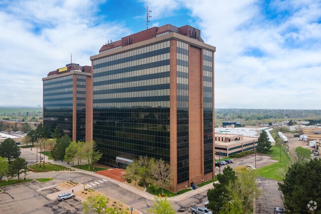
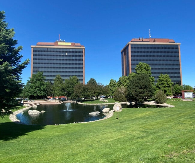
Property Record
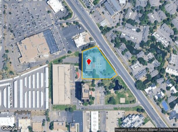
2821 S Parker Rd, Aurora, CO 80014
Current Lease Availabilities
NEARBY LISTINGS FOR SALE OR LEASE
Property Detail
2821 S Parker Rd
Denver-Aurora-Lakewood, CO
The Pavilion Sub 1St Flg
1973-35-2-16-001
SUBDIVISIONCD 061847 SUBDIVISIONNAME THE PAVILION SUB 1ST FLG BLOCK 001 LOT 001 LOT 1 BLK 1 THE PAVILION 1ST FLG
Officebuilding
Arapahoe
X
Colorado
0800460236H
001,1
2023
1.98 AC
2024
East Hampden
080400
Denver
168,745 SF
DEMOGRAPHICS near 2821 S Parker Rd
1 Mile
3 Mile
5 Mile
2024 Total Population
19,340
161,051
421,134
2029 Population
19,616
162,669
424,124
Pop Growth 2024-2029
+ 1.43%
+ 1.00%
+ 0.71%
Average Age
37
40
39
2024 Total Households
8,510
71,756
177,147
HH Growth 2024-2029
+ 1.25%
+ 0.98%
+ 0.77%
Median Household Inc
$62,479
$65,982
$72,013
Avg Household Size
2.20
2.20
2.30
2024 Avg HH Vehicles
2.00
2.00
2.00
Median Home Value
$440,941
$416,336
$444,445
Median Year Built
1977
1980
1980
Nearby Places
Map Layers
Map Styles
 Street
 Aerial
- Restaurants
- Banks
- Shops
- Fitness
- Groceries
Nearby Properties
Address
Land Use
TOTAL SIZE
Lot Size
Zoning
Address
Land Use
TOTAL SIZE
Lot Size
Zoning
496,493 SF
33.45 AC
Address
Land Use
TOTAL SIZE
Lot Size
Zoning
898,130 SF
89.50 AC
Address
Land Use
TOTAL SIZE
Lot Size
Zoning
476,186 SF
42.62 AC
Address
Land Use
TOTAL SIZE
Lot Size
Zoning
372,593 SF
5.61 AC
S-MX-12
Address
Land Use
TOTAL SIZE
Lot Size
Zoning
396,041 SF
6.77 AC
B-8
Address
Land Use
TOTAL SIZE
Lot Size
Zoning
231,867 SF
19.33 AC
S-MX-3A
Address
Land Use
TOTAL SIZE
Lot Size
Zoning
613,600 SF
29.40 AC
R-3
Address
Land Use
TOTAL SIZE
Lot Size
Zoning
193,299 SF
2.90 AC
S-MX-12
Address
Land Use
TOTAL SIZE
Lot Size
Zoning
295,877 SF
6 AC
S-MX-12
Address
Land Use
TOTAL SIZE
Lot Size
Zoning
258,612 SF
4.91 AC
B-8
Address
Land Use
TOTAL SIZE
Lot Size
Zoning
328,136 SF
3.56 AC
B-8
Address
Land Use
TOTAL SIZE
Lot Size
Zoning
478,994 SF
26.07 AC
Address
Land Use
TOTAL SIZE
Lot Size
Zoning
130,531 SF
3.41 AC
Address
Land Use
TOTAL SIZE
Lot Size
Zoning
540,380 SF
26.03 AC
RR3
Address
Land Use
TOTAL SIZE
Lot Size
Zoning
205,250 SF
10 AC
I-A
Address
Land Use
TOTAL SIZE
Lot Size
Zoning
273,952 SF
7.82 AC
C-MU-30
Address
Land Use
TOTAL SIZE
Lot Size
Zoning
154,808 SF
16.71 AC
S-SU-D
Address
Land Use
TOTAL SIZE
Lot Size
Zoning
138,750 SF
12.17 AC
OS-A
Address
Land Use
TOTAL SIZE
Lot Size
Zoning
462,048 SF
5.34 AC
RB3
Address
Land Use
TOTAL SIZE
Lot Size
Zoning
333,696 SF
17.52 AC
PUD
Address
Land Use
TOTAL SIZE
Lot Size
Zoning
227,756 SF
3.35 AC
C-MU-20
Address
Land Use
TOTAL SIZE
Lot Size
Zoning
506,272 SF
20.38 AC
PUD
Address
Land Use
TOTAL SIZE
Lot Size
Zoning
1,344,255 SF
15.88 AC
AMU
Address
Land Use
TOTAL SIZE
Lot Size
Zoning
209,690 SF
7.21 AC
S-SU-D
Address
Land Use
TOTAL SIZE
Lot Size
Zoning
350,692 SF
13.51 AC
R-2-A
Address
Land Use
TOTAL SIZE
Lot Size
Zoning
324,930 SF
12.96 AC
R-2-A
Address
Land Use
TOTAL SIZE
Lot Size
Zoning
58,903 SF
14.19 AC
C-MX
Address
Land Use
TOTAL SIZE
Lot Size
Zoning
238,669 SF
5.58 AC
B-2
Address
Land Use
TOTAL SIZE
Lot Size
Zoning
105,809 SF
48.79 AC
Address
Land Use
TOTAL SIZE
Lot Size
Zoning
353,956 SF
8.28 AC
R-3
The World's #1 Commercial Real Estate Marketplace
Connect with us
© 2025 CoStar Group
The information above has been obtained from sources believed reliable. While we do not doubt its accuracy we have not verified it and make no guarantee, warranty or representation about it. It is your responsibility to independently confirm its accuracy and completeness. Any projections, opinions, assumptions, or estimates used are for example only and do not represent the current or future performance of the property. The value of this transaction to you depends on tax and other factors which should be evaluated by your tax, financial, and legal advisors. You and your advisors should conduct a careful, independent investigation of the property to determine to your satisfaction the suitability of the property for your needs.