Property Record
2870 W State St, Boise, ID 83702
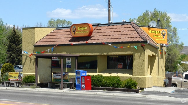


Property Detail
2870 W State St
R1624005046
LOTS 9 TO 11 INC & 1/2 VAC ALLEY ADJ EXC R/W BLK 51 CRUZEN ADD #05045-C #9359563
Commercialnec
Ada
C-2D
Idaho
C and X Area of minimal flood hazard, usually depicted on FIRMs as above the 500-year flood level.
9-11
2025
0.21 AC
2025
North Boise
000501
Boise City/Nampa
1,188 SF
Boise City, ID
NEARBY LISTINGS FOR SALE OR LEASE
DEMOGRAPHICS near 2870 W State St
1 mile
3 mile
5 mile
2024 Total Population
15,585
100,025
198,231
2029 Population
16,377
104,994
207,535
Pop Growth 2024-2029
+ 5.08%
+ 4.97%
+ 4.69%
Average Age
40
40
40
2024 Total Households
7,201
44,657
86,355
HH Growth 2024-2029
+ 5.50%
+ 5.53%
+ 5.20%
Median Household Inc
$85,078
$70,460
$74,445
Avg Household Size
2.10
2.10
2.20
2024 Avg HH Vehicles
2.00
2.00
2.00
Median Home Value
$681,407
$570,220
$486,360
Median Year Built
1971
1980
1984
Nearby Places
Map Layers
Map Styles
 Street
 Aerial
Transit
 Traffic
 Biking
Places
Listings with unknown addresses are not visible on the map
- Restaurants
- Banks
- Shops
- Fitness
- Groceries
PUBLIC TRANSPORTATION
AIRPORT
Boise Air Trml/Gowen Field
Drive
Walk
Distance
Boise Air Trml/Gowen Field
19 min
7.9 mi
Nearby Properties
Address
Land Use
TOTAL SIZE
Lot Size
Zoning
Address
Land Use
TOTAL SIZE
Lot Size
Zoning
369,584 SF
1 AC
C-5DD
Address
Land Use
TOTAL SIZE
Lot Size
Zoning
635,403 SF
23.42 AC
C-1D
Address
Land Use
TOTAL SIZE
Lot Size
Zoning
434,370 SF
0.56 AC
C-5DD
Address
Land Use
TOTAL SIZE
Lot Size
Zoning
129,663 SF
0.92 AC
C-5DD
Address
Land Use
TOTAL SIZE
Lot Size
Zoning
240,481 SF
1.79 AC
C-5DD/DA
Address
Land Use
TOTAL SIZE
Lot Size
Zoning
13.90 AC
R-2D
Address
Land Use
TOTAL SIZE
Lot Size
Zoning
4.02 AC
C-2
Address
Land Use
TOTAL SIZE
Lot Size
Zoning
279,694 SF
2.09 AC
R-ODD/DA
Address
Land Use
TOTAL SIZE
Lot Size
Zoning
258,747 SF
3.30 AC
R-OD/DA
Address
Land Use
TOTAL SIZE
Lot Size
Zoning
413,253 SF
3.33 AC
R-OD/DA
Address
Land Use
TOTAL SIZE
Lot Size
Zoning
402,504 SF
5.78 AC
C-5DD
Address
Land Use
TOTAL SIZE
Lot Size
Zoning
334,334 SF
3.21 AC
R-OD
Address
Land Use
TOTAL SIZE
Lot Size
Zoning
156,000 SF
4.57 AC
H-SD
Address
Land Use
TOTAL SIZE
Lot Size
Zoning
207,033 SF
10.67 AC
L-OD
Address
Land Use
TOTAL SIZE
Lot Size
Zoning
204,396 SF
0.82 AC
C-5DDC
Address
Land Use
TOTAL SIZE
Lot Size
Zoning
366,126 SF
0.82 AC
C-5DD
Address
Land Use
TOTAL SIZE
Lot Size
Zoning
223,171 SF
0.85 AC
C-5DD/DA
Address
Land Use
TOTAL SIZE
Lot Size
Zoning
225,032 SF
12.75 AC
R-3D
Address
Land Use
TOTAL SIZE
Lot Size
Zoning
359,820 SF
1.79 AC
C-5DD
Address
Land Use
TOTAL SIZE
Lot Size
Zoning
459,218 SF
1.79 AC
H-SD
Address
Land Use
TOTAL SIZE
Lot Size
Zoning
159,859 SF
0.80 AC
C-5DD/DA
Address
Land Use
TOTAL SIZE
Lot Size
Zoning
245,000 SF
12.28 AC
R-2D
Address
Land Use
TOTAL SIZE
Lot Size
Zoning
205,522 SF
0.82 AC
C-5DD
Address
Land Use
TOTAL SIZE
Lot Size
Zoning
276,099 SF
8.70 AC
C-5DDC
Address
Land Use
TOTAL SIZE
Lot Size
Zoning
216,371 SF
0.78 AC
C-5DDC
Address
Land Use
TOTAL SIZE
Lot Size
Zoning
151,285 SF
9.54 AC
R-1C
Address
Land Use
TOTAL SIZE
Lot Size
Zoning
189,100 SF
0.60 AC
C-5DD
Address
Land Use
TOTAL SIZE
Lot Size
Zoning
222,379 SF
1.37 AC
M
Address
Land Use
TOTAL SIZE
Lot Size
Zoning
182,950 SF
0.41 AC
C-5DD
Address
Land Use
TOTAL SIZE
Lot Size
Zoning
96,969 SF
2 AC
C-5DDC
The World's #1 Commercial Real Estate Marketplace
Connect with us
© 2026 CoStar Group
The information above has been obtained from sources believed reliable. While we do not doubt its accuracy we have not verified it and make no guarantee, warranty or representation about it. It is your responsibility to independently confirm its accuracy and completeness. Any projections, opinions, assumptions, or estimates used are for example only and do not represent the current or future performance of the property. The value of this transaction to you depends on tax and other factors which should be evaluated by your tax, financial, and legal advisors. You and your advisors should conduct a careful, independent investigation of the property to determine to your satisfaction the suitability of the property for your needs.