Property Record
2882 W Walnut St, Rogers, AR 72756
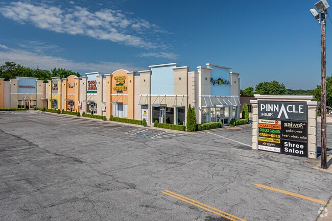

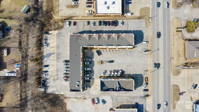
Property Detail
2882 W Walnut St
Fayetteville-Springdale-Rogers, AR
PT NW SE BEG 570.5'W NE/C S384' W151.87' N384' E151.87' POB ALSO E 85' OF BEG 89*W722.37' NE/C S0*W384' N89*W154.68' N0*E383.67' S89*E152' POB
02-00912-000
Benton
Regionalshoppingcenterormallwithanchorstore
Arkansas
B and X Area of moderate flood hazard, usually the area between the limits of the 100-year and 500-year floods.
8
2025
1.86 AC
2025
East Rogers
020401
Fayetteville/Springdale/Rogers
15,264 SF
NEARBY LISTINGS FOR SALE OR LEASE
DEMOGRAPHICS near 2882 W Walnut St
1 mile
3 mile
5 mile
2025 Total Population
11,824
59,435
129,992
2030 Population
12,969
65,448
143,784
Pop Growth 2025-2030
+ 9.68%
+ 10.12%
+ 10.61%
Average Age
38
37
36
2025 Total Households
4,380
22,917
48,297
HH Growth 2025-2030
+ 10.14%
+ 10.53%
+ 11.02%
Median Household Inc
$75,889
$72,924
$92,495
Avg Household Size
2.60
2.50
2.60
2025 Avg HH Vehicles
2.00
2.00
2.00
Median Home Value
$266,192
$295,076
$378,235
Median Year Built
1989
1993
2000
Nearby Places
Map Layers
Map Styles
 Street
 Aerial
Layers
 Traffic
 Biking
Places
Listings with unknown addresses are not visible on the map
- Restaurants
- Banks
- Shops
- Fitness
- Groceries
PUBLIC TRANSPORTATION
AIRPORT
Northwest Arkansas Ntl
Drive
Walk
Distance
Northwest Arkansas Ntl
26 min
12.6 mi
Freight Ports
Tulsa Port of Inola
Drive
Walk
Distance
Tulsa Port of Inola
113 min
97.8 mi
SALE & LEASE HISTORY
LISTING DATE
SALE/LEASE

Sep 26, 2016
For Lease
Nov 30, 2022
For Lease
Aug 09, 2018
For Lease
Nearby Properties
Address
Land Use
TOTAL SIZE
Lot Size
Zoning
Address
Land Use
TOTAL SIZE
Lot Size
Zoning
441,673 SF
55.19 AC
Address
Land Use
TOTAL SIZE
Lot Size
Zoning
147,199 SF
16.11 AC
Address
Land Use
TOTAL SIZE
Lot Size
Zoning
344,315 SF
12.74 AC
Address
Land Use
TOTAL SIZE
Lot Size
Zoning
117,522 SF
0.12 AC
Address
Land Use
TOTAL SIZE
Lot Size
Zoning
384,427 SF
10.51 AC
Address
Land Use
TOTAL SIZE
Lot Size
Zoning
216,538 SF
22.14 AC
Address
Land Use
TOTAL SIZE
Lot Size
Zoning
675,465 SF
37.34 AC
Address
Land Use
TOTAL SIZE
Lot Size
Zoning
472,987 SF
3.75 AC
Address
Land Use
TOTAL SIZE
Lot Size
Zoning
381,924 SF
10.23 AC
Address
Land Use
TOTAL SIZE
Lot Size
Zoning
307,725 SF
9.36 AC
Address
Land Use
TOTAL SIZE
Lot Size
Zoning
546,195 SF
15.80 AC
Address
Land Use
TOTAL SIZE
Lot Size
Zoning
375,605 SF
24.54 AC
Address
Land Use
TOTAL SIZE
Lot Size
Zoning
746,783 SF
77.03 AC
Address
Land Use
TOTAL SIZE
Lot Size
Zoning
234,432 SF
19.98 AC
Address
Land Use
TOTAL SIZE
Lot Size
Zoning
269,397 SF
27.07 AC
Address
Land Use
TOTAL SIZE
Lot Size
Zoning
299,595 SF
18 AC
Address
Land Use
TOTAL SIZE
Lot Size
Zoning
42,848 SF
3.08 AC
Address
Land Use
TOTAL SIZE
Lot Size
Zoning
251,590 SF
6.95 AC
Address
Land Use
TOTAL SIZE
Lot Size
Zoning
270,199 SF
10.23 AC
Address
Land Use
TOTAL SIZE
Lot Size
Zoning
418,411 SF
26.88 AC
Address
Land Use
TOTAL SIZE
Lot Size
Zoning
17,340 SF
14.15 AC
Address
Land Use
TOTAL SIZE
Lot Size
Zoning
542,873 SF
16.52 AC
Address
Land Use
TOTAL SIZE
Lot Size
Zoning
365,674 SF
18.05 AC
Address
Land Use
TOTAL SIZE
Lot Size
Zoning
84,890 SF
5.89 AC
Address
Land Use
TOTAL SIZE
Lot Size
Zoning
108,103 SF
8.53 AC
Address
Land Use
TOTAL SIZE
Lot Size
Zoning
6,545 SF
29.19 AC
Address
Land Use
TOTAL SIZE
Lot Size
Zoning
97,660 SF
5.35 AC
Address
Land Use
TOTAL SIZE
Lot Size
Zoning
543,020 SF
9.15 AC
Address
Land Use
TOTAL SIZE
Lot Size
Zoning
166,973 SF
7.58 AC
Address
Land Use
TOTAL SIZE
Lot Size
Zoning
171,746 SF
9.32 AC
The World's #1 Commercial Real Estate Marketplace
Connect with us
© 2026 CoStar Group
The information above has been obtained from sources believed reliable. While we do not doubt its accuracy we have not verified it and make no guarantee, warranty or representation about it. It is your responsibility to independently confirm its accuracy and completeness. Any projections, opinions, assumptions, or estimates used are for example only and do not represent the current or future performance of the property. The value of this transaction to you depends on tax and other factors which should be evaluated by your tax, financial, and legal advisors. You and your advisors should conduct a careful, independent investigation of the property to determine to your satisfaction the suitability of the property for your needs.