Property Record
300 E 55Th St, Los Angeles, CA 90011


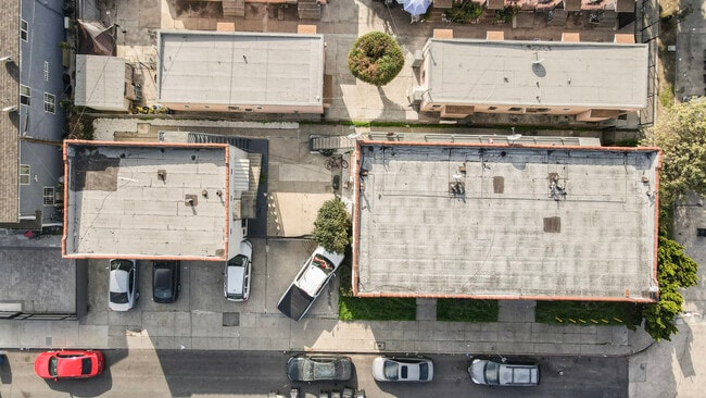

Property Detail
300 E 55Th St
5101-010-021
LUCKY BALDWIN TRACT LOT 22 BLK G
Multifamilydwelling
Los Angeles
LAR2
California
C and X Area of minimal flood hazard, usually depicted on FIRMs as above the 500-year flood level.
22
2024
0.13 AC
2025
Vernon-Main
229410
Los Angeles
4,222 SF
Los Angeles-Long Beach-Glendale, CA
NEARBY LISTINGS FOR SALE OR LEASE
DEMOGRAPHICS near 300 E 55Th St
1 mile
3 mile
5 mile
2025 Total Population
62,362
455,449
1,204,493
2030 Population
61,410
448,329
1,189,895
Pop Growth 2025-2030
(1.53%)
(1.56%)
(1.21%)
Average Age
35
35
37
2025 Total Households
14,684
117,886
371,278
HH Growth 2025-2030
(1.82%)
(1.80%)
(1.09%)
Median Household Inc
$57,122
$54,946
$57,829
Avg Household Size
3.90
3.60
3.00
2025 Avg HH Vehicles
2.00
2.00
2.00
Median Home Value
$684,193
$685,573
$735,067
Median Year Built
1951
1949
1954
Nearby Places
Map Layers
Map Styles
 Street
 Aerial
Transit
 Traffic
 Biking
Places
Listings with unknown addresses are not visible on the map
- Restaurants
- Banks
- Shops
- Fitness
- Groceries
PUBLIC TRANSPORTATION
COMMUTER RAIL
Los Angeles (Coast Starlight - Amtrak, Pacific Surfliner - Amtrak, Southwest Chief - Amtrak, Texas Eagle - Amtrak)
Drive
Walk
Distance
Los Angeles (Coast Starlight - Amtrak, Pacific Surfliner - Amtrak, Southwest Chief - Amtrak, Texas Eagle - Amtrak)
11 min
5.5 mi
Union Station (91 Line - Southern California Regional Rail Authority (Metrolink), Antelope Valley Line - Southern California Regional Rail Authority (Metrolink), Orange County Line - Southern California Regional Rail Authority (Metrolink), Riverside Line - Southern California Regional Rail Authority (Metrolink), San Bernardino Line - Southern California Regional Rail Authority (Metrolink), Ventura County Line - Southern California Regional Rail Authority (Metrolink))
Drive
Walk
Distance
Union Station (91 Line - Southern California Regional Rail Authority (Metrolink), Antelope Valley Line - Southern California Regional Rail Authority (Metrolink), Orange County Line - Southern California Regional Rail Authority (Metrolink), Riverside Line - Southern California Regional Rail Authority (Metrolink), San Bernardino Line - Southern California Regional Rail Authority (Metrolink), Ventura County Line - Southern California Regional Rail Authority (Metrolink))
13 min
5.8 mi
AIRPORT
Los Angeles International
Drive
Walk
Distance
Los Angeles International
19 min
10.5 mi
Long Beach (Daugherty Field)
Drive
Walk
Distance
Long Beach (Daugherty Field)
25 min
18.8 mi
Bob Hope
Drive
Walk
Distance
Bob Hope
31 min
22.7 mi
Freight Ports
Port of Long Beach
Drive
Walk
Distance
Port of Long Beach
28 min
20.6 mi
SALE & LEASE HISTORY
LISTING DATE
SALE/LEASE

Jun 27, 2018
For Sale
Dec 09, 2025
For Sale
Nearby Properties
Address
Land Use
TOTAL SIZE
Lot Size
Zoning
Address
Land Use
TOTAL SIZE
Lot Size
Zoning
969,516 SF
14.75 AC
Address
Land Use
TOTAL SIZE
Lot Size
Zoning
1,178,786 SF
3.89 AC
LAC2
Address
Land Use
TOTAL SIZE
Lot Size
Zoning
420,864 SF
63.07 AC
LAUSC-1A
Address
Land Use
TOTAL SIZE
Lot Size
Zoning
256,059 SF
Address
Land Use
TOTAL SIZE
Lot Size
Zoning
200,689 SF
5.79 AC
LAUSC-1A
Address
Land Use
TOTAL SIZE
Lot Size
Zoning
337,025 SF
14.59 AC
LAUSC-1A
Address
Land Use
TOTAL SIZE
Lot Size
Zoning
666,499 SF
10.63 AC
LAC2
Address
Land Use
TOTAL SIZE
Lot Size
Zoning
298,630 SF
4.64 AC
LAUSC-1B
Address
Land Use
TOTAL SIZE
Lot Size
Zoning
377,946 SF
5.03 AC
LAUSC-1A
Address
Land Use
TOTAL SIZE
Lot Size
Zoning
152,000 SF
1.04 AC
LAC2
Address
Land Use
TOTAL SIZE
Lot Size
Zoning
690,514 SF
LACM
Address
Land Use
TOTAL SIZE
Lot Size
Zoning
112,636 SF
24.20 AC
LAUSC-1A
Address
Land Use
TOTAL SIZE
Lot Size
Zoning
284,335 SF
2.01 AC
LAM1
Address
Land Use
TOTAL SIZE
Lot Size
Zoning
108,598 SF
15.93 AC
LCC3*
Address
Land Use
TOTAL SIZE
Lot Size
Zoning
188,146 SF
1.54 AC
LAUSC-1A
Address
Land Use
TOTAL SIZE
Lot Size
Zoning
Address
Land Use
TOTAL SIZE
Lot Size
Zoning
1 AC
LAC2
Address
Land Use
TOTAL SIZE
Lot Size
Zoning
1 AC
LAC2
Address
Land Use
TOTAL SIZE
Lot Size
Zoning
95,639 SF
0.53 AC
LAC2
Address
Land Use
TOTAL SIZE
Lot Size
Zoning
116,827 SF
0.64 AC
LAC2
Address
Land Use
TOTAL SIZE
Lot Size
Zoning
251,338 SF
10.62 AC
LAM3
Address
Land Use
TOTAL SIZE
Lot Size
Zoning
116,728 SF
0.86 AC
HPCP*
Address
Land Use
TOTAL SIZE
Lot Size
Zoning
372,634 SF
10.83 AC
VEM*
Address
Land Use
TOTAL SIZE
Lot Size
Zoning
369,554 SF
8.49 AC
VEM*
Address
Land Use
TOTAL SIZE
Lot Size
Zoning
564,529 SF
2.67 AC
LAUSC-1B
Address
Land Use
TOTAL SIZE
Lot Size
Zoning
261,540 SF
10.85 AC
VEM*
Address
Land Use
TOTAL SIZE
Lot Size
Zoning
386,865 SF
6 AC
VEM*
Address
Land Use
TOTAL SIZE
Lot Size
Zoning
353,151 SF
8.28 AC
VEM*
Address
Land Use
TOTAL SIZE
Lot Size
Zoning
150,790 SF
0.74 AC
LAC2
Address
Land Use
TOTAL SIZE
Lot Size
Zoning
122,517 SF
3.08 AC
LAR4
The World's #1 Commercial Real Estate Marketplace
Connect with us
© 2026 CoStar Group
The information above has been obtained from sources believed reliable. While we do not doubt its accuracy we have not verified it and make no guarantee, warranty or representation about it. It is your responsibility to independently confirm its accuracy and completeness. Any projections, opinions, assumptions, or estimates used are for example only and do not represent the current or future performance of the property. The value of this transaction to you depends on tax and other factors which should be evaluated by your tax, financial, and legal advisors. You and your advisors should conduct a careful, independent investigation of the property to determine to your satisfaction the suitability of the property for your needs.