Property Record
3024 W 300 N, Clearfield, UT 84015
NEARBY LISTINGS FOR SALE OR LEASE
Property Detail
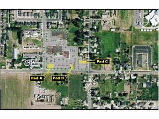
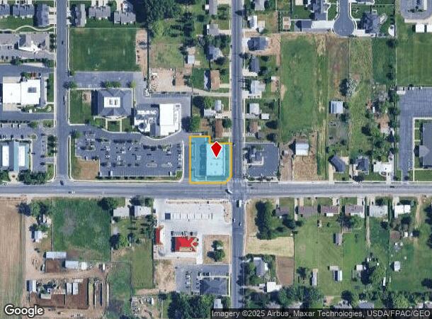
3024 W 300 N
14-450-0012
ALL OF LOT 5, WEST POINT TOWNE CENTER COMMERCIAL SUB AMENDED PLAT OF PART OF LOT 4. CONT. 0.68000 ACRES LESS & EXCEPTING: A PARCEL OF LAND IN FEE FOR THE CONSTRUCTION OF TRAFFIC SIGNAL & IMP
Stripcommercialcenter
Davis
X
Utah
49011C0205E
4-5
2025
0.68 AC
2025
Davis/Weber Counties
125407
Salt Lake City
9,526 SF
Ogden-Clearfield, UT
DEMOGRAPHICS near 3024 W 300 N
1 Mile
3 Mile
5 Mile
2024 Total Population
6,688
74,029
165,673
2029 Population
7,141
78,647
176,955
Pop Growth 2024-2029
+ 6.77%
+ 6.24%
+ 6.81%
Average Age
35
34
33
2024 Total Households
1,877
21,049
49,487
HH Growth 2024-2029
+ 6.87%
+ 6.30%
+ 7.01%
Median Household Inc
$111,976
$102,263
$90,141
Avg Household Size
3.50
3.50
3.30
2024 Avg HH Vehicles
3.00
3.00
2.00
Median Home Value
$435,786
$412,254
$379,928
Median Year Built
2000
1999
1997
Nearby Places
Map Layers
Map Styles
 Street
 Aerial
- Restaurants
- Banks
- Shops
- Fitness
- Groceries
PUBLIC TRANSPORTATION
COMMUTER RAIL
Clearfield (FrontRunner North - Utah Transit Authority (UTA))
DRIVE
WALK
Distance
Clearfield (FrontRunner North - Utah Transit Authority (UTA))
9 min
5.2 mi
Roy (FrontRunner North - Utah Transit Authority (UTA))
DRIVE
WALK
Distance
Roy (FrontRunner North - Utah Transit Authority (UTA))
13 min
7.3 mi
AIRPORT
Salt Lake City International
DRIVE
WALK
Distance
Salt Lake City International
43 min
34.2 mi
Nearby Properties
Address
Land Use
TOTAL SIZE
Lot Size
Zoning
Address
Land Use
TOTAL SIZE
Lot Size
Zoning
399,630 SF
31.55 AC
I
Address
Land Use
TOTAL SIZE
Lot Size
Zoning
664,440 SF
37.07 AC
Address
Land Use
TOTAL SIZE
Lot Size
Zoning
151,064 SF
48.81 AC
Address
Land Use
TOTAL SIZE
Lot Size
Zoning
86,213 SF
12.27 AC
Address
Land Use
TOTAL SIZE
Lot Size
Zoning
123,824 SF
41.89 AC
M1
Address
Land Use
TOTAL SIZE
Lot Size
Zoning
121,332 SF
44.40 AC
Address
Land Use
TOTAL SIZE
Lot Size
Zoning
27,763 SF
11.41 AC
Address
Land Use
TOTAL SIZE
Lot Size
Zoning
1,540 SF
11.52 AC
Address
Land Use
TOTAL SIZE
Lot Size
Zoning
5,481 SF
15.54 AC
Address
Land Use
TOTAL SIZE
Lot Size
Zoning
223,079 SF
22.55 AC
Address
Land Use
TOTAL SIZE
Lot Size
Zoning
503,599 SF
47.71 AC
M1
Address
Land Use
TOTAL SIZE
Lot Size
Zoning
199,214 SF
19.59 AC
C1
Address
Land Use
TOTAL SIZE
Lot Size
Zoning
57,165 SF
8.50 AC
GC
Address
Land Use
TOTAL SIZE
Lot Size
Zoning
46,207 SF
6.09 AC
A1
Address
Land Use
TOTAL SIZE
Lot Size
Zoning
11,877 SF
5.44 AC
CC
Address
Land Use
TOTAL SIZE
Lot Size
Zoning
121,173 SF
11.74 AC
CC
Address
Land Use
TOTAL SIZE
Lot Size
Zoning
69,331 SF
7.46 AC
R2
Address
Land Use
TOTAL SIZE
Lot Size
Zoning
76,267 SF
11.61 AC
R1
Address
Land Use
TOTAL SIZE
Lot Size
Zoning
62,246 SF
5.37 AC
PZ
Address
Land Use
TOTAL SIZE
Lot Size
Zoning
46,207 SF
6.48 AC
A1
Address
Land Use
TOTAL SIZE
Lot Size
Zoning
140,015 SF
12.14 AC
PZ
Address
Land Use
TOTAL SIZE
Lot Size
Zoning
8,144 SF
5.79 AC
A1
Address
Land Use
TOTAL SIZE
Lot Size
Zoning
88,125 SF
7.17 AC
PZ
Address
Land Use
TOTAL SIZE
Lot Size
Zoning
58,287 SF
5.18 AC
Address
Land Use
TOTAL SIZE
Lot Size
Zoning
104,180 SF
11.58 AC
I
Address
Land Use
TOTAL SIZE
Lot Size
Zoning
50,432 SF
3.86 AC
R115
Address
Land Use
TOTAL SIZE
Lot Size
Zoning
12,330 SF
20.89 AC
Address
Land Use
TOTAL SIZE
Lot Size
Zoning
95,394 SF
8.83 AC
The World's #1 Commercial Real Estate Marketplace
Connect with us
© 2025 CoStar Group
The information above has been obtained from sources believed reliable. While we do not doubt its accuracy we have not verified it and make no guarantee, warranty or representation about it. It is your responsibility to independently confirm its accuracy and completeness. Any projections, opinions, assumptions, or estimates used are for example only and do not represent the current or future performance of the property. The value of this transaction to you depends on tax and other factors which should be evaluated by your tax, financial, and legal advisors. You and your advisors should conduct a careful, independent investigation of the property to determine to your satisfaction the suitability of the property for your needs.