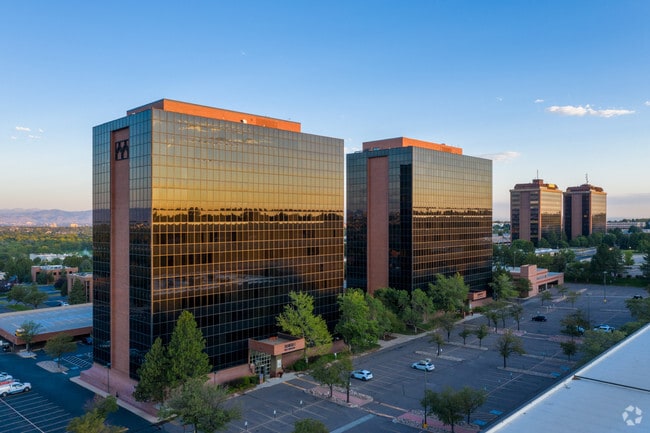
Property Record
3033 S Parker Rd, Aurora, CO 80014


Current Lease Availabilities
Property Detail
3033 S Parker Rd
Denver-Aurora-Centennial, CO
SUBDIVISIONCD 061854 SUBDIVISIONNAME THE MARKET PLACE SUB 2ND FLG BLOCK 001 LOT 001 PART LOT 1 BLK 1 DESC AS BEG AT SW COR SD LOT 1 TH N 393.55 FT TH E 422.57 FT TH S 232.5 FT TH E 30 FT TH S 161 FT TH W 458.48 FT TO BEG THE MARKET PLACE SUB 2ND FLG
1973-35-2-22-002
Arapahoe
Officebuilding
Colorado
B and X Area of moderate flood hazard, usually the area between the limits of the 100-year and 500-year floods.
001
2024
3.96 AC
2025
East Hampden
080400
Denver
188,776 SF
NEARBY LISTINGS FOR SALE OR LEASE
DEMOGRAPHICS near 3033 S Parker Rd
1 mile
3 mile
5 mile
2025 Total Population
16,371
152,812
419,393
2030 Population
16,732
155,763
427,213
Pop Growth 2025-2030
+ 2.21%
+ 1.93%
+ 1.86%
Average Age
37
40
39
2025 Total Households
7,248
68,290
176,993
HH Growth 2025-2030
+ 2.17%
+ 2.03%
+ 2.02%
Median Household Inc
$67,347
$75,677
$83,552
Avg Household Size
2.20
2.20
2.30
2025 Avg HH Vehicles
2.00
2.00
2.00
Median Home Value
$480,630
$469,315
$502,190
Median Year Built
1977
1981
1981
Nearby Places
Map Layers
Map Styles
 Street
 Aerial
Transit
 Traffic
 Biking
Places
Listings with unknown addresses are not visible on the map
- Restaurants
- Banks
- Shops
- Fitness
- Groceries
PUBLIC TRANSPORTATION
TRANSIT/SUBWAY
Nine Mile (G Line - Denver Regional Transportation District Light Rail (TheRide), H Line - Denver Regional Transportation District Light Rail (TheRide))
Drive
Walk
Distance
Nine Mile (G Line - Denver Regional Transportation District Light Rail (TheRide), H Line - Denver Regional Transportation District Light Rail (TheRide))
9 min
19 min
1.0 mi
AIRPORT
Denver International
Drive
Walk
Distance
Denver International
29 min
22.6 mi
Freight Ports
Tulsa Port Of Catoosa
Drive
Walk
Distance
Tulsa Port Of Catoosa
725 min
705.3 mi
Nearby Properties
Address
Land Use
TOTAL SIZE
Lot Size
Zoning
Address
Land Use
TOTAL SIZE
Lot Size
Zoning
163,033 SF
5.94 AC
PUD
Address
Land Use
TOTAL SIZE
Lot Size
Zoning
496,493 SF
33.45 AC
Address
Land Use
TOTAL SIZE
Lot Size
Zoning
898,130 SF
89.50 AC
Address
Land Use
TOTAL SIZE
Lot Size
Zoning
87,207 SF
Address
Land Use
TOTAL SIZE
Lot Size
Zoning
355,464 SF
6.20 AC
B-8
Address
Land Use
TOTAL SIZE
Lot Size
Zoning
476,186 SF
42.62 AC
Address
Land Use
TOTAL SIZE
Lot Size
Zoning
70,296 SF
4.96 AC
Address
Land Use
TOTAL SIZE
Lot Size
Zoning
74,888 SF
4.35 AC
AMU
Address
Land Use
TOTAL SIZE
Lot Size
Zoning
83,951 SF
0.30 AC
R2
Address
Land Use
TOTAL SIZE
Lot Size
Zoning
313,836 SF
5.90 AC
B-8
Address
Land Use
TOTAL SIZE
Lot Size
Zoning
50,106 SF
1.67 AC
RB1
Address
Land Use
TOTAL SIZE
Lot Size
Zoning
372,593 SF
5.61 AC
S-MX-12
Address
Land Use
TOTAL SIZE
Lot Size
Zoning
231,867 SF
19.33 AC
S-MX-3A
Address
Land Use
TOTAL SIZE
Lot Size
Zoning
613,600 SF
29.40 AC
R-3
Address
Land Use
TOTAL SIZE
Lot Size
Zoning
396,041 SF
6.77 AC
B-8
Address
Land Use
TOTAL SIZE
Lot Size
Zoning
359,561 SF
2.28 AC
B-8
Address
Land Use
TOTAL SIZE
Lot Size
Zoning
295,877 SF
6 AC
S-MX-12
Address
Land Use
TOTAL SIZE
Lot Size
Zoning
61,018 SF
2.72 AC
C-MX
Address
Land Use
TOTAL SIZE
Lot Size
Zoning
130,531 SF
3.41 AC
Address
Land Use
TOTAL SIZE
Lot Size
Zoning
258,612 SF
4.91 AC
B-8
Address
Land Use
TOTAL SIZE
Lot Size
Zoning
478,994 SF
26.07 AC
Address
Land Use
TOTAL SIZE
Lot Size
Zoning
193,299 SF
2.90 AC
S-MX-12
Address
Land Use
TOTAL SIZE
Lot Size
Zoning
48,961 SF
4.15 AC
Address
Land Use
TOTAL SIZE
Lot Size
Zoning
205,250 SF
10 AC
I-A
Address
Land Use
TOTAL SIZE
Lot Size
Zoning
138,750 SF
12.17 AC
OS-A
Address
Land Use
TOTAL SIZE
Lot Size
Zoning
196,374 SF
5.69 AC
B-8
Address
Land Use
TOTAL SIZE
Lot Size
Zoning
540,380 SF
26.03 AC
RR3
Address
Land Use
TOTAL SIZE
Lot Size
Zoning
197,537 SF
4.80 AC
B-8
Address
Land Use
TOTAL SIZE
Lot Size
Zoning
49,627 SF
4.18 AC
B-2
Address
Land Use
TOTAL SIZE
Lot Size
Zoning
209,690 SF
7.21 AC
S-SU-D
The World's #1 Commercial Real Estate Marketplace
Connect with us
© 2026 CoStar Group
The information above has been obtained from sources believed reliable. While we do not doubt its accuracy we have not verified it and make no guarantee, warranty or representation about it. It is your responsibility to independently confirm its accuracy and completeness. Any projections, opinions, assumptions, or estimates used are for example only and do not represent the current or future performance of the property. The value of this transaction to you depends on tax and other factors which should be evaluated by your tax, financial, and legal advisors. You and your advisors should conduct a careful, independent investigation of the property to determine to your satisfaction the suitability of the property for your needs.