Property Record
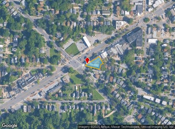
3201 Rhode Island Ave, Mount Rainier, MD 20712


NEARBY LISTINGS FOR SALE OR LEASE
Property Detail
3201 Rhode Island Ave
Washington-Arlington-Alexandria, DC-VA-MD-WV
Robert E Funkhousers 32Nd
17-1899608
LOTS 1.2.3.4.5
Apartment
Prince George's
X
Maryland
24033C0137E
1
2024
0.31 AC
2025
College Park
804700
Washington, DC
6,438 SF
DEMOGRAPHICS near 3201 Rhode Island Ave
1 Mile
3 Mile
5 Mile
2024 Total Population
25,509
221,239
737,526
2029 Population
23,946
209,508
692,045
Pop Growth 2024-2029
(6.13%)
(5.30%)
(6.17%)
Average Age
40
37
37
2024 Total Households
9,808
86,141
303,702
HH Growth 2024-2029
(6.70%)
(5.86%)
(7.25%)
Median Household Inc
$70,732
$74,419
$87,028
Avg Household Size
2.50
2.40
2.30
2024 Avg HH Vehicles
1.00
1.00
1.00
Median Home Value
$523,776
$494,018
$521,288
Median Year Built
1949
1957
1958
Nearby Places
Map Layers
Map Styles
 Street
 Aerial
- Restaurants
- Banks
- Shops
- Fitness
- Groceries
PUBLIC TRANSPORTATION
COMMUTER RAIL
Riverdale (CAMDEN - WASHINGTON - Maryland Area Regional Commuter Trains (The MARC), Camden Line - Maryland Area Regional Commuter Trains (The MARC))
DRIVE
WALK
Distance
Riverdale (CAMDEN - WASHINGTON - Maryland Area Regional Commuter Trains (The MARC), Camden Line - Maryland Area Regional Commuter Trains (The MARC))
8 min
3.4 mi
Lead (Fredericksburg Line - Virginia Railway Express, Manassas Line - Virginia Railway Express)
DRIVE
WALK
Distance
Lead (Fredericksburg Line - Virginia Railway Express, Manassas Line - Virginia Railway Express)
8 min
4.3 mi
AIRPORT
Ronald Reagan Washington Ntl
DRIVE
WALK
Distance
Ronald Reagan Washington Ntl
19 min
10.0 mi
Baltimore/Washington International Thurgood Marshall
DRIVE
WALK
Distance
Baltimore/Washington International Thurgood Marshall
41 min
27.2 mi
Washington Dulles International
DRIVE
WALK
Distance
Washington Dulles International
53 min
32.7 mi
Freight Ports
Port of Baltimore
DRIVE
WALK
Distance
Port of Baltimore
51 min
33.8 mi
SALE & LEASE HISTORY
LISTING DATE
SALE/LEASE

Feb 03, 2017
For Lease
Aug 22, 2017
For Lease
Nearby Properties
Address
Land Use
TOTAL SIZE
Lot Size
Zoning
Address
Land Use
TOTAL SIZE
Lot Size
Zoning
58,289 SF
418.97 AC
MU-4;PDR-1
Address
Land Use
TOTAL SIZE
Lot Size
Zoning
1,583,364 SF
276.66 AC
UNZONED
Address
Land Use
TOTAL SIZE
Lot Size
Zoning
1,642,951 SF
95.12 AC
RF-1
Address
Land Use
TOTAL SIZE
Lot Size
Zoning
95.32 AC
RA-1
Address
Land Use
TOTAL SIZE
Lot Size
Zoning
314,995 SF
5.83 AC
D-5
Address
Land Use
TOTAL SIZE
Lot Size
Zoning
1,835,827 SF
34.66 AC
UNZONED
Address
Land Use
TOTAL SIZE
Lot Size
Zoning
589,000 SF
1.39 AC
D-5
Address
Land Use
TOTAL SIZE
Lot Size
Zoning
791,730 SF
37.44 AC
RA-1
Address
Land Use
TOTAL SIZE
Lot Size
Zoning
823,802 SF
7.30 AC
MU-2
Address
Land Use
TOTAL SIZE
Lot Size
Zoning
2,985,682 SF
4.33 AC
RSF65
Address
Land Use
TOTAL SIZE
Lot Size
Zoning
503,872 SF
1.24 AC
D-5
Address
Land Use
TOTAL SIZE
Lot Size
Zoning
356,114 SF
2.97 AC
D-5
Address
Land Use
TOTAL SIZE
Lot Size
Zoning
407,850 SF
Address
Land Use
TOTAL SIZE
Lot Size
Zoning
248,643 SF
8.66 AC
RA-1
Address
Land Use
TOTAL SIZE
Lot Size
Zoning
338,258 SF
1.94 AC
PDR-1;PDR-
Address
Land Use
TOTAL SIZE
Lot Size
Zoning
281,204 SF
PDR-1;PDR-
Address
Land Use
TOTAL SIZE
Lot Size
Zoning
280,000 SF
1.55 AC
PDR-1
Address
Land Use
TOTAL SIZE
Lot Size
Zoning
1,201,133 SF
41.56 AC
RTOHC
Address
Land Use
TOTAL SIZE
Lot Size
Zoning
307,692 SF
0.58 AC
D-5
Address
Land Use
TOTAL SIZE
Lot Size
Zoning
348,844 SF
0.94 AC
D-5
Address
Land Use
TOTAL SIZE
Lot Size
Zoning
869,190 SF
4.97 AC
RA-1
Address
Land Use
TOTAL SIZE
Lot Size
Zoning
41.12 AC
RA-1
Address
Land Use
TOTAL SIZE
Lot Size
Zoning
446,000 SF
PDR-1
Address
Land Use
TOTAL SIZE
Lot Size
Zoning
268,520 SF
PDR-1
Address
Land Use
TOTAL SIZE
Lot Size
Zoning
425,000 SF
1.04 AC
MU-9B
Address
Land Use
TOTAL SIZE
Lot Size
Zoning
327,745 SF
9.39 AC
RF-1
Address
Land Use
TOTAL SIZE
Lot Size
Zoning
944,105 SF
23.09 AC
CGO
Address
Land Use
TOTAL SIZE
Lot Size
Zoning
241,725 SF
4.71 AC
MU-7B;PDR-
Address
Land Use
TOTAL SIZE
Lot Size
Zoning
424,800 SF
1.64 AC
NMU-5A/H-R
Address
Land Use
TOTAL SIZE
Lot Size
Zoning
326,985 SF
1.13 AC
MU-6B
The World's #1 Commercial Real Estate Marketplace
Connect with us
© 2025 CoStar Group
The information above has been obtained from sources believed reliable. While we do not doubt its accuracy we have not verified it and make no guarantee, warranty or representation about it. It is your responsibility to independently confirm its accuracy and completeness. Any projections, opinions, assumptions, or estimates used are for example only and do not represent the current or future performance of the property. The value of this transaction to you depends on tax and other factors which should be evaluated by your tax, financial, and legal advisors. You and your advisors should conduct a careful, independent investigation of the property to determine to your satisfaction the suitability of the property for your needs.