Property Record
321 N Preston Rd, Prosper, TX 75078


Property Detail
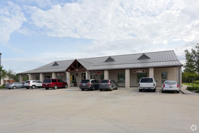
321 N Preston Rd
Dallas-Fort Worth-Arlington, TX
STONE CREEK COMMERCIAL, BLK C, LOT 4R; REPLAT
R-9102-00C-004R-1
COLLIN
Officebuilding
Texas
B and X Area of moderate flood hazard, usually the area between the limits of the 100-year and 500-year floods.
4r
2025
0.52 AC
2025
Outlying Collin County
030304
Dallas/Ft Worth
8,300 SF
NEARBY LISTINGS FOR SALE OR LEASE
DEMOGRAPHICS near 321 N Preston Rd
1 mile
3 mile
5 mile
2024 Total Population
8,296
52,860
146,727
2029 Population
10,131
65,657
180,826
Pop Growth 2024-2029
+ 22.12%
+ 24.21%
+ 23.24%
Average Age
36
34
35
2024 Total Households
2,362
15,951
45,107
HH Growth 2024-2029
+ 22.35%
+ 24.47%
+ 23.54%
Median Household Inc
$162,373
$163,911
$149,366
Avg Household Size
3.40
3.30
3.20
2024 Avg HH Vehicles
3.00
2.00
2.00
Median Home Value
$581,713
$521,749
$473,984
Median Year Built
2008
2011
2010
Nearby Places
Map Layers
Map Styles
 Street
 Aerial
Transit
 Traffic
 Biking
Places
Listings with unknown addresses are not visible on the map
- Restaurants
- Banks
- Shops
- Fitness
- Groceries
SALE & LEASE HISTORY
LISTING DATE
SALE/LEASE

Feb 01, 2019
For Lease
Nearby Properties
Address
Land Use
TOTAL SIZE
Lot Size
Zoning
Address
Land Use
TOTAL SIZE
Lot Size
Zoning
479,244 SF
26.82 AC
COMM
Address
Land Use
TOTAL SIZE
Lot Size
Zoning
882,734 SF
98.26 AC
Address
Land Use
TOTAL SIZE
Lot Size
Zoning
621,249 SF
80.03 AC
Address
Land Use
TOTAL SIZE
Lot Size
Zoning
980,997 SF
93.94 AC
Address
Land Use
TOTAL SIZE
Lot Size
Zoning
151,733 SF
Address
Land Use
TOTAL SIZE
Lot Size
Zoning
530,080 SF
16.91 AC
Address
Land Use
TOTAL SIZE
Lot Size
Zoning
528,218 SF
32.80 AC
PD
Address
Land Use
TOTAL SIZE
Lot Size
Zoning
357,333 SF
15.01 AC
Address
Land Use
TOTAL SIZE
Lot Size
Zoning
218,013 SF
32.85 AC
AG
Address
Land Use
TOTAL SIZE
Lot Size
Zoning
536,616 SF
23.21 AC
MF-M
Address
Land Use
TOTAL SIZE
Lot Size
Zoning
348,136 SF
23.07 AC
MF-L
Address
Land Use
TOTAL SIZE
Lot Size
Zoning
275,288 SF
19.40 AC
MF-M
Address
Land Use
TOTAL SIZE
Lot Size
Zoning
262,995 SF
10.27 AC
Address
Land Use
TOTAL SIZE
Lot Size
Zoning
200,259 SF
44.76 AC
Address
Land Use
TOTAL SIZE
Lot Size
Zoning
309,073 SF
32.96 AC
Address
Land Use
TOTAL SIZE
Lot Size
Zoning
251,455 SF
35.62 AC
Address
Land Use
TOTAL SIZE
Lot Size
Zoning
300,566 SF
7.86 AC
Address
Land Use
TOTAL SIZE
Lot Size
Zoning
436,200 SF
24.95 AC
Address
Land Use
TOTAL SIZE
Lot Size
Zoning
208,462 SF
24.46 AC
Address
Land Use
TOTAL SIZE
Lot Size
Zoning
429,823 SF
73.82 AC
Address
Land Use
TOTAL SIZE
Lot Size
Zoning
136,969 SF
19.87 AC
Address
Land Use
TOTAL SIZE
Lot Size
Zoning
220,499 SF
35.28 AC
Address
Land Use
TOTAL SIZE
Lot Size
Zoning
140,868 SF
12.64 AC
Address
Land Use
TOTAL SIZE
Lot Size
Zoning
201,473 SF
48.22 AC
Address
Land Use
TOTAL SIZE
Lot Size
Zoning
139,799 SF
19.66 AC
RESI
Address
Land Use
TOTAL SIZE
Lot Size
Zoning
110.70 AC
Address
Land Use
TOTAL SIZE
Lot Size
Zoning
63,002 SF
59.05 AC
COMM
Address
Land Use
TOTAL SIZE
Lot Size
Zoning
96,173 SF
13.92 AC
Address
Land Use
TOTAL SIZE
Lot Size
Zoning
212,155 SF
12.16 AC
Address
Land Use
TOTAL SIZE
Lot Size
Zoning
100,441 SF
12.31 AC
The World's #1 Commercial Real Estate Marketplace
Connect with us
© 2026 CoStar Group
The information above has been obtained from sources believed reliable. While we do not doubt its accuracy we have not verified it and make no guarantee, warranty or representation about it. It is your responsibility to independently confirm its accuracy and completeness. Any projections, opinions, assumptions, or estimates used are for example only and do not represent the current or future performance of the property. The value of this transaction to you depends on tax and other factors which should be evaluated by your tax, financial, and legal advisors. You and your advisors should conduct a careful, independent investigation of the property to determine to your satisfaction the suitability of the property for your needs.