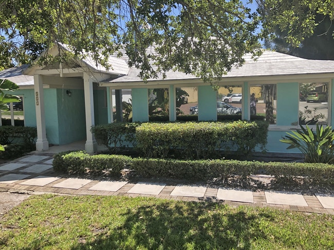
Property Record
322 Se Georgia Ave, Stuart, FL 34994

Save to a Folder
{{folder.Name}}
{{folder.ListingIds.length}} Properties
{{folder.ListingIds.length}} Property
Create a New Folder
Property Detail
322 Se Georgia Ave
04-38-41-000-000-00060-3
BEG 1798.3 E OF SW COR GOVT LOT 3 RUN N 300 W 70 S 300 E 70 TO BEG (LESS RW & LESS N 1/2 OF THIS DESC) OR 358/999
Officebuilding
MARTIN
B1
Florida
B and X Area of moderate flood hazard, usually the area between the limits of the 100-year and 500-year floods.
3
2024
0.20 AC
2025
Port St Lucie
000800
Port St Lucie/Fort Pierce
1,787 SF
Port St. Lucie, FL
NEARBY LISTINGS FOR SALE OR LEASE
DEMOGRAPHICS near 322 Se Georgia Ave
1 mile
3 mile
5 mile
2025 Total Population
4,571
51,747
108,560
2030 Population
4,786
54,162
114,458
Pop Growth 2025-2030
+ 4.70%
+ 4.67%
+ 5.43%
Average Age
46
49
49
2025 Total Households
1,960
23,627
48,279
HH Growth 2025-2030
+ 4.49%
+ 4.63%
+ 5.53%
Median Household Inc
$54,539
$66,521
$76,509
Avg Household Size
2.00
2.10
2.20
2025 Avg HH Vehicles
2.00
2.00
2.00
Median Home Value
$416,201
$409,507
$451,316
Median Year Built
1976
1983
1986
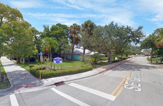
Nearby Places
Map Layers
Map Styles
 Street
 Aerial
Layers
 Traffic
 Biking
Places
Listings with unknown addresses are not visible on the map
- Restaurants
- Banks
- Shops
- Fitness
- Groceries
SALE & LEASE HISTORY
LISTING DATE
SALE/LEASE

May 31, 2019
For Lease
Nearby Properties
Address
Land Use
TOTAL SIZE
Lot Size
Zoning
Address
Land Use
TOTAL SIZE
Lot Size
Zoning
609,195 SF
13.77 AC
H
Address
Land Use
TOTAL SIZE
Lot Size
Zoning
436,532 SF
636.83 AC
PAF
Address
Land Use
TOTAL SIZE
Lot Size
Zoning
309,276 SF
13.73 AC
CPUD
Address
Land Use
TOTAL SIZE
Lot Size
Zoning
11.34 AC
Address
Land Use
TOTAL SIZE
Lot Size
Zoning
309,031 SF
76.74 AC
RPUD
Address
Land Use
TOTAL SIZE
Lot Size
Zoning
15.79 AC
Address
Land Use
TOTAL SIZE
Lot Size
Zoning
378,814 SF
34.25 AC
PUDR
Address
Land Use
TOTAL SIZE
Lot Size
Zoning
14.86 AC
M1
Address
Land Use
TOTAL SIZE
Lot Size
Zoning
310,460 SF
48.85 AC
PS2
Address
Land Use
TOTAL SIZE
Lot Size
Zoning
6.66 AC
RPUD
Address
Land Use
TOTAL SIZE
Lot Size
Zoning
23.08 AC
RM8
Address
Land Use
TOTAL SIZE
Lot Size
Zoning
9.45 AC
RS6
Address
Land Use
TOTAL SIZE
Lot Size
Zoning
200,686 SF
9.98 AC
RPUD
Address
Land Use
TOTAL SIZE
Lot Size
Zoning
160,211 SF
17.44 AC
CPUD
Address
Land Use
TOTAL SIZE
Lot Size
Zoning
284,610 SF
33.04 AC
R3
Address
Land Use
TOTAL SIZE
Lot Size
Zoning
195,729 SF
20.25 AC
CPUD
Address
Land Use
TOTAL SIZE
Lot Size
Zoning
545,151 SF
62.49 AC
PAF
Address
Land Use
TOTAL SIZE
Lot Size
Zoning
85,872 SF
7.91 AC
CPUD
Address
Land Use
TOTAL SIZE
Lot Size
Zoning
334,117 SF
54 AC
RPUD
Address
Land Use
TOTAL SIZE
Lot Size
Zoning
127,238 SF
3.62 AC
P
Address
Land Use
TOTAL SIZE
Lot Size
Zoning
106,357 SF
22.96 AC
Address
Land Use
TOTAL SIZE
Lot Size
Zoning
307,010 SF
33.70 AC
CPUD
Address
Land Use
TOTAL SIZE
Lot Size
Zoning
189,035 SF
20.63 AC
R3
Address
Land Use
TOTAL SIZE
Lot Size
Zoning
171,655 SF
15.17 AC
B2
Address
Land Use
TOTAL SIZE
Lot Size
Zoning
136,615 SF
21.72 AC
Address
Land Use
TOTAL SIZE
Lot Size
Zoning
1,050 SF
5.33 AC
R3
Address
Land Use
TOTAL SIZE
Lot Size
Zoning
23,640 SF
15.28 AC
B2
Address
Land Use
TOTAL SIZE
Lot Size
Zoning
124,082 SF
4.60 AC
P
Address
Land Use
TOTAL SIZE
Lot Size
Zoning
2,221 SF
18.12 AC
R3A
Address
Land Use
TOTAL SIZE
Lot Size
Zoning
2,400 SF
7.31 AC
INDUST
The World's #1 Commercial Real Estate Marketplace
Connect with us
© 2026 CoStar Group
The information above has been obtained from sources believed reliable. While we do not doubt its accuracy we have not verified it and make no guarantee, warranty or representation about it. It is your responsibility to independently confirm its accuracy and completeness. Any projections, opinions, assumptions, or estimates used are for example only and do not represent the current or future performance of the property. The value of this transaction to you depends on tax and other factors which should be evaluated by your tax, financial, and legal advisors. You and your advisors should conduct a careful, independent investigation of the property to determine to your satisfaction the suitability of the property for your needs.