Property Record
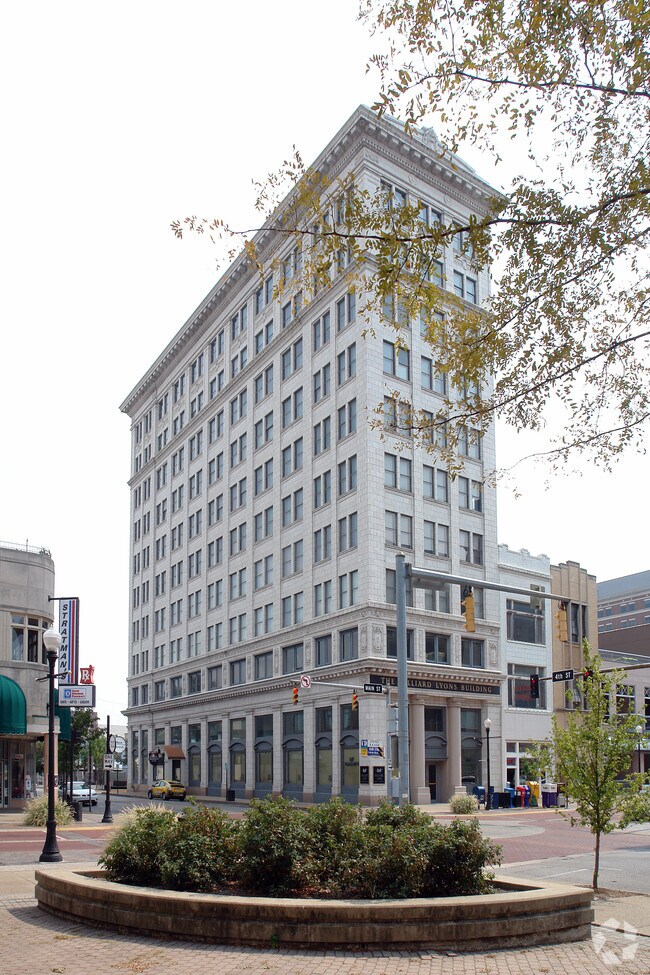
329 Main St, Evansville, IN 47708


Property Detail
329 Main St
Evansville, IN
COR PT 37 1/2 DONATION LOT 182
82-06-30-020-022.013-029
Vanderburgh
Apartment
Indiana
B and X Area of moderate flood hazard, usually the area between the limits of the 100-year and 500-year floods.
182
2025
0.12 AC
2025
Downtown Evansville
001800
Evansville
65,812 SF
NEARBY LISTINGS FOR SALE OR LEASE
DEMOGRAPHICS near 329 Main St
1 mile
3 mile
5 mile
2025 Total Population
9,584
66,752
122,629
2030 Population
10,067
67,841
123,249
Pop Growth 2025-2030
+ 5.04%
+ 1.63%
+ 0.51%
Average Age
40
39
40
2025 Total Households
4,526
28,833
53,828
HH Growth 2025-2030
+ 5.57%
+ 1.68%
+ 0.48%
Median Household Inc
$35,979
$48,108
$53,925
Avg Household Size
1.90
2.20
2.20
2025 Avg HH Vehicles
1.00
2.00
2.00
Median Home Value
$114,878
$116,606
$149,253
Median Year Built
1949
1949
1959
Nearby Places
Map Layers
Map Styles
 Street
 Aerial
Layers
 Traffic
 Biking
Places
Listings with unknown addresses are not visible on the map
- Restaurants
- Banks
- Shops
- Fitness
- Groceries
PUBLIC TRANSPORTATION
AIRPORT
Evansville Regional
Drive
Walk
Distance
Evansville Regional
14 min
6.4 mi
Nearby Properties
Address
Land Use
TOTAL SIZE
Lot Size
Zoning
Address
Land Use
TOTAL SIZE
Lot Size
Zoning
84,660 SF
12.95 AC
Address
Land Use
TOTAL SIZE
Lot Size
Zoning
20,964 SF
2.35 AC
Address
Land Use
TOTAL SIZE
Lot Size
Zoning
15,233 SF
3.31 AC
Address
Land Use
TOTAL SIZE
Lot Size
Zoning
51,342 SF
4.43 AC
Address
Land Use
TOTAL SIZE
Lot Size
Zoning
165,472 SF
1.38 AC
Address
Land Use
TOTAL SIZE
Lot Size
Zoning
117,580 SF
1.74 AC
Address
Land Use
TOTAL SIZE
Lot Size
Zoning
21,831 SF
3.03 AC
Address
Land Use
TOTAL SIZE
Lot Size
Zoning
92,132 SF
1.68 AC
Address
Land Use
TOTAL SIZE
Lot Size
Zoning
13,182 SF
25.33 AC
Address
Land Use
TOTAL SIZE
Lot Size
Zoning
23,108 SF
2.92 AC
Address
Land Use
TOTAL SIZE
Lot Size
Zoning
223,202 SF
2.28 AC
Address
Land Use
TOTAL SIZE
Lot Size
Zoning
784,971 SF
15.37 AC
Address
Land Use
TOTAL SIZE
Lot Size
Zoning
87,099 SF
2.28 AC
Address
Land Use
TOTAL SIZE
Lot Size
Zoning
235,153 SF
2.61 AC
Address
Land Use
TOTAL SIZE
Lot Size
Zoning
20,286 SF
4.57 AC
Address
Land Use
TOTAL SIZE
Lot Size
Zoning
4,284 SF
13.14 AC
Address
Land Use
TOTAL SIZE
Lot Size
Zoning
25,595 SF
14.99 AC
Address
Land Use
TOTAL SIZE
Lot Size
Zoning
61,652 SF
15.02 AC
Address
Land Use
TOTAL SIZE
Lot Size
Zoning
82,488 SF
1.90 AC
8
Address
Land Use
TOTAL SIZE
Lot Size
Zoning
159,074 SF
1.07 AC
Address
Land Use
TOTAL SIZE
Lot Size
Zoning
8,920 SF
2.62 AC
Address
Land Use
TOTAL SIZE
Lot Size
Zoning
331,588 SF
0.96 AC
Address
Land Use
TOTAL SIZE
Lot Size
Zoning
75,109 SF
1.64 AC
Address
Land Use
TOTAL SIZE
Lot Size
Zoning
4,200 SF
15.32 AC
Address
Land Use
TOTAL SIZE
Lot Size
Zoning
5,808 SF
12.20 AC
Address
Land Use
TOTAL SIZE
Lot Size
Zoning
4,160 SF
9.22 AC
Address
Land Use
TOTAL SIZE
Lot Size
Zoning
185,563 SF
12.47 AC
Address
Land Use
TOTAL SIZE
Lot Size
Zoning
33,898 SF
2.34 AC
Address
Land Use
TOTAL SIZE
Lot Size
Zoning
150,102 SF
20.72 AC
Address
Land Use
TOTAL SIZE
Lot Size
Zoning
49,533 SF
0.29 AC
The World's #1 Commercial Real Estate Marketplace
Connect with us
© 2026 CoStar Group
The information above has been obtained from sources believed reliable. While we do not doubt its accuracy we have not verified it and make no guarantee, warranty or representation about it. It is your responsibility to independently confirm its accuracy and completeness. Any projections, opinions, assumptions, or estimates used are for example only and do not represent the current or future performance of the property. The value of this transaction to you depends on tax and other factors which should be evaluated by your tax, financial, and legal advisors. You and your advisors should conduct a careful, independent investigation of the property to determine to your satisfaction the suitability of the property for your needs.