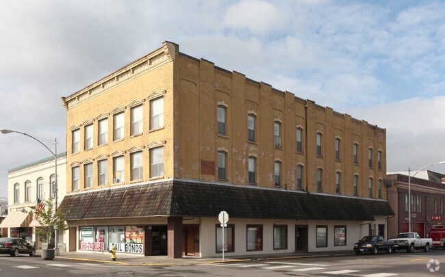
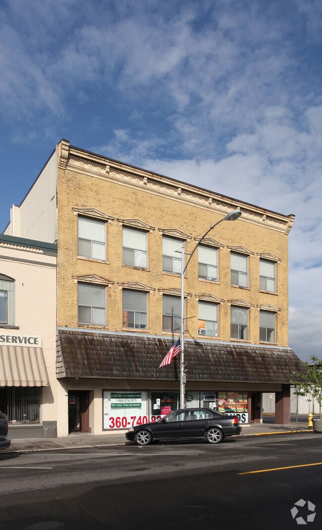
Property Record
383 Nw Chehalis Ave, Chehalis, WA 98532

Property Detail
383 Nw Chehalis Ave
003755-000-000
SECTION 29 TOWNSHIP 14N RANGE 02W N2 OF LOTS 2 & 3, BLK 14 BARRETTS ADD
Multifamilydwelling
LEWIS
CBD
Washington
2024
2,3
2025
0.11 AC
970800
Other Market Areas
9,897 SF
Centralia, WA
NEARBY LISTINGS FOR SALE OR LEASE
DEMOGRAPHICS near 383 Nw Chehalis Ave
1 mile
3 mile
5 mile
2025 Total Population
5,122
13,095
35,391
2030 Population
5,288
13,596
36,701
Pop Growth 2025-2030
+ 3.24%
+ 3.83%
+ 3.70%
Average Age
38
39
40
2025 Total Households
1,970
5,000
13,548
HH Growth 2025-2030
+ 3.20%
+ 3.82%
+ 3.67%
Median Household Inc
$70,879
$76,548
$70,955
Avg Household Size
2.40
2.50
2.50
2025 Avg HH Vehicles
2.00
2.00
2.00
Median Home Value
$370,226
$383,150
$381,317
Median Year Built
1958
1973
1976
Nearby Places
Map Layers
Map Styles
 Street
 Aerial
Layers
 Traffic
 Biking
Places
Listings with unknown addresses are not visible on the map
- Restaurants
- Banks
- Shops
- Fitness
- Groceries
PUBLIC TRANSPORTATION
COMMUTER RAIL
Drive
Walk
Distance
10 min
4.4 mi
Freight Ports
Port of Long View, WA
Drive
Walk
Distance
Port of Long View, WA
55 min
42.8 mi
SALE & LEASE HISTORY
LISTING DATE
SALE/LEASE

Oct 16, 2019
For Lease
Apr 10, 2019
For Lease
Nearby Properties
Address
Land Use
TOTAL SIZE
Lot Size
Zoning
Address
Land Use
TOTAL SIZE
Lot Size
Zoning
83,945 SF
3.12 AC
ILCG
Address
Land Use
TOTAL SIZE
Lot Size
Zoning
215,594 SF
42.22 AC
RUGA
Address
Land Use
TOTAL SIZE
Lot Size
Zoning
147,432 SF
8.28 AC
IL
Address
Land Use
TOTAL SIZE
Lot Size
Zoning
15,000 SF
66.30 AC
EPFI
Address
Land Use
TOTAL SIZE
Lot Size
Zoning
62,057 SF
2.08 AC
EPFG
Address
Land Use
TOTAL SIZE
Lot Size
Zoning
1,714 SF
220.30 AC
EPFA
Address
Land Use
TOTAL SIZE
Lot Size
Zoning
222,077 SF
Address
Land Use
TOTAL SIZE
Lot Size
Zoning
3,012 SF
11.23 AC
R4
Address
Land Use
TOTAL SIZE
Lot Size
Zoning
82,667 SF
Address
Land Use
TOTAL SIZE
Lot Size
Zoning
7,168 SF
3.95 AC
OSPF
Address
Land Use
TOTAL SIZE
Lot Size
Zoning
43,477 SF
8.64 AC
CG
Address
Land Use
TOTAL SIZE
Lot Size
Zoning
53,794 SF
7.50 AC
EPFS
Address
Land Use
TOTAL SIZE
Lot Size
Zoning
3,742 SF
21.83 AC
EPFU
Address
Land Use
TOTAL SIZE
Lot Size
Zoning
34,150 SF
7.20 AC
CG
Address
Land Use
TOTAL SIZE
Lot Size
Zoning
2,741 SF
20.47 AC
EPFS
Address
Land Use
TOTAL SIZE
Lot Size
Zoning
70,940 SF
10.34 AC
IL
Address
Land Use
TOTAL SIZE
Lot Size
Zoning
4,361 SF
5.41 AC
R2
Address
Land Use
TOTAL SIZE
Lot Size
Zoning
94,044 SF
Address
Land Use
TOTAL SIZE
Lot Size
Zoning
2,750 SF
2 AC
CG
Address
Land Use
TOTAL SIZE
Lot Size
Zoning
13.11 AC
Address
Land Use
TOTAL SIZE
Lot Size
Zoning
83,043 SF
6.76 AC
CG
Address
Land Use
TOTAL SIZE
Lot Size
Zoning
30,308 SF
45.31 AC
OSPF
Address
Land Use
TOTAL SIZE
Lot Size
Zoning
31,418 SF
1.75 AC
CF
Address
Land Use
TOTAL SIZE
Lot Size
Zoning
4.32 AC
RUGA
Address
Land Use
TOTAL SIZE
Lot Size
Zoning
138,421 SF
12.16 AC
CG
Address
Land Use
TOTAL SIZE
Lot Size
Zoning
56,121 SF
4.05 AC
ILCG
Address
Land Use
TOTAL SIZE
Lot Size
Zoning
Address
Land Use
TOTAL SIZE
Lot Size
Zoning
22,974 SF
8.73 AC
CF
Address
Land Use
TOTAL SIZE
Lot Size
Zoning
304,473 SF
27.22 AC
CG
Address
Land Use
TOTAL SIZE
Lot Size
Zoning
1,056 SF
12.90 AC
EPFS
The World's #1 Commercial Real Estate Marketplace
Connect with us
© 2026 CoStar Group
The information above has been obtained from sources believed reliable. While we do not doubt its accuracy we have not verified it and make no guarantee, warranty or representation about it. It is your responsibility to independently confirm its accuracy and completeness. Any projections, opinions, assumptions, or estimates used are for example only and do not represent the current or future performance of the property. The value of this transaction to you depends on tax and other factors which should be evaluated by your tax, financial, and legal advisors. You and your advisors should conduct a careful, independent investigation of the property to determine to your satisfaction the suitability of the property for your needs.