Property Record
40 Excel Dr, Rochester, NY 14621
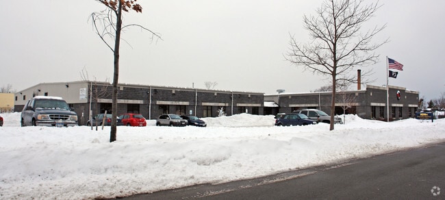

Property Detail
40 Excel Dr
Rochester, NY
MONROE
261400 091.63-1-2.008
New York
Commercialacreage
2.008
2025
1.21 AC
2025
Greater Rochester
004702
Rochester
NEARBY LISTINGS FOR SALE OR LEASE
DEMOGRAPHICS near 40 Excel Dr
1 mile
3 mile
5 mile
2025 Total Population
25,099
165,199
320,912
2030 Population
24,856
163,568
317,657
Pop Growth 2025-2030
(0.97%)
(0.99%)
(1.01%)
Average Age
38
38
39
2025 Total Households
10,210
71,121
141,917
HH Growth 2025-2030
(0.82%)
(0.89%)
(1.01%)
Median Household Inc
$35,383
$45,407
$56,487
Avg Household Size
2.30
2.20
2.20
2025 Avg HH Vehicles
1.00
1.00
1.00
Median Home Value
$96,702
$135,969
$159,792
Median Year Built
1950
1948
1950
Nearby Places
Map Layers
Map Styles
 Street
 Aerial
Layers
 Traffic
 Biking
Places
Listings with unknown addresses are not visible on the map
- Restaurants
- Banks
- Shops
- Fitness
- Groceries
PUBLIC TRANSPORTATION
AIRPORT
Frederick Douglass/Greater Rochester International
Drive
Walk
Distance
Frederick Douglass/Greater Rochester International
12 min
6.9 mi
Freight Ports
Albany, NY Port
Drive
Walk
Distance
Albany, NY Port
271 min
229.1 mi
SALE & LEASE HISTORY
LISTING DATE
SALE/LEASE

Oct 25, 2024
For Lease
Oct 04, 2024
For Sale
Nearby Properties
Address
Land Use
TOTAL SIZE
Lot Size
Zoning
Address
Land Use
TOTAL SIZE
Lot Size
Zoning
847,728 SF
41.57 AC
Address
Land Use
TOTAL SIZE
Lot Size
Zoning
0.47 AC
Address
Land Use
TOTAL SIZE
Lot Size
Zoning
60,300 SF
59.02 AC
06 - INDUS
Address
Land Use
TOTAL SIZE
Lot Size
Zoning
0.13 AC
Address
Land Use
TOTAL SIZE
Lot Size
Zoning
181,500 SF
57.85 AC
Address
Land Use
TOTAL SIZE
Lot Size
Zoning
270,150 SF
34.40 AC
02 - SINGL
Address
Land Use
TOTAL SIZE
Lot Size
Zoning
13.10 AC
Address
Land Use
TOTAL SIZE
Lot Size
Zoning
373,200 SF
5.42 AC
Address
Land Use
TOTAL SIZE
Lot Size
Zoning
178,321 SF
3.10 AC
Address
Land Use
TOTAL SIZE
Lot Size
Zoning
0.01 AC
Address
Land Use
TOTAL SIZE
Lot Size
Zoning
302,484 SF
2.53 AC
Address
Land Use
TOTAL SIZE
Lot Size
Zoning
473,876 SF
1.47 AC
Address
Land Use
TOTAL SIZE
Lot Size
Zoning
342,266 SF
1.44 AC
Address
Land Use
TOTAL SIZE
Lot Size
Zoning
7,200 SF
12.35 AC
Address
Land Use
TOTAL SIZE
Lot Size
Zoning
0.41 AC
Address
Land Use
TOTAL SIZE
Lot Size
Zoning
0.01 AC
Address
Land Use
TOTAL SIZE
Lot Size
Zoning
416,083 SF
0.94 AC
Address
Land Use
TOTAL SIZE
Lot Size
Zoning
323,264 SF
21.06 AC
06 - INDUS
Address
Land Use
TOTAL SIZE
Lot Size
Zoning
0.01 AC
Address
Land Use
TOTAL SIZE
Lot Size
Zoning
491,375 SF
5.90 AC
Address
Land Use
TOTAL SIZE
Lot Size
Zoning
161,812 SF
5.18 AC
06 - INDUS
Address
Land Use
TOTAL SIZE
Lot Size
Zoning
336,447 SF
1.39 AC
Address
Land Use
TOTAL SIZE
Lot Size
Zoning
335,958 SF
10.19 AC
Address
Land Use
TOTAL SIZE
Lot Size
Zoning
151,590 SF
1.14 AC
Address
Land Use
TOTAL SIZE
Lot Size
Zoning
238,750 SF
17.07 AC
03 - MULTI
Address
Land Use
TOTAL SIZE
Lot Size
Zoning
233,579 SF
1.13 AC
Address
Land Use
TOTAL SIZE
Lot Size
Zoning
410,400 SF
2.88 AC
Address
Land Use
TOTAL SIZE
Lot Size
Zoning
193,892 SF
18.62 AC
05 - COMME
Address
Land Use
TOTAL SIZE
Lot Size
Zoning
261,960 SF
3.73 AC
Address
Land Use
TOTAL SIZE
Lot Size
Zoning
203,306 SF
3.91 AC
The World's #1 Commercial Real Estate Marketplace
Connect with us
© 2026 CoStar Group
The information above has been obtained from sources believed reliable. While we do not doubt its accuracy we have not verified it and make no guarantee, warranty or representation about it. It is your responsibility to independently confirm its accuracy and completeness. Any projections, opinions, assumptions, or estimates used are for example only and do not represent the current or future performance of the property. The value of this transaction to you depends on tax and other factors which should be evaluated by your tax, financial, and legal advisors. You and your advisors should conduct a careful, independent investigation of the property to determine to your satisfaction the suitability of the property for your needs.