Property Record
4039 Gap Rd, Knoxville, TN 37912


Save to a Folder
{{folder.Name}}
{{folder.ListingIds.length}} Properties
{{folder.ListingIds.length}} Property
Create a New Folder
Property Detail
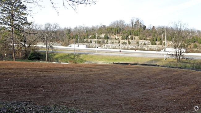
4039 Gap Rd
Knoxville, TN
SUBDIVISIONNAME RICHARDS NEW DEAL RESUB MAPPLATB 200611 15 MAPPLATP 0041971 DIMENSIONS 409.2 X 276.58 X IRR
080EE-009
KNOX
Vacantlandnec
Tennessee
B and X Area of moderate flood hazard, usually the area between the limits of the 100-year and 500-year floods.
4r1
2025
2.07 AC
2025
North/Broadway
002800
Knoxville
NEARBY LISTINGS FOR SALE OR LEASE
DEMOGRAPHICS near 4039 Gap Rd
1 mile
3 mile
5 mile
2025 Total Population
9,399
73,400
177,909
2030 Population
9,822
76,627
185,981
Pop Growth 2025-2030
+ 4.50%
+ 4.40%
+ 4.54%
Average Age
34
36
37
2025 Total Households
3,720
31,725
75,110
HH Growth 2025-2030
+ 4.65%
+ 4.39%
+ 4.75%
Median Household Inc
$36,902
$45,663
$49,934
Avg Household Size
2.40
2.20
2.20
2025 Avg HH Vehicles
2.00
2.00
2.00
Median Home Value
$192,883
$239,374
$273,707
Median Year Built
1977
1972
1976
Nearby Places
Map Layers
Map Styles
 Street
 Aerial
Layers
 Traffic
 Biking
Places
Listings with unknown addresses are not visible on the map
- Restaurants
- Banks
- Shops
- Fitness
- Groceries
PUBLIC TRANSPORTATION
AIRPORT
McGhee Tyson
Drive
Walk
Distance
McGhee Tyson
35 min
19.3 mi
Freight Ports
North Charleston Terminal
Drive
Walk
Distance
North Charleston Terminal
421 min
366.4 mi
Nearby Properties
Address
Land Use
TOTAL SIZE
Lot Size
Zoning
Address
Land Use
TOTAL SIZE
Lot Size
Zoning
285,481 SF
1.77 AC
Address
Land Use
TOTAL SIZE
Lot Size
Zoning
254,407 SF
1.08 AC
Address
Land Use
TOTAL SIZE
Lot Size
Zoning
180,708 SF
5.26 AC
Address
Land Use
TOTAL SIZE
Lot Size
Zoning
52,072 SF
18.05 AC
Address
Land Use
TOTAL SIZE
Lot Size
Zoning
291,550 SF
2.47 AC
Address
Land Use
TOTAL SIZE
Lot Size
Zoning
201,897 SF
2.07 AC
Address
Land Use
TOTAL SIZE
Lot Size
Zoning
62,114 SF
3.60 AC
Address
Land Use
TOTAL SIZE
Lot Size
Zoning
4,922 SF
46.42 AC
Address
Land Use
TOTAL SIZE
Lot Size
Zoning
84,171 SF
1.88 AC
Address
Land Use
TOTAL SIZE
Lot Size
Zoning
3,850 SF
23.59 AC
Address
Land Use
TOTAL SIZE
Lot Size
Zoning
87,764 SF
5.59 AC
Address
Land Use
TOTAL SIZE
Lot Size
Zoning
8,050 SF
8 AC
Address
Land Use
TOTAL SIZE
Lot Size
Zoning
54,996 SF
2.31 AC
Address
Land Use
TOTAL SIZE
Lot Size
Zoning
77,112 SF
5.81 AC
Address
Land Use
TOTAL SIZE
Lot Size
Zoning
10,000 SF
4.85 AC
Address
Land Use
TOTAL SIZE
Lot Size
Zoning
83,408 SF
1.66 AC
Address
Land Use
TOTAL SIZE
Lot Size
Zoning
225,330 SF
2.84 AC
Address
Land Use
TOTAL SIZE
Lot Size
Zoning
347,788 SF
43.95 AC
Address
Land Use
TOTAL SIZE
Lot Size
Zoning
72,808 SF
6.38 AC
Address
Land Use
TOTAL SIZE
Lot Size
Zoning
24,160 SF
4.15 AC
Address
Land Use
TOTAL SIZE
Lot Size
Zoning
35,784 SF
6.88 AC
Address
Land Use
TOTAL SIZE
Lot Size
Zoning
7,375 SF
9.72 AC
Address
Land Use
TOTAL SIZE
Lot Size
Zoning
80,946 SF
2.04 AC
Address
Land Use
TOTAL SIZE
Lot Size
Zoning
39,926 SF
0.01 AC
Address
Land Use
TOTAL SIZE
Lot Size
Zoning
1,218 SF
2.37 AC
Address
Land Use
TOTAL SIZE
Lot Size
Zoning
94,026 SF
5.07 AC
Address
Land Use
TOTAL SIZE
Lot Size
Zoning
11,187 SF
9.85 AC
Address
Land Use
TOTAL SIZE
Lot Size
Zoning
3,547 SF
2.12 AC
Address
Land Use
TOTAL SIZE
Lot Size
Zoning
75,582 SF
2.63 AC
Address
Land Use
TOTAL SIZE
Lot Size
Zoning
48,229 SF
4.77 AC
The World's #1 Commercial Real Estate Marketplace
Connect with us
© 2026 CoStar Group
The information above has been obtained from sources believed reliable. While we do not doubt its accuracy we have not verified it and make no guarantee, warranty or representation about it. It is your responsibility to independently confirm its accuracy and completeness. Any projections, opinions, assumptions, or estimates used are for example only and do not represent the current or future performance of the property. The value of this transaction to you depends on tax and other factors which should be evaluated by your tax, financial, and legal advisors. You and your advisors should conduct a careful, independent investigation of the property to determine to your satisfaction the suitability of the property for your needs.