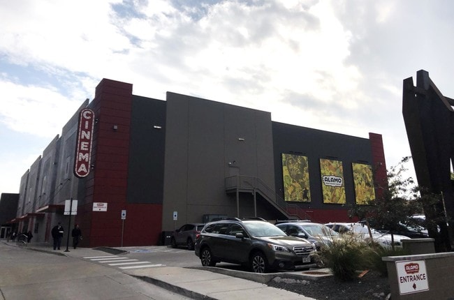
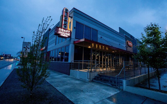
Property Record
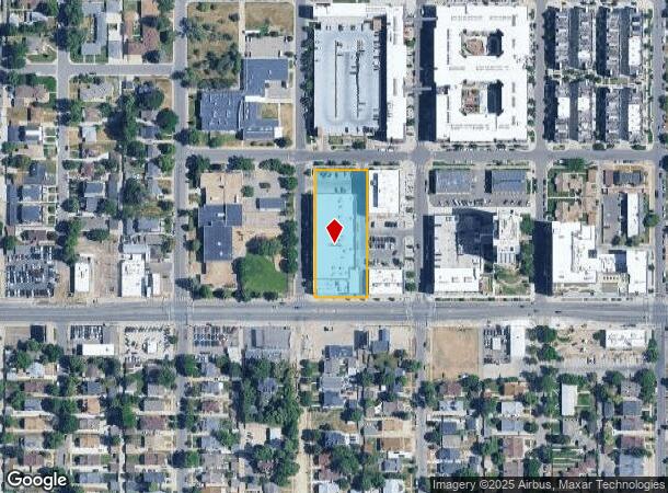
4255 W Colfax Ave, Denver, CO 80204

NEARBY LISTINGS FOR SALE OR LEASE
Property Detail
4255 W Colfax Ave
Denver-Aurora-Lakewood, CO
South Sloans Lake Flg 1
2314-38-003
SOUTH SLOANS LAKE FLG 1 BLK 7 L3
Theater
Denver
X
Colorado
0800460181H
3
2024
1.14 AC
2024
West
000703
Denver
32,310 SF
DEMOGRAPHICS near 4255 W Colfax Ave
1 Mile
3 Mile
5 Mile
2024 Total Population
27,070
196,118
474,241
2029 Population
27,918
198,235
478,608
Pop Growth 2024-2029
+ 3.13%
+ 1.08%
+ 0.92%
Average Age
36
38
38
2024 Total Households
11,991
91,258
221,291
HH Growth 2024-2029
+ 3.32%
+ 1.30%
+ 1.03%
Median Household Inc
$73,149
$78,923
$79,040
Avg Household Size
2.10
2.10
2.00
2024 Avg HH Vehicles
1.00
2.00
2.00
Median Home Value
$615,377
$575,985
$555,326
Median Year Built
1969
1971
1967
Nearby Places
Map Layers
Map Styles
 Street
 Aerial
- Restaurants
- Banks
- Shops
- Fitness
- Groceries
PUBLIC TRANSPORTATION
TRANSIT/SUBWAY
Perry (W Line - Denver Regional Transportation District Light Rail (TheRide))
DRIVE
WALK
Distance
Perry (W Line - Denver Regional Transportation District Light Rail (TheRide))
2 min
13 min
0.5 mi
Knox (W Line - Denver Regional Transportation District Light Rail (TheRide))
DRIVE
WALK
Distance
Knox (W Line - Denver Regional Transportation District Light Rail (TheRide))
3 min
17 min
0.9 mi
Sheridan (W Line - Denver Regional Transportation District Light Rail (TheRide))
DRIVE
WALK
Distance
Sheridan (W Line - Denver Regional Transportation District Light Rail (TheRide))
3 min
18 min
0.9 mi
Lamar (W Line - Denver Regional Transportation District Light Rail (TheRide))
DRIVE
WALK
Distance
Lamar (W Line - Denver Regional Transportation District Light Rail (TheRide))
4 min
18 min
1.0 mi
AIRPORT
Denver International
DRIVE
WALK
Distance
Denver International
37 min
27.9 mi
Freight Ports
Port of Shreveport
DRIVE
WALK
Distance
Port of Shreveport
1 min
815.7 mi
SALE & LEASE HISTORY
LISTING DATE
SALE/LEASE

Jan 28, 2019
For Sale
Nearby Properties
Address
Land Use
TOTAL SIZE
Lot Size
Zoning
Address
Land Use
TOTAL SIZE
Lot Size
Zoning
1,882,179 SF
21.15 AC
D-TD
Address
Land Use
TOTAL SIZE
Lot Size
Zoning
1,721,086 SF
21.34 AC
C-MU-30
Address
Land Use
TOTAL SIZE
Lot Size
Zoning
794,383 SF
0.90 AC
D-TD
Address
Land Use
TOTAL SIZE
Lot Size
Zoning
1,542,612 SF
1.56 AC
D-C
Address
Land Use
TOTAL SIZE
Lot Size
Zoning
1,567,575 SF
1.40 AC
D-C
Address
Land Use
TOTAL SIZE
Lot Size
Zoning
1,096,923 SF
16.14 AC
CMP-H
Address
Land Use
TOTAL SIZE
Lot Size
Zoning
1,048,471 SF
2.44 AC
PUD
Address
Land Use
TOTAL SIZE
Lot Size
Zoning
545,292 SF
1.15 AC
D-C
Address
Land Use
TOTAL SIZE
Lot Size
Zoning
656,257 SF
3.05 AC
D-CV
Address
Land Use
TOTAL SIZE
Lot Size
Zoning
614,750 SF
0.23 AC
D-C
Address
Land Use
TOTAL SIZE
Lot Size
Zoning
611,828 SF
0.94 AC
PUD
Address
Land Use
TOTAL SIZE
Lot Size
Zoning
150,202 SF
13.24 AC
T-MU-30
Address
Land Use
TOTAL SIZE
Lot Size
Zoning
337,495 SF
0.57 AC
D-C
Address
Land Use
TOTAL SIZE
Lot Size
Zoning
858,528 SF
2.53 AC
D-C
Address
Land Use
TOTAL SIZE
Lot Size
Zoning
755,793 SF
2.44 AC
D-C
Address
Land Use
TOTAL SIZE
Lot Size
Zoning
677,832 SF
2.42 AC
D-C
Address
Land Use
TOTAL SIZE
Lot Size
Zoning
298,387 SF
0.88 AC
PUD
Address
Land Use
TOTAL SIZE
Lot Size
Zoning
724,981 SF
1.26 AC
D-C
Address
Land Use
TOTAL SIZE
Lot Size
Zoning
405,974 SF
1.78 AC
PUD
Address
Land Use
TOTAL SIZE
Lot Size
Zoning
1,018,386 SF
2.46 AC
D-C
Address
Land Use
TOTAL SIZE
Lot Size
Zoning
290,821 SF
1.16 AC
PUD
Address
Land Use
TOTAL SIZE
Lot Size
Zoning
604,358 SF
2.45 AC
D-C
Address
Land Use
TOTAL SIZE
Lot Size
Zoning
716,151 SF
2.45 AC
D-C
Address
Land Use
TOTAL SIZE
Lot Size
Zoning
618,768 SF
1.23 AC
D-C
Address
Land Use
TOTAL SIZE
Lot Size
Zoning
778,340 SF
0.61 AC
D-C
Address
Land Use
TOTAL SIZE
Lot Size
Zoning
334,746 SF
1.25 AC
D-LD
Address
Land Use
TOTAL SIZE
Lot Size
Zoning
764,724 SF
1 AC
D-C
Address
Land Use
TOTAL SIZE
Lot Size
Zoning
824,150 SF
1.95 AC
D-C
Address
Land Use
TOTAL SIZE
Lot Size
Zoning
1,078,109 SF
36.79 AC
CMP-EI
Address
Land Use
TOTAL SIZE
Lot Size
Zoning
888,385 SF
20.40 AC
I-A
The World's #1 Commercial Real Estate Marketplace
Connect with us
© 2025 CoStar Group
The information above has been obtained from sources believed reliable. While we do not doubt its accuracy we have not verified it and make no guarantee, warranty or representation about it. It is your responsibility to independently confirm its accuracy and completeness. Any projections, opinions, assumptions, or estimates used are for example only and do not represent the current or future performance of the property. The value of this transaction to you depends on tax and other factors which should be evaluated by your tax, financial, and legal advisors. You and your advisors should conduct a careful, independent investigation of the property to determine to your satisfaction the suitability of the property for your needs.