Property Record
4320 Morrison Rd, Denver, CO 80219

NEARBY LISTINGS FOR SALE OR LEASE
Property Detail
4320 Morrison Rd
Denver-Aurora-Centennial, CO
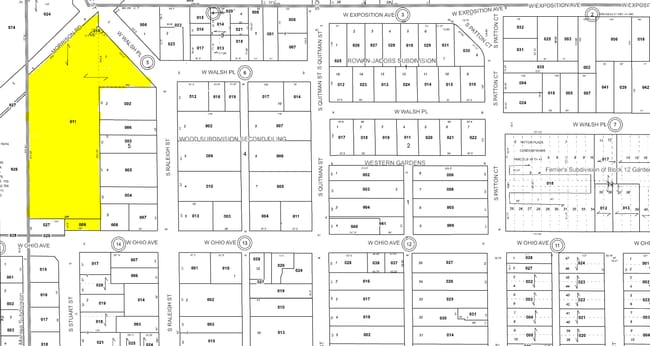
Wood Subdivision Second Filing
5184-05-011
W 100FT OF S 31.6FT L 5 BLK 5 WOODS SUB 2ND FLG 201.3FT S OF CENTER 1/4 SEC 18 TH S 399.20FT E 200.00FT N 581.21FT S 48.4000 W 269.5FT TPOB TOG/W *
Parkplaygroundpicnicarea
Denver
X
Colorado
08059C0308F
5
0
2.55 AC
2024
West
004503
Denver
1,203,600 SF
DEMOGRAPHICS near 4320 Morrison Rd
1 Mile
3 Mile
5 Mile
2024 Total Population
24,968
163,501
476,679
2029 Population
24,858
163,794
479,890
Pop Growth 2024-2029
(0.44%)
+ 0.18%
+ 0.67%
Average Age
35
38
39
2024 Total Households
8,010
62,107
221,029
HH Growth 2024-2029
(0.61%)
+ 0.24%
+ 0.83%
Median Household Inc
$46,967
$66,190
$77,881
Avg Household Size
3.00
2.50
2.10
2024 Avg HH Vehicles
2.00
2.00
2.00
Median Home Value
$345,159
$424,079
$547,640
Median Year Built
1956
1963
1970
Nearby Places
Map Layers
Map Styles
 Street
 Aerial
- Restaurants
- Banks
- Shops
- Fitness
- Groceries
PUBLIC TRANSPORTATION
COMMUTER RAIL
Union Station: LoDo-Coors Field-16th Street Mall (C Line - Denver Regional Transportation District Light Rail (TheRide), E Line - Denver Regional Transportation District Light Rail (TheRide), W Line - Denver Regional Transportation District Light Rail (TheRide))
DRIVE
WALK
Distance
Union Station: LoDo-Coors Field-16th Street Mall (C Line - Denver Regional Transportation District Light Rail (TheRide), E Line - Denver Regional Transportation District Light Rail (TheRide), W Line - Denver Regional Transportation District Light Rail (TheRide))
11 min
5.1 mi
DRIVE
WALK
Distance
11 min
5.2 mi
AIRPORT
Denver International
DRIVE
WALK
Distance
Denver International
42 min
29.2 mi
Nearby Properties
Address
Land Use
TOTAL SIZE
Lot Size
Zoning
Address
Land Use
TOTAL SIZE
Lot Size
Zoning
113,932 SF
9.60 AC
I-B
Address
Land Use
TOTAL SIZE
Lot Size
Zoning
33.40 AC
C-MU-30
Address
Land Use
TOTAL SIZE
Lot Size
Zoning
323,426 SF
29.84 AC
I-B
Address
Land Use
TOTAL SIZE
Lot Size
Zoning
333,925 SF
3.34 AC
C-MX-5
Address
Land Use
TOTAL SIZE
Lot Size
Zoning
362,988 SF
4.71 AC
T-MU-30
Address
Land Use
TOTAL SIZE
Lot Size
Zoning
356,004 SF
4.59 AC
C-MX-12
Address
Land Use
TOTAL SIZE
Lot Size
Zoning
175,000 SF
2.99 AC
C-MX
Address
Land Use
TOTAL SIZE
Lot Size
Zoning
233,688 SF
22.37 AC
Address
Land Use
TOTAL SIZE
Lot Size
Zoning
310,910 SF
2.68 AC
C-MX-16
Address
Land Use
TOTAL SIZE
Lot Size
Zoning
325,844 SF
4.08 AC
C-MX-12
Address
Land Use
TOTAL SIZE
Lot Size
Zoning
199,685 SF
27.73 AC
Address
Land Use
TOTAL SIZE
Lot Size
Zoning
67,603 SF
24.89 AC
I-B
Address
Land Use
TOTAL SIZE
Lot Size
Zoning
288,570 SF
2.57 AC
C-MX-16
Address
Land Use
TOTAL SIZE
Lot Size
Zoning
81,896 SF
0.61 AC
C-MX-5
Address
Land Use
TOTAL SIZE
Lot Size
Zoning
307,325 SF
5.35 AC
C-RX-5
Address
Land Use
TOTAL SIZE
Lot Size
Zoning
368,527 SF
18.71 AC
S-SU-D
Address
Land Use
TOTAL SIZE
Lot Size
Zoning
247,459 SF
2.31 AC
C-MX-8
Address
Land Use
TOTAL SIZE
Lot Size
Zoning
84,120 SF
0.41 AC
C-MX-12
Address
Land Use
TOTAL SIZE
Lot Size
Zoning
188,297 SF
2.11 AC
R-MU-30
Address
Land Use
TOTAL SIZE
Lot Size
Zoning
202,867 SF
2.28 AC
C-MX
Address
Land Use
TOTAL SIZE
Lot Size
Zoning
238,452 SF
8.03 AC
Address
Land Use
TOTAL SIZE
Lot Size
Zoning
339,907 SF
11.18 AC
I-A
Address
Land Use
TOTAL SIZE
Lot Size
Zoning
324,531 SF
14.97 AC
I-A
Address
Land Use
TOTAL SIZE
Lot Size
Zoning
174,850 SF
17.21 AC
I-A
Address
Land Use
TOTAL SIZE
Lot Size
Zoning
6.84 AC
C-MX-12
Address
Land Use
TOTAL SIZE
Lot Size
Zoning
298,427 SF
6.80 AC
C-MX-12
Address
Land Use
TOTAL SIZE
Lot Size
Zoning
135,372 SF
11.66 AC
Address
Land Use
TOTAL SIZE
Lot Size
Zoning
297,776 SF
2.88 AC
C-MX
Address
Land Use
TOTAL SIZE
Lot Size
Zoning
180,689 SF
2.67 AC
I-A
Address
Land Use
TOTAL SIZE
Lot Size
Zoning
100,615 SF
2.28 AC
The World's #1 Commercial Real Estate Marketplace
Connect with us
© 2026 CoStar Group
The information above has been obtained from sources believed reliable. While we do not doubt its accuracy we have not verified it and make no guarantee, warranty or representation about it. It is your responsibility to independently confirm its accuracy and completeness. Any projections, opinions, assumptions, or estimates used are for example only and do not represent the current or future performance of the property. The value of this transaction to you depends on tax and other factors which should be evaluated by your tax, financial, and legal advisors. You and your advisors should conduct a careful, independent investigation of the property to determine to your satisfaction the suitability of the property for your needs.