Property Record
43305 Junction Plz, Ashburn, VA 20147


Save to a Folder
{{folder.Name}}
{{folder.ListingIds.length}} Properties
{{folder.ListingIds.length}} Property
Create a New Folder
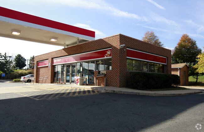
Property Detail
43305 Junction Plz
117-38-0530
ASHBURN FARM SEC.4 BLK.7 TOWN CENTER LOT 5 201008250050924
Servicestation
Loudoun
PDH4
Virginia
B and X Area of moderate flood hazard, usually the area between the limits of the 100-year and 500-year floods.
5
2025
1.70 AC
2025
Route 7 Corridor
611005
Washington, DC
2,166 SF
Washington-Arlington-Alexandria, DC-VA-MD-WV
NEARBY LISTINGS FOR SALE OR LEASE
DEMOGRAPHICS near 43305 Junction Plz
1 mile
3 mile
5 mile
2025 Total Population
13,861
92,110
182,494
2030 Population
14,234
96,141
190,414
Pop Growth 2025-2030
+ 2.69%
+ 4.38%
+ 4.34%
Average Age
38
39
38
2025 Total Households
4,546
32,393
62,727
HH Growth 2025-2030
+ 2.75%
+ 4.62%
+ 4.51%
Median Household Inc
$177,162
$181,134
$179,639
Avg Household Size
3.00
2.80
2.90
2025 Avg HH Vehicles
2.00
2.00
2.00
Median Home Value
$714,779
$744,070
$741,245
Median Year Built
1995
2003
2004
Nearby Places
Map Layers
Map Styles
 Street
 Aerial
Layers
 Traffic
 Biking
Places
Listings with unknown addresses are not visible on the map
- Restaurants
- Banks
- Shops
- Fitness
- Groceries
PUBLIC TRANSPORTATION
AIRPORT
Washington Dulles International
Drive
Walk
Distance
Washington Dulles International
19 min
9.8 mi
Ronald Reagan Washington Ntl
Drive
Walk
Distance
Ronald Reagan Washington Ntl
51 min
34.7 mi
Freight Ports
Port of Baltimore
Drive
Walk
Distance
Port of Baltimore
90 min
66.5 mi
Nearby Properties
Address
Land Use
TOTAL SIZE
Lot Size
Zoning
Address
Land Use
TOTAL SIZE
Lot Size
Zoning
1,137,740 SF
38.21 AC
PDOP
Address
Land Use
TOTAL SIZE
Lot Size
Zoning
438,460 SF
10.85 AC
OP
Address
Land Use
TOTAL SIZE
Lot Size
Zoning
1,156,721 SF
77.92 AC
PDIP
Address
Land Use
TOTAL SIZE
Lot Size
Zoning
250,459 SF
OP
Address
Land Use
TOTAL SIZE
Lot Size
Zoning
518,449 SF
32.11 AC
IP
Address
Land Use
TOTAL SIZE
Lot Size
Zoning
462,210 SF
PDOP
Address
Land Use
TOTAL SIZE
Lot Size
Zoning
521,784 SF
PDOP
Address
Land Use
TOTAL SIZE
Lot Size
Zoning
1,434,706 SF
30.91 AC
PDRDP
Address
Land Use
TOTAL SIZE
Lot Size
Zoning
446,512 SF
25.41 AC
IP
Address
Land Use
TOTAL SIZE
Lot Size
Zoning
368,624 SF
8.85 AC
PDOP
Address
Land Use
TOTAL SIZE
Lot Size
Zoning
679,455 SF
31.97 AC
PDIP
Address
Land Use
TOTAL SIZE
Lot Size
Zoning
2,735,138 SF
123.03 AC
PDAAAR
Address
Land Use
TOTAL SIZE
Lot Size
Zoning
288,403 SF
16.56 AC
PDOP
Address
Land Use
TOTAL SIZE
Lot Size
Zoning
286,865 SF
18.56 AC
IP
Address
Land Use
TOTAL SIZE
Lot Size
Zoning
356,841 SF
119.07 AC
PDGI
Address
Land Use
TOTAL SIZE
Lot Size
Zoning
493,504 SF
15.73 AC
PDOP
Address
Land Use
TOTAL SIZE
Lot Size
Zoning
684,976 SF
85.31 AC
PDOP
Address
Land Use
TOTAL SIZE
Lot Size
Zoning
286,800 SF
10.97 AC
IP
Address
Land Use
TOTAL SIZE
Lot Size
Zoning
1,434,706 SF
96.74 AC
PDRDP
Address
Land Use
TOTAL SIZE
Lot Size
Zoning
455,793 SF
22.60 AC
IP
Address
Land Use
TOTAL SIZE
Lot Size
Zoning
362,108 SF
18.82 AC
PDOP
Address
Land Use
TOTAL SIZE
Lot Size
Zoning
400,232 SF
21.38 AC
IP
Address
Land Use
TOTAL SIZE
Lot Size
Zoning
109,320 SF
7.20 AC
PDIP
Address
Land Use
TOTAL SIZE
Lot Size
Zoning
431.05 AC
LB:PRC
Address
Land Use
TOTAL SIZE
Lot Size
Zoning
108,336 SF
6.21 AC
PDOP
Address
Land Use
TOTAL SIZE
Lot Size
Zoning
123,200 SF
4.74 AC
PDIP
Address
Land Use
TOTAL SIZE
Lot Size
Zoning
89.99 AC
IP
Address
Land Use
TOTAL SIZE
Lot Size
Zoning
108.01 AC
PDOP
Address
Land Use
TOTAL SIZE
Lot Size
Zoning
585,593 SF
15.38 AC
PDOP
Address
Land Use
TOTAL SIZE
Lot Size
Zoning
138,600 SF
8.20 AC
PDIP
The World's #1 Commercial Real Estate Marketplace
Connect with us
© 2026 CoStar Group
The information above has been obtained from sources believed reliable. While we do not doubt its accuracy we have not verified it and make no guarantee, warranty or representation about it. It is your responsibility to independently confirm its accuracy and completeness. Any projections, opinions, assumptions, or estimates used are for example only and do not represent the current or future performance of the property. The value of this transaction to you depends on tax and other factors which should be evaluated by your tax, financial, and legal advisors. You and your advisors should conduct a careful, independent investigation of the property to determine to your satisfaction the suitability of the property for your needs.