Property Record
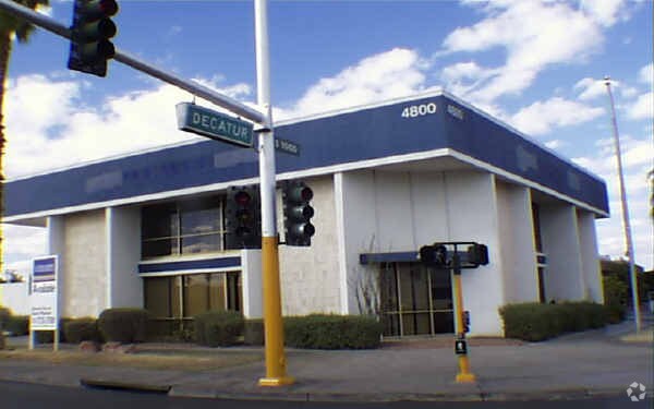
4800 W Charleston Blvd, Las Vegas, NV 89146


NEARBY LISTINGS FOR SALE OR LEASE
Property Detail
4800 W Charleston Blvd
138-36-804-009
GOV LOT 64
Storebuilding
Clark
X
Nevada
32003C2165D
64
2025
1.33 AC
2025
Central West Las Vegas
000107
Las Vegas
13,699 SF
Las Vegas-Henderson-Paradise, NV
DEMOGRAPHICS near 4800 W Charleston Blvd
1 Mile
3 Mile
5 Mile
2024 Total Population
20,183
182,250
491,672
2029 Population
21,649
196,317
528,690
Pop Growth 2024-2029
+ 7.26%
+ 7.72%
+ 7.53%
Average Age
42
38
39
2024 Total Households
8,070
68,342
195,557
HH Growth 2024-2029
+ 7.53%
+ 7.87%
+ 7.60%
Median Household Inc
$42,236
$43,862
$44,908
Avg Household Size
2.40
2.60
2.40
2024 Avg HH Vehicles
1.00
2.00
1.00
Median Home Value
$254,844
$281,957
$300,757
Median Year Built
1976
1980
1986
Nearby Places
Map Layers
Map Styles
 Street
 Aerial
- Restaurants
- Banks
- Shops
- Fitness
- Groceries
PUBLIC TRANSPORTATION
AIRPORT
Harry Reid International
DRIVE
WALK
Distance
Harry Reid International
17 min
8.6 mi
Boulder City Municipal
DRIVE
WALK
Distance
Boulder City Municipal
40 min
30.7 mi
Nearby Properties
Address
Land Use
TOTAL SIZE
Lot Size
Zoning
Address
Land Use
TOTAL SIZE
Lot Size
Zoning
1,044,724 SF
56.56 AC
Address
Land Use
TOTAL SIZE
Lot Size
Zoning
315,865 SF
19.85 AC
Address
Land Use
TOTAL SIZE
Lot Size
Zoning
1,069,498 SF
28.36 AC
H1
Address
Land Use
TOTAL SIZE
Lot Size
Zoning
162,214 SF
4.32 AC
Address
Land Use
TOTAL SIZE
Lot Size
Zoning
497,331 SF
24.44 AC
Address
Land Use
TOTAL SIZE
Lot Size
Zoning
34,354 SF
33.06 AC
Address
Land Use
TOTAL SIZE
Lot Size
Zoning
1,617,320 SF
7.21 AC
PD
Address
Land Use
TOTAL SIZE
Lot Size
Zoning
115,059 SF
30.12 AC
Address
Land Use
TOTAL SIZE
Lot Size
Zoning
24,965 SF
25.75 AC
Address
Land Use
TOTAL SIZE
Lot Size
Zoning
1,283,663 SF
8.56 AC
PD
Address
Land Use
TOTAL SIZE
Lot Size
Zoning
80.45 AC
CV
Address
Land Use
TOTAL SIZE
Lot Size
Zoning
573,491 SF
38.94 AC
Address
Land Use
TOTAL SIZE
Lot Size
Zoning
34.83 AC
CV
Address
Land Use
TOTAL SIZE
Lot Size
Zoning
814,789 SF
13.75 AC
C1
Address
Land Use
TOTAL SIZE
Lot Size
Zoning
38.80 AC
CV
Address
Land Use
TOTAL SIZE
Lot Size
Zoning
64,229 SF
15.49 AC
Address
Land Use
TOTAL SIZE
Lot Size
Zoning
88,160 SF
18.56 AC
Address
Land Use
TOTAL SIZE
Lot Size
Zoning
8.96 AC
L:PD
Address
Land Use
TOTAL SIZE
Lot Size
Zoning
17,454 SF
2.51 AC
L:C-2
Address
Land Use
TOTAL SIZE
Lot Size
Zoning
22,018 SF
6.91 AC
Address
Land Use
TOTAL SIZE
Lot Size
Zoning
8,523 SF
6.06 AC
Address
Land Use
TOTAL SIZE
Lot Size
Zoning
71,155 SF
0.22 AC
Address
Land Use
TOTAL SIZE
Lot Size
Zoning
49,716 SF
59.37 AC
CV
Address
Land Use
TOTAL SIZE
Lot Size
Zoning
Address
Land Use
TOTAL SIZE
Lot Size
Zoning
12.23 AC
PF
Address
Land Use
TOTAL SIZE
Lot Size
Zoning
Address
Land Use
TOTAL SIZE
Lot Size
Zoning
28,956 SF
75.82 AC
CV
The World's #1 Commercial Real Estate Marketplace
Connect with us
© 2026 CoStar Group
The information above has been obtained from sources believed reliable. While we do not doubt its accuracy we have not verified it and make no guarantee, warranty or representation about it. It is your responsibility to independently confirm its accuracy and completeness. Any projections, opinions, assumptions, or estimates used are for example only and do not represent the current or future performance of the property. The value of this transaction to you depends on tax and other factors which should be evaluated by your tax, financial, and legal advisors. You and your advisors should conduct a careful, independent investigation of the property to determine to your satisfaction the suitability of the property for your needs.