Property Record
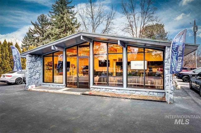
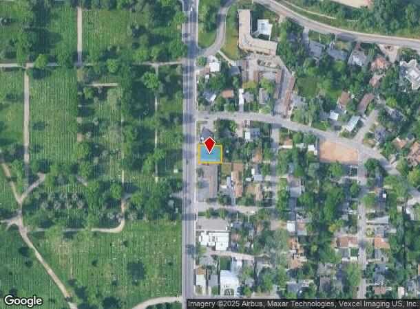
522 N Latah St, Boise, ID 83706
Property Detail
522 N Latah St
Boise City, ID
Crescent Rim Sub
R1608250017
S 70 OF LOTS 3 & 4 EXC R/W BLK 3 CRESCENT RIM SUB
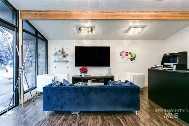
Commercialbuilding
Ada
X
Idaho
16001C0276J
3,4
2025
0.16 AC
2025
Central Boise
001003
Boise City/Nampa
1,920 SF
NEARBY LISTINGS FOR SALE OR LEASE
DEMOGRAPHICS near 522 N Latah St
1 mile
3 mile
5 mile
2024 Total Population
13,334
116,032
211,023
2029 Population
15,088
131,629
238,799
Pop Growth 2024-2029
+ 13.15%
+ 13.44%
+ 13.16%
Average Age
38
39
40
2024 Total Households
6,434
51,910
90,356
HH Growth 2024-2029
+ 13.52%
+ 13.89%
+ 13.56%
Median Household Inc
$42,043
$58,845
$66,275
Avg Household Size
2.00
2.10
2.20
2024 Avg HH Vehicles
2.00
2.00
2.00
Median Home Value
$441,532
$458,889
$448,265
Median Year Built
1982
1977
1983
Nearby Places
Map Layers
Map Styles
 Street
 Aerial
Transit
 Traffic
 Biking
Places
Listings with unknown addresses are not visible on the map
- Restaurants
- Banks
- Shops
- Fitness
- Groceries
PUBLIC TRANSPORTATION
AIRPORT
Boise Air Trml/Gowen Field
Drive
Walk
Distance
Boise Air Trml/Gowen Field
14 min
5.9 mi
SALE & LEASE HISTORY
LISTING DATE
SALE/LEASE

Sep 25, 2016
For Lease
Sep 24, 2016
For Sale
May 31, 2024
For Sale
Mar 09, 2020
For Sale
Nearby Properties
Address
Land Use
TOTAL SIZE
Lot Size
Zoning
Address
Land Use
TOTAL SIZE
Lot Size
Zoning
369,584 SF
1 AC
C-5DD
Address
Land Use
TOTAL SIZE
Lot Size
Zoning
646,787 SF
27.37 AC
C-2D
Address
Land Use
TOTAL SIZE
Lot Size
Zoning
635,403 SF
23.42 AC
C-1D
Address
Land Use
TOTAL SIZE
Lot Size
Zoning
434,370 SF
0.56 AC
C-5DD
Address
Land Use
TOTAL SIZE
Lot Size
Zoning
129,663 SF
0.92 AC
C-5DD
Address
Land Use
TOTAL SIZE
Lot Size
Zoning
240,481 SF
1.79 AC
C-5DD/DA
Address
Land Use
TOTAL SIZE
Lot Size
Zoning
251,614 SF
12.62 AC
L-OD
Address
Land Use
TOTAL SIZE
Lot Size
Zoning
13.90 AC
R-2D
Address
Land Use
TOTAL SIZE
Lot Size
Zoning
4.02 AC
C-2
Address
Land Use
TOTAL SIZE
Lot Size
Zoning
279,694 SF
2.09 AC
R-ODD/DA
Address
Land Use
TOTAL SIZE
Lot Size
Zoning
258,747 SF
3.30 AC
R-OD/DA
Address
Land Use
TOTAL SIZE
Lot Size
Zoning
413,253 SF
3.33 AC
R-OD/DA
Address
Land Use
TOTAL SIZE
Lot Size
Zoning
402,504 SF
5.78 AC
C-5DD
Address
Land Use
TOTAL SIZE
Lot Size
Zoning
334,334 SF
3.21 AC
R-OD
Address
Land Use
TOTAL SIZE
Lot Size
Zoning
156,000 SF
4.57 AC
H-SD
Address
Land Use
TOTAL SIZE
Lot Size
Zoning
197,268 SF
10.95 AC
R-3D
Address
Land Use
TOTAL SIZE
Lot Size
Zoning
207,033 SF
10.67 AC
L-OD
Address
Land Use
TOTAL SIZE
Lot Size
Zoning
204,396 SF
0.82 AC
C-5DDC
Address
Land Use
TOTAL SIZE
Lot Size
Zoning
203,503 SF
7.93 AC
L-OD
Address
Land Use
TOTAL SIZE
Lot Size
Zoning
366,126 SF
0.82 AC
C-5DD
Address
Land Use
TOTAL SIZE
Lot Size
Zoning
223,171 SF
0.85 AC
C-5DD/DA
Address
Land Use
TOTAL SIZE
Lot Size
Zoning
225,032 SF
12.75 AC
R-3D
Address
Land Use
TOTAL SIZE
Lot Size
Zoning
359,820 SF
1.79 AC
C-5DD
Address
Land Use
TOTAL SIZE
Lot Size
Zoning
459,218 SF
1.79 AC
H-SD
Address
Land Use
TOTAL SIZE
Lot Size
Zoning
159,859 SF
0.80 AC
C-5DD/DA
Address
Land Use
TOTAL SIZE
Lot Size
Zoning
10.03 AC
R-3D
Address
Land Use
TOTAL SIZE
Lot Size
Zoning
205,522 SF
0.82 AC
C-5DD
Address
Land Use
TOTAL SIZE
Lot Size
Zoning
276,099 SF
8.70 AC
C-5DDC
Address
Land Use
TOTAL SIZE
Lot Size
Zoning
319,052 SF
24.33 AC
C-2D
Address
Land Use
TOTAL SIZE
Lot Size
Zoning
216,371 SF
0.78 AC
C-5DDC
The World's #1 Commercial Real Estate Marketplace
Connect with us
© 2026 CoStar Group
The information above has been obtained from sources believed reliable. While we do not doubt its accuracy we have not verified it and make no guarantee, warranty or representation about it. It is your responsibility to independently confirm its accuracy and completeness. Any projections, opinions, assumptions, or estimates used are for example only and do not represent the current or future performance of the property. The value of this transaction to you depends on tax and other factors which should be evaluated by your tax, financial, and legal advisors. You and your advisors should conduct a careful, independent investigation of the property to determine to your satisfaction the suitability of the property for your needs.