Property Record
5357 Royal Woods Pky, Tucker, GA 30084
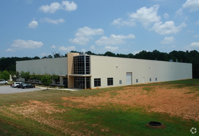


Property Detail
5357 Royal Woods Pky
6-118-051
ROYAL WOODS PARKWAY
Warehouse
Gwinnett
M1
Georgia
B and X Area of moderate flood hazard, usually the area between the limits of the 100-year and 500-year floods.
5.85 AC
2025
Stone Mountain
2025
Atlanta
050464
Atlanta-Sandy Springs-Roswell, GA
46,400 SF
NEARBY LISTINGS FOR SALE OR LEASE
DEMOGRAPHICS near 5357 Royal Woods Pky
1 mile
3 mile
5 mile
2025 Total Population
9,033
70,824
235,817
2030 Population
9,304
72,898
242,340
Pop Growth 2025-2030
+ 3.00%
+ 2.93%
+ 2.77%
Average Age
39
39
37
2025 Total Households
2,975
24,619
83,594
HH Growth 2025-2030
+ 2.52%
+ 2.79%
+ 2.68%
Median Household Inc
$93,393
$73,137
$66,852
Avg Household Size
3.00
2.80
2.80
2025 Avg HH Vehicles
2.00
2.00
2.00
Median Home Value
$396,197
$379,944
$355,612
Median Year Built
1992
1983
1983
Nearby Places
Map Layers
Map Styles
 Street
 Aerial
Layers
 Traffic
 Biking
Places
Listings with unknown addresses are not visible on the map
- Restaurants
- Banks
- Shops
- Fitness
- Groceries
PUBLIC TRANSPORTATION
AIRPORT
Hartsfield - Jackson Atlanta International
Drive
Walk
Distance
Hartsfield - Jackson Atlanta International
41 min
27.6 mi
Freight Ports
Georgia Ports - Savannah
Drive
Walk
Distance
Georgia Ports - Savannah
295 min
259.5 mi
Nearby Properties
Address
Land Use
TOTAL SIZE
Lot Size
Zoning
Address
Land Use
TOTAL SIZE
Lot Size
Zoning
656,837 SF
88.74 AC
RM100
Address
Land Use
TOTAL SIZE
Lot Size
Zoning
273,492 SF
23.08 AC
RM
Address
Land Use
TOTAL SIZE
Lot Size
Zoning
819,703 SF
55.80 AC
M
Address
Land Use
TOTAL SIZE
Lot Size
Zoning
413,878 SF
29.13 AC
CB
Address
Land Use
TOTAL SIZE
Lot Size
Zoning
321,956 SF
26.87 AC
RM13
Address
Land Use
TOTAL SIZE
Lot Size
Zoning
334,795 SF
42.50 AC
RM13
Address
Land Use
TOTAL SIZE
Lot Size
Zoning
257,050 SF
26.17 AC
RM13
Address
Land Use
TOTAL SIZE
Lot Size
Zoning
375,436 SF
33.24 AC
RM10
Address
Land Use
TOTAL SIZE
Lot Size
Zoning
284,236 SF
22.25 AC
RM100
Address
Land Use
TOTAL SIZE
Lot Size
Zoning
285,384 SF
21.32 AC
RM
Address
Land Use
TOTAL SIZE
Lot Size
Zoning
276,262 SF
22.17 AC
RM13
Address
Land Use
TOTAL SIZE
Lot Size
Zoning
367,517 SF
34.61 AC
RM13
Address
Land Use
TOTAL SIZE
Lot Size
Zoning
89,362 SF
13.99 AC
M
Address
Land Use
TOTAL SIZE
Lot Size
Zoning
170,933 SF
15.39 AC
X
Address
Land Use
TOTAL SIZE
Lot Size
Zoning
339,262 SF
26.16 AC
RM100
Address
Land Use
TOTAL SIZE
Lot Size
Zoning
244,131 SF
32.59 AC
RM8
Address
Land Use
TOTAL SIZE
Lot Size
Zoning
302,988 SF
41.36 AC
X
Address
Land Use
TOTAL SIZE
Lot Size
Zoning
292,996 SF
15.84 AC
RM100
Address
Land Use
TOTAL SIZE
Lot Size
Zoning
373,062 SF
20.59 AC
RM100
Address
Land Use
TOTAL SIZE
Lot Size
Zoning
241,314 SF
20.22 AC
RM10
Address
Land Use
TOTAL SIZE
Lot Size
Zoning
490,343 SF
28.70 AC
X
Address
Land Use
TOTAL SIZE
Lot Size
Zoning
279,568 SF
0.15 AC
X
Address
Land Use
TOTAL SIZE
Lot Size
Zoning
195,253 SF
21.87 AC
R100
Address
Land Use
TOTAL SIZE
Lot Size
Zoning
223,756 SF
18.34 AC
RM85
Address
Land Use
TOTAL SIZE
Lot Size
Zoning
200,227 SF
21.17 AC
RM10
Address
Land Use
TOTAL SIZE
Lot Size
Zoning
331,031 SF
27.34 AC
RM100
Address
Land Use
TOTAL SIZE
Lot Size
Zoning
186,766 SF
11.21 AC
R100
Address
Land Use
TOTAL SIZE
Lot Size
Zoning
232,418 SF
21.57 AC
RM100
Address
Land Use
TOTAL SIZE
Lot Size
Zoning
224,560 SF
12.89 AC
X
Address
Land Use
TOTAL SIZE
Lot Size
Zoning
175,028 SF
9.53 AC
M
The World's #1 Commercial Real Estate Marketplace
Connect with us
© 2026 CoStar Group
The information above has been obtained from sources believed reliable. While we do not doubt its accuracy we have not verified it and make no guarantee, warranty or representation about it. It is your responsibility to independently confirm its accuracy and completeness. Any projections, opinions, assumptions, or estimates used are for example only and do not represent the current or future performance of the property. The value of this transaction to you depends on tax and other factors which should be evaluated by your tax, financial, and legal advisors. You and your advisors should conduct a careful, independent investigation of the property to determine to your satisfaction the suitability of the property for your needs.