Property Record
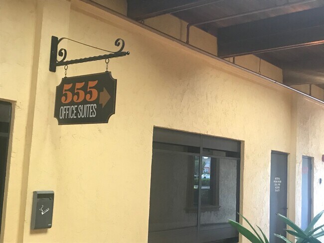
555 S Colorado Ave, Stuart, FL 34994


Property Detail
555 S Colorado Ave
04-38-41-024-002-00040-6
WOODLAWN PARK LOTS 4 TO 11 INC & ALLEY BTWN SD LOTS BLK 2
Regionalshoppingcenterormallwithanchorstore
Martin
B2
Florida
B and X Area of moderate flood hazard, usually the area between the limits of the 100-year and 500-year floods.
4-11
2024
1.06 AC
2025
Port St Lucie
001000
Port St Lucie/Fort Pierce
13,227 SF
Port St. Lucie, FL
NEARBY LISTINGS FOR SALE OR LEASE
DEMOGRAPHICS near 555 S Colorado Ave
1 mile
3 mile
5 mile
2025 Total Population
4,960
52,075
107,624
2030 Population
5,209
54,444
113,348
Pop Growth 2025-2030
+ 5.02%
+ 4.55%
+ 5.32%
Average Age
48
49
49
2025 Total Households
2,172
23,733
47,661
HH Growth 2025-2030
+ 4.88%
+ 4.52%
+ 5.41%
Median Household Inc
$50,739
$68,876
$76,866
Avg Household Size
2.00
2.10
2.20
2025 Avg HH Vehicles
2.00
2.00
2.00
Median Home Value
$351,428
$417,074
$452,251
Median Year Built
1977
1984
1986
Nearby Places
Map Layers
Map Styles
 Street
 Aerial
Layers
 Traffic
 Biking
Places
Listings with unknown addresses are not visible on the map
- Restaurants
- Banks
- Shops
- Fitness
- Groceries
SALE & LEASE HISTORY
LISTING DATE
SALE/LEASE

Sep 27, 2021
For Lease
Nov 15, 2022
For Lease
May 09, 2019
For Lease
Mar 26, 2019
For Lease
Mar 07, 2023
For Lease
Mar 02, 2022
For Lease
Feb 06, 2025
For Lease
Aug 20, 2024
For Lease
Nearby Properties
Address
Land Use
TOTAL SIZE
Lot Size
Zoning
Address
Land Use
TOTAL SIZE
Lot Size
Zoning
609,195 SF
13.77 AC
H
Address
Land Use
TOTAL SIZE
Lot Size
Zoning
436,532 SF
636.83 AC
PAF
Address
Land Use
TOTAL SIZE
Lot Size
Zoning
309,276 SF
13.73 AC
CPUD
Address
Land Use
TOTAL SIZE
Lot Size
Zoning
11.34 AC
Address
Land Use
TOTAL SIZE
Lot Size
Zoning
309,031 SF
76.74 AC
RPUD
Address
Land Use
TOTAL SIZE
Lot Size
Zoning
15.79 AC
Address
Land Use
TOTAL SIZE
Lot Size
Zoning
378,814 SF
34.25 AC
PUDR
Address
Land Use
TOTAL SIZE
Lot Size
Zoning
14.86 AC
M1
Address
Land Use
TOTAL SIZE
Lot Size
Zoning
310,460 SF
48.85 AC
PS2
Address
Land Use
TOTAL SIZE
Lot Size
Zoning
6.66 AC
RPUD
Address
Land Use
TOTAL SIZE
Lot Size
Zoning
23.08 AC
RM8
Address
Land Use
TOTAL SIZE
Lot Size
Zoning
9.45 AC
RS6
Address
Land Use
TOTAL SIZE
Lot Size
Zoning
200,686 SF
9.98 AC
RPUD
Address
Land Use
TOTAL SIZE
Lot Size
Zoning
284,610 SF
33.04 AC
R3
Address
Land Use
TOTAL SIZE
Lot Size
Zoning
195,729 SF
20.25 AC
CPUD
Address
Land Use
TOTAL SIZE
Lot Size
Zoning
545,151 SF
62.49 AC
PAF
Address
Land Use
TOTAL SIZE
Lot Size
Zoning
85,872 SF
7.91 AC
CPUD
Address
Land Use
TOTAL SIZE
Lot Size
Zoning
334,117 SF
54 AC
RPUD
Address
Land Use
TOTAL SIZE
Lot Size
Zoning
127,238 SF
3.62 AC
P
Address
Land Use
TOTAL SIZE
Lot Size
Zoning
307,010 SF
33.70 AC
CPUD
Address
Land Use
TOTAL SIZE
Lot Size
Zoning
189,035 SF
20.63 AC
R3
Address
Land Use
TOTAL SIZE
Lot Size
Zoning
171,655 SF
15.17 AC
B2
Address
Land Use
TOTAL SIZE
Lot Size
Zoning
136,615 SF
21.72 AC
Address
Land Use
TOTAL SIZE
Lot Size
Zoning
1,050 SF
5.33 AC
R3
Address
Land Use
TOTAL SIZE
Lot Size
Zoning
23,640 SF
15.28 AC
B2
Address
Land Use
TOTAL SIZE
Lot Size
Zoning
124,082 SF
4.60 AC
P
Address
Land Use
TOTAL SIZE
Lot Size
Zoning
2,221 SF
18.12 AC
R3A
Address
Land Use
TOTAL SIZE
Lot Size
Zoning
2,400 SF
7.31 AC
INDUST
Address
Land Use
TOTAL SIZE
Lot Size
Zoning
116,258 SF
14.58 AC
R3
Address
Land Use
TOTAL SIZE
Lot Size
Zoning
259,952 SF
25.50 AC
PS
The World's #1 Commercial Real Estate Marketplace
Connect with us
© 2026 CoStar Group
The information above has been obtained from sources believed reliable. While we do not doubt its accuracy we have not verified it and make no guarantee, warranty or representation about it. It is your responsibility to independently confirm its accuracy and completeness. Any projections, opinions, assumptions, or estimates used are for example only and do not represent the current or future performance of the property. The value of this transaction to you depends on tax and other factors which should be evaluated by your tax, financial, and legal advisors. You and your advisors should conduct a careful, independent investigation of the property to determine to your satisfaction the suitability of the property for your needs.