Property Record
569 N Us Highway 287 St, Lafayette, CO 80026


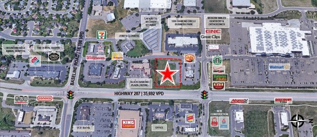
Property Detail
569 N Us Highway 287 St
Boulder, CO
LOT 2 BLACK DIAMOND CENTER NORTH
1465340-58-002
Boulder
Storesoffices
Colorado
B and X Area of moderate flood hazard, usually the area between the limits of the 100-year and 500-year floods.
2
2024
1.53 AC
2025
Boulder County
012903
Denver
3,500 SF
NEARBY LISTINGS FOR SALE OR LEASE
DEMOGRAPHICS near 569 N Us Highway 287 St
1 mile
3 mile
5 mile
2025 Total Population
10,198
53,462
114,865
2030 Population
10,289
53,812
117,911
Pop Growth 2025-2030
+ 0.89%
+ 0.65%
+ 2.65%
Average Age
42
41
41
2025 Total Households
4,068
20,920
43,888
HH Growth 2025-2030
+ 0.84%
+ 0.57%
+ 2.58%
Median Household Inc
$118,382
$118,791
$135,190
Avg Household Size
2.50
2.50
2.60
2025 Avg HH Vehicles
2.00
2.00
2.00
Median Home Value
$763,145
$773,151
$788,455
Median Year Built
1988
1994
1998
Nearby Places
Map Layers
Map Styles
 Street
 Aerial
Transit
 Traffic
 Biking
Places
Listings with unknown addresses are not visible on the map
- Restaurants
- Banks
- Shops
- Fitness
- Groceries
PUBLIC TRANSPORTATION
AIRPORT
Denver International
Drive
Walk
Distance
Denver International
40 min
34.0 mi
SALE & LEASE HISTORY
LISTING DATE
SALE/LEASE

May 23, 2022
For Sale
Jan 19, 2018
For Lease
Nearby Properties
Address
Land Use
TOTAL SIZE
Lot Size
Zoning
Address
Land Use
TOTAL SIZE
Lot Size
Zoning
420,330 SF
41.96 AC
A
Address
Land Use
TOTAL SIZE
Lot Size
Zoning
62.60 AC
Address
Land Use
TOTAL SIZE
Lot Size
Zoning
188,092 SF
2.01 AC
Address
Land Use
TOTAL SIZE
Lot Size
Zoning
57.98 AC
A
Address
Land Use
TOTAL SIZE
Lot Size
Zoning
120,510 SF
11.02 AC
Address
Land Use
TOTAL SIZE
Lot Size
Zoning
153,430 SF
12.16 AC
Address
Land Use
TOTAL SIZE
Lot Size
Zoning
102 AC
A
Address
Land Use
TOTAL SIZE
Lot Size
Zoning
113,473 SF
8.59 AC
Address
Land Use
TOTAL SIZE
Lot Size
Zoning
165,172 SF
11.12 AC
Address
Land Use
TOTAL SIZE
Lot Size
Zoning
164,842 SF
10.97 AC
Address
Land Use
TOTAL SIZE
Lot Size
Zoning
109,056 SF
7.76 AC
Address
Land Use
TOTAL SIZE
Lot Size
Zoning
Address
Land Use
TOTAL SIZE
Lot Size
Zoning
76,658 SF
6.40 AC
Address
Land Use
TOTAL SIZE
Lot Size
Zoning
67,551 SF
4.27 AC
Address
Land Use
TOTAL SIZE
Lot Size
Zoning
130,348 SF
8.88 AC
Address
Land Use
TOTAL SIZE
Lot Size
Zoning
91,570 SF
6.09 AC
Address
Land Use
TOTAL SIZE
Lot Size
Zoning
136,448 SF
10.86 AC
Address
Land Use
TOTAL SIZE
Lot Size
Zoning
247,609 SF
14.53 AC
Address
Land Use
TOTAL SIZE
Lot Size
Zoning
132.98 AC
Address
Land Use
TOTAL SIZE
Lot Size
Zoning
109,547 SF
7.91 AC
Address
Land Use
TOTAL SIZE
Lot Size
Zoning
273,678 SF
10.79 AC
Address
Land Use
TOTAL SIZE
Lot Size
Zoning
83,615 SF
6.81 AC
Address
Land Use
TOTAL SIZE
Lot Size
Zoning
217,874 SF
10.49 AC
Address
Land Use
TOTAL SIZE
Lot Size
Zoning
200,885 SF
17.84 AC
Address
Land Use
TOTAL SIZE
Lot Size
Zoning
64,231 SF
5.91 AC
Address
Land Use
TOTAL SIZE
Lot Size
Zoning
106,869 SF
7.46 AC
Address
Land Use
TOTAL SIZE
Lot Size
Zoning
36.81 AC
RR
Address
Land Use
TOTAL SIZE
Lot Size
Zoning
92,365 SF
5.40 AC
Address
Land Use
TOTAL SIZE
Lot Size
Zoning
65.53 AC
Address
Land Use
TOTAL SIZE
Lot Size
Zoning
51.39 AC
The World's #1 Commercial Real Estate Marketplace
Connect with us
© 2026 CoStar Group
The information above has been obtained from sources believed reliable. While we do not doubt its accuracy we have not verified it and make no guarantee, warranty or representation about it. It is your responsibility to independently confirm its accuracy and completeness. Any projections, opinions, assumptions, or estimates used are for example only and do not represent the current or future performance of the property. The value of this transaction to you depends on tax and other factors which should be evaluated by your tax, financial, and legal advisors. You and your advisors should conduct a careful, independent investigation of the property to determine to your satisfaction the suitability of the property for your needs.