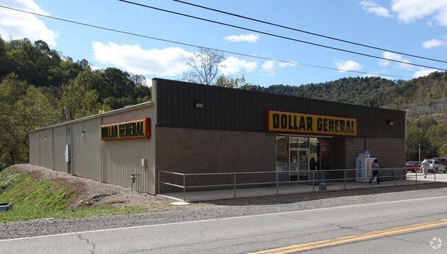
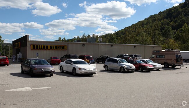
Property Record
577 E Main St, Sutton, WV 26601

Property Detail
577 E Main St
08-2-00220001
.74AC SUTTON
Wholesaleoutletdiscountstore
BRAXTON
AE The base floodplain where base flood elevations are provided. AE Zones are now used on new format FIRMs instead of A1-A30 Zones.
West Virginia
2025
0.74 AC
2025
West Virginia North Area
968100
Other Market Areas
NEARBY LISTINGS FOR SALE OR LEASE
DEMOGRAPHICS near 577 E Main St
1 mile
3 mile
5 mile
2025 Total Population
1,067
2,816
4,780
2030 Population
1,064
2,791
4,722
Pop Growth 2025-2030
(0.28%)
(0.89%)
(1.21%)
Average Age
44
44
44
2025 Total Households
467
1,225
2,001
HH Growth 2025-2030
(0.21%)
(0.82%)
(1.10%)
Median Household Inc
$39,749
$39,285
$39,267
Avg Household Size
2.20
2.20
2.20
2025 Avg HH Vehicles
2.00
2.00
2.00
Median Home Value
$79,896
$83,202
$92,390
Median Year Built
1961
1964
1970
Nearby Places
Map Layers
Map Styles
 Street
 Aerial
Layers
 Traffic
 Biking
Places
Listings with unknown addresses are not visible on the map
- Restaurants
- Banks
- Shops
- Fitness
- Groceries
Nearby Properties
Address
Land Use
TOTAL SIZE
Lot Size
Zoning
Address
Land Use
TOTAL SIZE
Lot Size
Zoning
14,040 AC
Address
Land Use
TOTAL SIZE
Lot Size
Zoning
5.86 AC
Address
Land Use
TOTAL SIZE
Lot Size
Zoning
7.15 AC
Address
Land Use
TOTAL SIZE
Lot Size
Zoning
1.50 AC
Address
Land Use
TOTAL SIZE
Lot Size
Zoning
5.41 AC
Address
Land Use
TOTAL SIZE
Lot Size
Zoning
2.02 AC
Address
Land Use
TOTAL SIZE
Lot Size
Zoning
6.18 AC
Address
Land Use
TOTAL SIZE
Lot Size
Zoning
4.11 AC
Address
Land Use
TOTAL SIZE
Lot Size
Zoning
Address
Land Use
TOTAL SIZE
Lot Size
Zoning
6.56 AC
Address
Land Use
TOTAL SIZE
Lot Size
Zoning
7.48 AC
Address
Land Use
TOTAL SIZE
Lot Size
Zoning
Address
Land Use
TOTAL SIZE
Lot Size
Zoning
0.26 AC
Address
Land Use
TOTAL SIZE
Lot Size
Zoning
1.66 AC
Address
Land Use
TOTAL SIZE
Lot Size
Zoning
1.12 AC
Address
Land Use
TOTAL SIZE
Lot Size
Zoning
0.90 AC
Address
Land Use
TOTAL SIZE
Lot Size
Zoning
0.16 AC
Address
Land Use
TOTAL SIZE
Lot Size
Zoning
2.49 AC
Address
Land Use
TOTAL SIZE
Lot Size
Zoning
10.88 AC
Address
Land Use
TOTAL SIZE
Lot Size
Zoning
0.91 AC
Address
Land Use
TOTAL SIZE
Lot Size
Zoning
5,039 SF
1.39 AC
Address
Land Use
TOTAL SIZE
Lot Size
Zoning
3.40 AC
Address
Land Use
TOTAL SIZE
Lot Size
Zoning
0.90 AC
Address
Land Use
TOTAL SIZE
Lot Size
Zoning
3.17 AC
Address
Land Use
TOTAL SIZE
Lot Size
Zoning
2.05 AC
Address
Land Use
TOTAL SIZE
Lot Size
Zoning
1.37 AC
Address
Land Use
TOTAL SIZE
Lot Size
Zoning
Address
Land Use
TOTAL SIZE
Lot Size
Zoning
1.02 AC
Address
Land Use
TOTAL SIZE
Lot Size
Zoning
Address
Land Use
TOTAL SIZE
Lot Size
Zoning
3,456 SF
57.69 AC
The World's #1 Commercial Real Estate Marketplace
Connect with us
© 2026 CoStar Group
The information above has been obtained from sources believed reliable. While we do not doubt its accuracy we have not verified it and make no guarantee, warranty or representation about it. It is your responsibility to independently confirm its accuracy and completeness. Any projections, opinions, assumptions, or estimates used are for example only and do not represent the current or future performance of the property. The value of this transaction to you depends on tax and other factors which should be evaluated by your tax, financial, and legal advisors. You and your advisors should conduct a careful, independent investigation of the property to determine to your satisfaction the suitability of the property for your needs.