Property Record
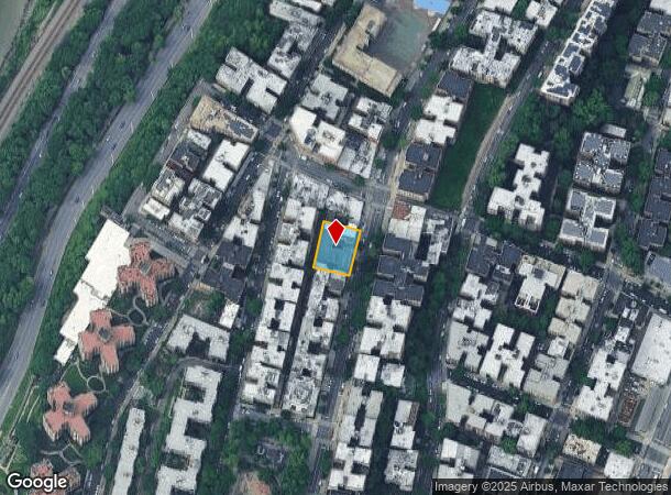
579 Fort Washington Ave, New York, NY 10033
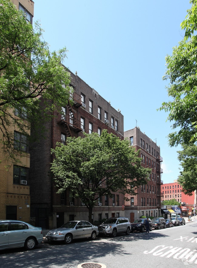
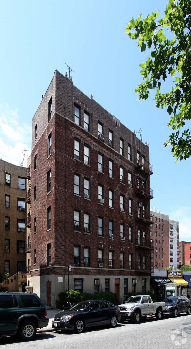
This Property Is For Sale
NEARBY LISTINGS FOR SALE OR LEASE
-
-
-
-
-
-
-
-
-
-
-
-
-
-
-
-
-
-
-
-
-
-
-
-
-
-
-
No Photo
-
-
-
-
View all New York listings for sale on LoopNet.com
Property Detail
579 Fort Washington Ave
2179-0218
Manhattan
Multifamilydwelling
New York
X
218
3604970081F
0.29 AC
2024
Hudson Heights
2025
New York City
027300
New York-Jersey City-White Plains, NY-NJ
46,550 SF
DEMOGRAPHICS near 579 Fort Washington Ave
1 Mile
3 Mile
5 Mile
2024 Total Population
125,109
1,035,834
2,046,382
2029 Population
116,141
973,667
1,912,828
Pop Growth 2024-2029
(7.17%)
(6.00%)
(6.53%)
Average Age
41
39
39
2024 Total Households
48,005
383,884
767,389
HH Growth 2024-2029
(7.43%)
(6.41%)
(6.98%)
Median Household Inc
$54,696
$44,967
$49,110
Avg Household Size
2.50
2.50
2.50
2024 Avg HH Vehicles
.00
.00
1.00
Median Home Value
$561,609
$503,820
$574,736
Median Year Built
1947
1950
1951
Nearby Places
- Restaurants
- Banks
- Shops
- Fitness
- Groceries
PUBLIC TRANSPORTATION
TRANSIT/SUBWAY
181 Street (A Line) (A - New York MTA Subway (The Subway))
DRIVE
WALK
Distance
181 Street (A Line) (A - New York MTA Subway (The Subway))
1 min
5 min
0.3 mi
190 Street (A - New York MTA Subway (The Subway))
DRIVE
WALK
Distance
190 Street (A - New York MTA Subway (The Subway))
1 min
6 min
0.3 mi
181 Street (1 Line) (1 - New York MTA Subway (The Subway))
DRIVE
WALK
Distance
181 Street (1 Line) (1 - New York MTA Subway (The Subway))
3 min
10 min
0.5 mi
191 Street (1 - New York MTA Subway (The Subway))
DRIVE
WALK
Distance
191 Street (1 - New York MTA Subway (The Subway))
4 min
11 min
0.6 mi
175 Street (A - New York MTA Subway (The Subway))
DRIVE
WALK
Distance
175 Street (A - New York MTA Subway (The Subway))
3 min
11 min
0.6 mi
COMMUTER RAIL
DRIVE
WALK
Distance
7 min
2.1 mi
University Heights Station (Hudson Line - Metro-North Commuter Railroad Company (Metro-North))
DRIVE
WALK
Distance
University Heights Station (Hudson Line - Metro-North Commuter Railroad Company (Metro-North))
6 min
2.2 mi
AIRPORT
LaGuardia
DRIVE
WALK
Distance
LaGuardia
21 min
9.7 mi
Newark Liberty International
DRIVE
WALK
Distance
Newark Liberty International
24 min
20.5 mi
John F Kennedy International
DRIVE
WALK
Distance
John F Kennedy International
33 min
21.1 mi
Freight Ports
NY - Red Hook Container Terminal
DRIVE
WALK
Distance
NY - Red Hook Container Terminal
33 min
14.5 mi
Nearby Properties
Address
Land Use
TOTAL SIZE
Lot Size
Zoning
Address
Land Use
TOTAL SIZE
Lot Size
Zoning
3,693,539 SF
8.37 AC
R8
Address
Land Use
TOTAL SIZE
Lot Size
Zoning
400,160 SF
10.96 AC
R7-2
Address
Land Use
TOTAL SIZE
Lot Size
Zoning
1,299,700 SF
29.82 AC
R6
Address
Land Use
TOTAL SIZE
Lot Size
Zoning
1,743,584 SF
77.87 AC
R6
Address
Land Use
TOTAL SIZE
Lot Size
Zoning
26.93 AC
R8
Address
Land Use
TOTAL SIZE
Lot Size
Zoning
111.37 AC
P1
Address
Land Use
TOTAL SIZE
Lot Size
Zoning
2,278,432 SF
5.99 AC
R7-2
Address
Land Use
TOTAL SIZE
Lot Size
Zoning
24.08 AC
B2-A
Address
Land Use
TOTAL SIZE
Lot Size
Zoning
4.87 AC
R11
Address
Land Use
TOTAL SIZE
Lot Size
Zoning
873,000 SF
9.95 AC
R7-2
Address
Land Use
TOTAL SIZE
Lot Size
Zoning
1,651,267 SF
1.23 AC
R8
Address
Land Use
TOTAL SIZE
Lot Size
Zoning
Address
Land Use
TOTAL SIZE
Lot Size
Zoning
72 AC
P1
Address
Land Use
TOTAL SIZE
Lot Size
Zoning
2.61 AC
D5
Address
Land Use
TOTAL SIZE
Lot Size
Zoning
478,842 SF
3.56 AC
C6-1
Address
Land Use
TOTAL SIZE
Lot Size
Zoning
0.36 AC
R8
Address
Land Use
TOTAL SIZE
Lot Size
Zoning
891,040 SF
5.63 AC
R8
Address
Land Use
TOTAL SIZE
Lot Size
Zoning
1,311,800 SF
9.89 AC
C4-4
Address
Land Use
TOTAL SIZE
Lot Size
Zoning
23.12 AC
PARK
Address
Land Use
TOTAL SIZE
Lot Size
Zoning
1,237,424 SF
21.25 AC
R6
Address
Land Use
TOTAL SIZE
Lot Size
Zoning
1,390,324 SF
6.87 AC
R8
Address
Land Use
TOTAL SIZE
Lot Size
Zoning
3.75 AC
Address
Land Use
TOTAL SIZE
Lot Size
Zoning
42.68 AC
P1
Address
Land Use
TOTAL SIZE
Lot Size
Zoning
13.09 AC
C3
Address
Land Use
TOTAL SIZE
Lot Size
Zoning
2 AC
R11
Address
Land Use
TOTAL SIZE
Lot Size
Zoning
100,151 SF
22.13 AC
B2
Address
Land Use
TOTAL SIZE
Lot Size
Zoning
2.55 AC
D5
Address
Land Use
TOTAL SIZE
Lot Size
Zoning
807,327 SF
0.60 AC
R8
Address
Land Use
TOTAL SIZE
Lot Size
Zoning
39 AC
P1
Address
Land Use
TOTAL SIZE
Lot Size
Zoning
5.87 AC
R10
The World's #1 Commercial Real Estate Marketplace
Connect with us
© 2025 CoStar Group
The information above has been obtained from sources believed reliable. While we do not doubt its accuracy we have not verified it and make no guarantee, warranty or representation about it. It is your responsibility to independently confirm its accuracy and completeness. Any projections, opinions, assumptions, or estimates used are for example only and do not represent the current or future performance of the property. The value of this transaction to you depends on tax and other factors which should be evaluated by your tax, financial, and legal advisors. You and your advisors should conduct a careful, independent investigation of the property to determine to your satisfaction the suitability of the property for your needs.