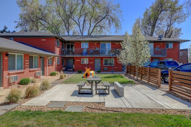
Property Record
5978 W 29Th Ave, Wheat Ridge, CO 80214


NEARBY LISTINGS FOR SALE OR LEASE
Property Detail
5978 W 29Th Ave
39-254-00-006
Acreage
Multifamilydwelling
SECTION 25 TOWNSHIP 03 RANGE 69 QTR SE SIZE: 19993 VALUE: .459 KEY=051
X
Jefferson
0800460068H
Colorado
2023
0.46 AC
2024
Lakeside
010702
Denver
9,200 SF
Denver-Aurora-Centennial, CO
DEMOGRAPHICS near 5978 W 29Th Ave
1 Mile
3 Mile
5 Mile
2024 Total Population
19,394
154,584
431,719
2029 Population
19,260
155,809
435,736
Pop Growth 2024-2029
(0.69%)
+ 0.79%
+ 0.93%
Average Age
40
39
38
2024 Total Households
9,020
70,369
198,252
HH Growth 2024-2029
(0.81%)
+ 0.79%
+ 1.08%
Median Household Inc
$81,046
$79,631
$78,184
Avg Household Size
2.10
2.10
2.10
2024 Avg HH Vehicles
2.00
2.00
2.00
Median Home Value
$585,696
$595,567
$527,330
Median Year Built
1958
1964
1971
Nearby Places
Map Layers
Map Styles
 Street
 Aerial
- Restaurants
- Banks
- Shops
- Fitness
- Groceries
PUBLIC TRANSPORTATION
COMMUTER RAIL
Union Station: LoDo-Coors Field-16th Street Mall (C Line - Denver Regional Transportation District Light Rail (TheRide), E Line - Denver Regional Transportation District Light Rail (TheRide), W Line - Denver Regional Transportation District Light Rail (TheRide))
DRIVE
WALK
Distance
Union Station: LoDo-Coors Field-16th Street Mall (C Line - Denver Regional Transportation District Light Rail (TheRide), E Line - Denver Regional Transportation District Light Rail (TheRide), W Line - Denver Regional Transportation District Light Rail (TheRide))
9 min
3.6 mi
DRIVE
WALK
Distance
9 min
3.6 mi
AIRPORT
Denver International
DRIVE
WALK
Distance
Denver International
38 min
27.8 mi
SALE & LEASE HISTORY
LISTING DATE
SALE/LEASE

Apr 23, 2025
For Sale
Nearby Properties
Address
Land Use
TOTAL SIZE
Lot Size
Zoning
Address
Land Use
TOTAL SIZE
Lot Size
Zoning
1,721,086 SF
21.34 AC
C-MU-30
Address
Land Use
TOTAL SIZE
Lot Size
Zoning
860,132 SF
68.50 AC
R-5
Address
Land Use
TOTAL SIZE
Lot Size
Zoning
168,523 SF
44.89 AC
CPV-R
Address
Land Use
TOTAL SIZE
Lot Size
Zoning
424,862 SF
32.28 AC
G-MU-3
Address
Land Use
TOTAL SIZE
Lot Size
Zoning
44.93 AC
CPV-C
Address
Land Use
TOTAL SIZE
Lot Size
Zoning
729,679 SF
C-MX
Address
Land Use
TOTAL SIZE
Lot Size
Zoning
265,054 SF
1.39 AC
C-MX-5
Address
Land Use
TOTAL SIZE
Lot Size
Zoning
203,148 SF
1.36 AC
C-MX-5
Address
Land Use
TOTAL SIZE
Lot Size
Zoning
33.40 AC
C-MU-30
Address
Land Use
TOTAL SIZE
Lot Size
Zoning
333,925 SF
3.34 AC
C-MX-5
Address
Land Use
TOTAL SIZE
Lot Size
Zoning
827,707 SF
19 AC
C-MU-30
Address
Land Use
TOTAL SIZE
Lot Size
Zoning
159,202 SF
1.03 AC
C-MX-5
Address
Land Use
TOTAL SIZE
Lot Size
Zoning
8,295 SF
2.57 AC
C-RX
Address
Land Use
TOTAL SIZE
Lot Size
Zoning
89,270 SF
3.02 AC
C-MX-12
Address
Land Use
TOTAL SIZE
Lot Size
Zoning
34,642 SF
C-MX-8
Address
Land Use
TOTAL SIZE
Lot Size
Zoning
107,351 SF
5.67 AC
C-MX-5
Address
Land Use
TOTAL SIZE
Lot Size
Zoning
111,673 SF
29.06 AC
Address
Land Use
TOTAL SIZE
Lot Size
Zoning
565,418 SF
4.07 AC
C-RX
Address
Land Use
TOTAL SIZE
Lot Size
Zoning
96,106 SF
0.67 AC
C-MX-5
Address
Land Use
TOTAL SIZE
Lot Size
Zoning
10.13 AC
CPV-C
Address
Land Use
TOTAL SIZE
Lot Size
Zoning
298,150 SF
24.21 AC
Address
Land Use
TOTAL SIZE
Lot Size
Zoning
132,874 SF
6.53 AC
G-MU-3
Address
Land Use
TOTAL SIZE
Lot Size
Zoning
81,896 SF
0.61 AC
C-MX-5
Address
Land Use
TOTAL SIZE
Lot Size
Zoning
187,095 SF
23.42 AC
Address
Land Use
TOTAL SIZE
Lot Size
Zoning
325,844 SF
4.08 AC
C-MX-12
Address
Land Use
TOTAL SIZE
Lot Size
Zoning
302,529 SF
1.20 AC
PUD
Address
Land Use
TOTAL SIZE
Lot Size
Zoning
392,996 SF
7.39 AC
C-MX-12
Address
Land Use
TOTAL SIZE
Lot Size
Zoning
27,921 SF
0.29 AC
C-MX-5
Address
Land Use
TOTAL SIZE
Lot Size
Zoning
175,000 SF
2.99 AC
C-MU-30
Address
Land Use
TOTAL SIZE
Lot Size
Zoning
4.35 AC
I-B
The World's #1 Commercial Real Estate Marketplace
Connect with us
© 2026 CoStar Group
The information above has been obtained from sources believed reliable. While we do not doubt its accuracy we have not verified it and make no guarantee, warranty or representation about it. It is your responsibility to independently confirm its accuracy and completeness. Any projections, opinions, assumptions, or estimates used are for example only and do not represent the current or future performance of the property. The value of this transaction to you depends on tax and other factors which should be evaluated by your tax, financial, and legal advisors. You and your advisors should conduct a careful, independent investigation of the property to determine to your satisfaction the suitability of the property for your needs.