Property Record
599 29 1/2 Rd, Grand Junction, CO 81504
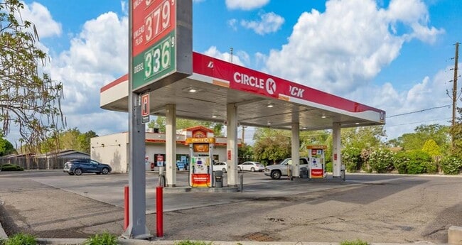


This Property Is For Sale
Property Detail
599 29 1/2 Rd
2943-082-11-016
LOTS 1 & 2 BLK 1 NORTH PARK ESTATES SEC 8 1S 1E EXC ROW ON N & E AS DESC IN B-1381 P-569 MESA CO RECDS
Commercialnec
MESA
B-1
Colorado
B and X Area of moderate flood hazard, usually the area between the limits of the 100-year and 500-year floods.
1
2023
0.31 AC
2024
Colorado Northwest Area
001104
Other Market Areas
2,880 SF
Grand Junction, CO
NEARBY LISTINGS FOR SALE OR LEASE
DEMOGRAPHICS near 599 29 1/2 Rd
1 mile
3 mile
5 mile
2025 Total Population
12,966
62,758
110,622
2030 Population
13,323
64,421
113,814
Pop Growth 2025-2030
+ 2.75%
+ 2.65%
+ 2.89%
Average Age
41
41
41
2025 Total Households
5,356
25,485
45,209
HH Growth 2025-2030
+ 2.93%
+ 2.86%
+ 3.11%
Median Household Inc
$61,299
$56,927
$59,735
Avg Household Size
2.40
2.30
2.30
2025 Avg HH Vehicles
2.00
2.00
2.00
Median Home Value
$328,658
$323,561
$338,081
Median Year Built
1986
1985
1986
Nearby Places
Map Layers
Map Styles
 Street
 Aerial
Layers
 Traffic
 Biking
Places
Listings with unknown addresses are not visible on the map
- Restaurants
- Banks
- Shops
- Fitness
- Groceries
PUBLIC TRANSPORTATION
COMMUTER RAIL
Drive
Walk
Distance
10 min
4.9 mi
AIRPORT
Grand Junction Regional
Drive
Walk
Distance
Grand Junction Regional
10 min
4.6 mi
Nearby Properties
Address
Land Use
TOTAL SIZE
Lot Size
Zoning
Address
Land Use
TOTAL SIZE
Lot Size
Zoning
365,495 SF
20.90 AC
CSR
Address
Land Use
TOTAL SIZE
Lot Size
Zoning
482,392 SF
24.70 AC
CSR
Address
Land Use
TOTAL SIZE
Lot Size
Zoning
429,786 SF
16.99 AC
CSR
Address
Land Use
TOTAL SIZE
Lot Size
Zoning
127,583 SF
12.35 AC
C-1
Address
Land Use
TOTAL SIZE
Lot Size
Zoning
181,976 SF
14.80 AC
CSR
Address
Land Use
TOTAL SIZE
Lot Size
Zoning
191,078 SF
37.91 AC
Address
Land Use
TOTAL SIZE
Lot Size
Zoning
70,718 SF
82.62 AC
CSR
Address
Land Use
TOTAL SIZE
Lot Size
Zoning
130,260 SF
0.20 AC
C-1
Address
Land Use
TOTAL SIZE
Lot Size
Zoning
113,925 SF
0.16 AC
PD
Address
Land Use
TOTAL SIZE
Lot Size
Zoning
82,986 SF
4.20 AC
PD
Address
Land Use
TOTAL SIZE
Lot Size
Zoning
110,905 SF
29.81 AC
RSF-4
Address
Land Use
TOTAL SIZE
Lot Size
Zoning
105,693 SF
18.23 AC
CSR
Address
Land Use
TOTAL SIZE
Lot Size
Zoning
112,810 SF
6.33 AC
MU
Address
Land Use
TOTAL SIZE
Lot Size
Zoning
69,390 SF
0.14 AC
C-1
Address
Land Use
TOTAL SIZE
Lot Size
Zoning
94,639 SF
0.16 AC
C-1
Address
Land Use
TOTAL SIZE
Lot Size
Zoning
95,382 SF
16.48 AC
RSF-4
Address
Land Use
TOTAL SIZE
Lot Size
Zoning
93,531 SF
5.19 AC
Address
Land Use
TOTAL SIZE
Lot Size
Zoning
66,178 SF
2.02 AC
PD
Address
Land Use
TOTAL SIZE
Lot Size
Zoning
83,518 SF
1.45 AC
CSR
Address
Land Use
TOTAL SIZE
Lot Size
Zoning
70,394 SF
6.19 AC
PD
Address
Land Use
TOTAL SIZE
Lot Size
Zoning
79,905 SF
8.43 AC
PD
Address
Land Use
TOTAL SIZE
Lot Size
Zoning
222,950 SF
17.36 AC
C-1
Address
Land Use
TOTAL SIZE
Lot Size
Zoning
43,390 SF
3.80 AC
Address
Land Use
TOTAL SIZE
Lot Size
Zoning
181,829 SF
10.03 AC
C-1
Address
Land Use
TOTAL SIZE
Lot Size
Zoning
60,530 SF
8.42 AC
Address
Land Use
TOTAL SIZE
Lot Size
Zoning
53,104 SF
22.43 AC
AFT
Address
Land Use
TOTAL SIZE
Lot Size
Zoning
104,483 SF
11.76 AC
C-2
Address
Land Use
TOTAL SIZE
Lot Size
Zoning
45,000 SF
0.20 AC
Address
Land Use
TOTAL SIZE
Lot Size
Zoning
57,297 SF
9.39 AC
RSF-4
The World's #1 Commercial Real Estate Marketplace
Connect with us
© 2026 CoStar Group
The information above has been obtained from sources believed reliable. While we do not doubt its accuracy we have not verified it and make no guarantee, warranty or representation about it. It is your responsibility to independently confirm its accuracy and completeness. Any projections, opinions, assumptions, or estimates used are for example only and do not represent the current or future performance of the property. The value of this transaction to you depends on tax and other factors which should be evaluated by your tax, financial, and legal advisors. You and your advisors should conduct a careful, independent investigation of the property to determine to your satisfaction the suitability of the property for your needs.