Property Record
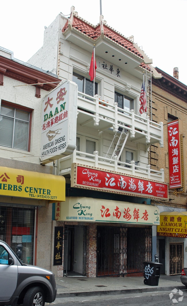
604 Jackson St, San Francisco, CA 94133


Property Detail
604 Jackson St
0177-003
SAN FRANCISCO
Storemultistory
California
CRNC
3
2024
0.10 AC
2025
Van Ness/Chinatown
061101
San Francisco
8,401 SF
San Francisco-San Mateo-Redwood City, CA
NEARBY LISTINGS FOR SALE OR LEASE
DEMOGRAPHICS near 604 Jackson St
1 mile
3 mile
5 mile
2025 Total Population
103,880
382,976
628,516
2030 Population
106,109
391,970
639,894
Pop Growth 2025-2030
+ 2.15%
+ 2.35%
+ 1.81%
Average Age
44
42
42
2025 Total Households
56,059
188,345
284,505
HH Growth 2025-2030
+ 2.07%
+ 2.25%
+ 1.84%
Median Household Inc
$92,086
$126,095
$133,504
Avg Household Size
1.70
1.90
2.10
2025 Avg HH Vehicles
1.00
1.00
1.00
Median Home Value
$1,066,476
$1,090,289
$1,099,922
Median Year Built
1949
1955
1949
Nearby Places
Map Layers
Map Styles
 Street
 Aerial
Layers
 Traffic
 Biking
Places
Listings with unknown addresses are not visible on the map
- Restaurants
- Banks
- Shops
- Fitness
- Groceries
PUBLIC TRANSPORTATION
TRANSIT/SUBWAY
Chinatown - Rose Pak Station (THIRD - San Francisco Municipal Transportation Agency)
Drive
Walk
Distance
Chinatown - Rose Pak Station (THIRD - San Francisco Municipal Transportation Agency)
1 min
4 min
0.3 mi
California St & Kearny St (CALIFORNIA STREET CABLE CAR - San Francisco Municipal Transportation Agency)
Drive
Walk
Distance
California St & Kearny St (CALIFORNIA STREET CABLE CAR - San Francisco Municipal Transportation Agency)
1 min
5 min
0.3 mi
Powell And Washington (Powell-Hyde Cable Car - San Francisco Municipal Railway (MUNI Metro), POWELL-HYDE CABLE CAR - San Francisco Municipal Railway (MUNI Metro), Powell-Mason Cable Car - San Francisco Municipal Railway (MUNI Metro), POWELL-MASON CABLE CAR - San Francisco Municipal Railway (MUNI Metro))
Drive
Walk
Distance
Powell And Washington (Powell-Hyde Cable Car - San Francisco Municipal Railway (MUNI Metro), POWELL-HYDE CABLE CAR - San Francisco Municipal Railway (MUNI Metro), Powell-Mason Cable Car - San Francisco Municipal Railway (MUNI Metro), POWELL-MASON CABLE CAR - San Francisco Municipal Railway (MUNI Metro))
2 min
6 min
0.3 mi
California St & Grant Ave (CALIFORNIA STREET CABLE CAR - San Francisco Municipal Transportation Agency)
Drive
Walk
Distance
California St & Grant Ave (CALIFORNIA STREET CABLE CAR - San Francisco Municipal Transportation Agency)
2 min
6 min
0.4 mi
Powell St & Clay St (POWELL-HYDE CABLE CAR - San Francisco Municipal Transportation Agency, POWELL-MASON CABLE CAR - San Francisco Municipal Transportation Agency)
Drive
Walk
Distance
Powell St & Clay St (POWELL-HYDE CABLE CAR - San Francisco Municipal Transportation Agency, POWELL-MASON CABLE CAR - San Francisco Municipal Transportation Agency)
2 min
7 min
0.4 mi
COMMUTER RAIL
San Francisco Caltrain Station Southbound (Express - Caltrain (Caltrain), Limited - Caltrain (Caltrain), Local Weekday - Caltrain (Caltrain), Local Weekend - Caltrain (Caltrain))
Drive
Walk
Distance
San Francisco Caltrain Station Southbound (Express - Caltrain (Caltrain), Limited - Caltrain (Caltrain), Local Weekday - Caltrain (Caltrain), Local Weekend - Caltrain (Caltrain))
4 min
1.9 mi
Bayshore Caltrain Station Southbound (Local Weekday - Caltrain (Caltrain), Local Weekend - Caltrain (Caltrain))
Drive
Walk
Distance
Bayshore Caltrain Station Southbound (Local Weekday - Caltrain (Caltrain), Local Weekend - Caltrain (Caltrain))
13 min
7.0 mi
AIRPORT
San Francisco International
Drive
Walk
Distance
San Francisco International
23 min
14.8 mi
Metro Oakland International
Drive
Walk
Distance
Metro Oakland International
30 min
19.4 mi
Freight Ports
Port of San Francisco
Drive
Walk
Distance
Port of San Francisco
1 min
0.8 mi
Nearby Properties
Address
Land Use
TOTAL SIZE
Lot Size
Zoning
Address
Land Use
TOTAL SIZE
Lot Size
Zoning
1,015,000 SF
2.43 AC
RC4
Address
Land Use
TOTAL SIZE
Lot Size
Zoning
764,661 SF
0.67 AC
C3OSD
Address
Land Use
TOTAL SIZE
Lot Size
Zoning
750,370 SF
3.25 AC
MBR3
Address
Land Use
TOTAL SIZE
Lot Size
Zoning
1,471,929 SF
1.93 AC
C3O
Address
Land Use
TOTAL SIZE
Lot Size
Zoning
1,300,000 SF
1.74 AC
C3O
Address
Land Use
TOTAL SIZE
Lot Size
Zoning
1,420,430 SF
1.16 AC
C3OSD
Address
Land Use
TOTAL SIZE
Lot Size
Zoning
1,534,312 SF
2.60 AC
C3O
Address
Land Use
TOTAL SIZE
Lot Size
Zoning
914,037 SF
1.36 AC
C3O
Address
Land Use
TOTAL SIZE
Lot Size
Zoning
717,234 SF
3.47 AC
UMU
Address
Land Use
TOTAL SIZE
Lot Size
Zoning
605,459 SF
0.63 AC
C3O
Address
Land Use
TOTAL SIZE
Lot Size
Zoning
475,791 SF
0.55 AC
C3OSD
Address
Land Use
TOTAL SIZE
Lot Size
Zoning
690,442 SF
0.79 AC
C3O
Address
Land Use
TOTAL SIZE
Lot Size
Zoning
10.92 AC
Address
Land Use
TOTAL SIZE
Lot Size
Zoning
750,491 SF
0.51 AC
C3O
Address
Land Use
TOTAL SIZE
Lot Size
Zoning
432,000 SF
0.35 AC
C3OSD
Address
Land Use
TOTAL SIZE
Lot Size
Zoning
266,143 SF
4 AC
C-3-R
Address
Land Use
TOTAL SIZE
Lot Size
Zoning
885,581 SF
5.20 AC
M2
Address
Land Use
TOTAL SIZE
Lot Size
Zoning
512,395 SF
1.24 AC
C3O
Address
Land Use
TOTAL SIZE
Lot Size
Zoning
508,714 SF
1.29 AC
C3R
Address
Land Use
TOTAL SIZE
Lot Size
Zoning
1,084,662 SF
1.67 AC
C3O
Address
Land Use
TOTAL SIZE
Lot Size
Zoning
505,120 SF
0.41 AC
C3O
Address
Land Use
TOTAL SIZE
Lot Size
Zoning
694,334 SF
1.01 AC
C3O
Address
Land Use
TOTAL SIZE
Lot Size
Zoning
696,431 SF
0.97 AC
C3G
Address
Land Use
TOTAL SIZE
Lot Size
Zoning
139,070 SF
0.64 AC
C3O
Address
Land Use
TOTAL SIZE
Lot Size
Zoning
1.52 AC
C3G
Address
Land Use
TOTAL SIZE
Lot Size
Zoning
1,424,230 SF
2.60 AC
C3G
Address
Land Use
TOTAL SIZE
Lot Size
Zoning
614,740 SF
1.74 AC
C3OSD
Address
Land Use
TOTAL SIZE
Lot Size
Zoning
615,957 SF
0.63 AC
C3O
Address
Land Use
TOTAL SIZE
Lot Size
Zoning
492,980 SF
0.43 AC
C3O
Address
Land Use
TOTAL SIZE
Lot Size
Zoning
385,000 SF
0.81 AC
C3O
The World's #1 Commercial Real Estate Marketplace
Connect with us
© 2026 CoStar Group
The information above has been obtained from sources believed reliable. While we do not doubt its accuracy we have not verified it and make no guarantee, warranty or representation about it. It is your responsibility to independently confirm its accuracy and completeness. Any projections, opinions, assumptions, or estimates used are for example only and do not represent the current or future performance of the property. The value of this transaction to you depends on tax and other factors which should be evaluated by your tax, financial, and legal advisors. You and your advisors should conduct a careful, independent investigation of the property to determine to your satisfaction the suitability of the property for your needs.