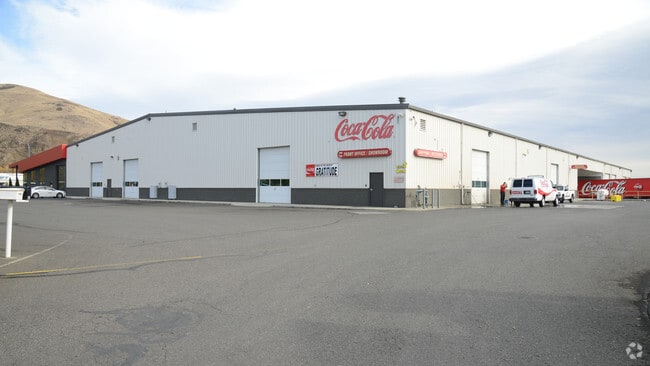
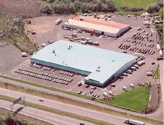
Property Record
607 E R St, Yakima, WA 98901


Property Detail
607 E R St
Yakima, WA
BSP AF 7204253: LOT -1
191307-34401
Yakima
Industrialgeneral
Washington
RD
1
2026
5.04 AC
2026
Greater Yakima
000200
Yakima
73,820 SF
NEARBY LISTINGS FOR SALE OR LEASE
DEMOGRAPHICS near 607 E R St
1 mile
3 mile
5 mile
2025 Total Population
5,040
58,946
115,694
2030 Population
5,074
59,342
116,695
Pop Growth 2025-2030
+ 0.67%
+ 0.67%
+ 0.87%
Average Age
33
36
37
2025 Total Households
1,546
21,010
42,093
HH Growth 2025-2030
+ 0.52%
+ 0.77%
+ 0.90%
Median Household Inc
$28,480
$52,311
$63,682
Avg Household Size
2.90
2.60
2.60
2025 Avg HH Vehicles
2.00
2.00
2.00
Median Home Value
$169,999
$260,710
$312,346
Median Year Built
1969
1966
1972
Nearby Places
Map Layers
Map Styles
 Street
 Aerial
Layers
 Traffic
 Biking
Places
Listings with unknown addresses are not visible on the map
- Restaurants
- Banks
- Shops
- Fitness
- Groceries
PUBLIC TRANSPORTATION
AIRPORT
Yakima Air Trml/McAllister Field
Drive
Walk
Distance
Yakima Air Trml/McAllister Field
14 min
5.7 mi
Freight Ports
Port of Tacoma
Drive
Walk
Distance
Port of Tacoma
180 min
153.7 mi
Nearby Properties
Address
Land Use
TOTAL SIZE
Lot Size
Zoning
Address
Land Use
TOTAL SIZE
Lot Size
Zoning
390,527 SF
11.86 AC
R3
Address
Land Use
TOTAL SIZE
Lot Size
Zoning
409,453 SF
8.25 AC
R3
Address
Land Use
TOTAL SIZE
Lot Size
Zoning
239,131 SF
36.70 AC
GC
Address
Land Use
TOTAL SIZE
Lot Size
Zoning
326,323 SF
30.05 AC
R2
Address
Land Use
TOTAL SIZE
Lot Size
Zoning
193,955 SF
9.94 AC
GC
Address
Land Use
TOTAL SIZE
Lot Size
Zoning
474,587 SF
18.06 AC
M1
Address
Land Use
TOTAL SIZE
Lot Size
Zoning
499,230 SF
22.57 AC
M1
Address
Land Use
TOTAL SIZE
Lot Size
Zoning
132,582 SF
32.50 AC
R1
Address
Land Use
TOTAL SIZE
Lot Size
Zoning
87,068 SF
2.89 AC
BCOM
Address
Land Use
TOTAL SIZE
Lot Size
Zoning
176,098 SF
1.67 AC
BCOM
Address
Land Use
TOTAL SIZE
Lot Size
Zoning
235,222 SF
14.23 AC
M1
Address
Land Use
TOTAL SIZE
Lot Size
Zoning
106,878 SF
3.46 AC
RD
Address
Land Use
TOTAL SIZE
Lot Size
Zoning
329,388 SF
16.13 AC
M1
Address
Land Use
TOTAL SIZE
Lot Size
Zoning
298,360 SF
15.21 AC
M1
Address
Land Use
TOTAL SIZE
Lot Size
Zoning
501,270 SF
21.09 AC
M1
Address
Land Use
TOTAL SIZE
Lot Size
Zoning
129,042 SF
6.53 AC
R2
Address
Land Use
TOTAL SIZE
Lot Size
Zoning
82,436 SF
11 AC
RD
Address
Land Use
TOTAL SIZE
Lot Size
Zoning
79,293 SF
14.01 AC
R1
Address
Land Use
TOTAL SIZE
Lot Size
Zoning
121,488 SF
5.97 AC
R2
Address
Land Use
TOTAL SIZE
Lot Size
Zoning
91,856 SF
9.17 AC
RD
Address
Land Use
TOTAL SIZE
Lot Size
Zoning
126,988 SF
9.65 AC
R2
Address
Land Use
TOTAL SIZE
Lot Size
Zoning
100,992 SF
9.15 AC
RD
Address
Land Use
TOTAL SIZE
Lot Size
Zoning
56,505 SF
2.75 AC
GC
Address
Land Use
TOTAL SIZE
Lot Size
Zoning
124,505 SF
13.59 AC
R1
Address
Land Use
TOTAL SIZE
Lot Size
Zoning
116,192 SF
6.34 AC
R3
Address
Land Use
TOTAL SIZE
Lot Size
Zoning
327,890 SF
18.44 AC
M1
Address
Land Use
TOTAL SIZE
Lot Size
Zoning
97,056 SF
5.80 AC
R2
Address
Land Use
TOTAL SIZE
Lot Size
Zoning
197,263 SF
18.08 AC
GC
Address
Land Use
TOTAL SIZE
Lot Size
Zoning
162,933 SF
14.96 AC
SCC
Address
Land Use
TOTAL SIZE
Lot Size
Zoning
163,130 SF
1.95 AC
BCOM
The World's #1 Commercial Real Estate Marketplace
Connect with us
© 2026 CoStar Group
The information above has been obtained from sources believed reliable. While we do not doubt its accuracy we have not verified it and make no guarantee, warranty or representation about it. It is your responsibility to independently confirm its accuracy and completeness. Any projections, opinions, assumptions, or estimates used are for example only and do not represent the current or future performance of the property. The value of this transaction to you depends on tax and other factors which should be evaluated by your tax, financial, and legal advisors. You and your advisors should conduct a careful, independent investigation of the property to determine to your satisfaction the suitability of the property for your needs.