Property Record
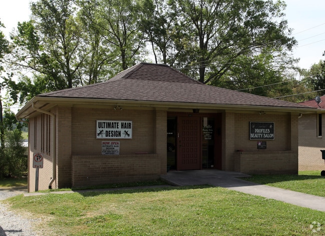
618 Gary St, Durham, NC 27703


Property Detail
618 Gary St
120897
HILLCREST ADN/PROP-GARY P LAZA ASSOC/LT#04 PROFILE PL:000109-000156
Officebuilding
Durham
CN
North Carolina
B and X Area of moderate flood hazard, usually the area between the limits of the 100-year and 500-year floods.
4
2024
0.15 AC
2025
South Durham
001002
Raleigh/Durham
1,296 SF
Durham-Chapel Hill, NC
NEARBY LISTINGS FOR SALE OR LEASE
DEMOGRAPHICS near 618 Gary St
1 mile
3 mile
5 mile
2025 Total Population
13,536
85,532
193,296
2030 Population
14,407
91,366
205,621
Pop Growth 2025-2030
+ 6.43%
+ 6.82%
+ 6.38%
Average Age
35
37
37
2025 Total Households
4,710
33,254
76,944
HH Growth 2025-2030
+ 6.65%
+ 7.29%
+ 6.79%
Median Household Inc
$48,954
$69,341
$70,887
Avg Household Size
2.70
2.40
2.30
2025 Avg HH Vehicles
1.00
2.00
2.00
Median Home Value
$296,058
$370,631
$387,016
Median Year Built
1967
1980
1989
Nearby Places
Map Layers
Map Styles
 Street
 Aerial
Transit
 Traffic
 Biking
Places
Listings with unknown addresses are not visible on the map
- Restaurants
- Banks
- Shops
- Fitness
- Groceries
PUBLIC TRANSPORTATION
COMMUTER RAIL
Drive
Walk
Distance
6 min
2.3 mi
AIRPORT
Raleigh-Durham International
Drive
Walk
Distance
Raleigh-Durham International
20 min
11.5 mi
Nearby Properties
Address
Land Use
TOTAL SIZE
Lot Size
Zoning
Address
Land Use
TOTAL SIZE
Lot Size
Zoning
839,237 SF
9.84 AC
DD-C
Address
Land Use
TOTAL SIZE
Lot Size
Zoning
310,825 SF
3.20 AC
DD-C
Address
Land Use
TOTAL SIZE
Lot Size
Zoning
3.38 AC
DD-C
Address
Land Use
TOTAL SIZE
Lot Size
Zoning
63,921 SF
3.76 AC
DD-C
Address
Land Use
TOTAL SIZE
Lot Size
Zoning
171,375 SF
3.80 AC
DD-C
Address
Land Use
TOTAL SIZE
Lot Size
Zoning
294,862 SF
2.37 AC
DD-C
Address
Land Use
TOTAL SIZE
Lot Size
Zoning
478,037 SF
4.51 AC
DD-C
Address
Land Use
TOTAL SIZE
Lot Size
Zoning
69,430 SF
2.61 AC
DD-C
Address
Land Use
TOTAL SIZE
Lot Size
Zoning
230,275 SF
2.12 AC
DD-C
Address
Land Use
TOTAL SIZE
Lot Size
Zoning
218,882 SF
3.10 AC
DD-S1
Address
Land Use
TOTAL SIZE
Lot Size
Zoning
265,592 SF
2.04 AC
DD-C
Address
Land Use
TOTAL SIZE
Lot Size
Zoning
218,946 SF
1.91 AC
DD-S1
Address
Land Use
TOTAL SIZE
Lot Size
Zoning
358,462 SF
1.48 AC
DD-C
Address
Land Use
TOTAL SIZE
Lot Size
Zoning
262,593 SF
2.73 AC
DD-C
Address
Land Use
TOTAL SIZE
Lot Size
Zoning
410,000 SF
31.41 AC
IL
Address
Land Use
TOTAL SIZE
Lot Size
Zoning
250,392 SF
16.67 AC
DD-S2
Address
Land Use
TOTAL SIZE
Lot Size
Zoning
144,812 SF
1.44 AC
DD-C
Address
Land Use
TOTAL SIZE
Lot Size
Zoning
1,524 SF
11.97 AC
CG(D)
Address
Land Use
TOTAL SIZE
Lot Size
Zoning
69.37 AC
IL
Address
Land Use
TOTAL SIZE
Lot Size
Zoning
137,472 SF
1.04 AC
DD-C
Address
Land Use
TOTAL SIZE
Lot Size
Zoning
260,000 SF
35.58 AC
I,IL
Address
Land Use
TOTAL SIZE
Lot Size
Zoning
40.81 AC
IL
Address
Land Use
TOTAL SIZE
Lot Size
Zoning
167,530 SF
1.46 AC
DD-S1
Address
Land Use
TOTAL SIZE
Lot Size
Zoning
13,731 SF
11.18 AC
DD-C
Address
Land Use
TOTAL SIZE
Lot Size
Zoning
69,247 SF
3.09 AC
DD-C
Address
Land Use
TOTAL SIZE
Lot Size
Zoning
103,784 SF
0.84 AC
Address
Land Use
TOTAL SIZE
Lot Size
Zoning
305,872 SF
4.51 AC
DD-S1
Address
Land Use
TOTAL SIZE
Lot Size
Zoning
303,996 SF
0.98 AC
DD-S1
Address
Land Use
TOTAL SIZE
Lot Size
Zoning
3.61 AC
DD-S1
Address
Land Use
TOTAL SIZE
Lot Size
Zoning
11,520 SF
1.18 AC
DD-S1
The World's #1 Commercial Real Estate Marketplace
Connect with us
© 2026 CoStar Group
The information above has been obtained from sources believed reliable. While we do not doubt its accuracy we have not verified it and make no guarantee, warranty or representation about it. It is your responsibility to independently confirm its accuracy and completeness. Any projections, opinions, assumptions, or estimates used are for example only and do not represent the current or future performance of the property. The value of this transaction to you depends on tax and other factors which should be evaluated by your tax, financial, and legal advisors. You and your advisors should conduct a careful, independent investigation of the property to determine to your satisfaction the suitability of the property for your needs.