Property Record
64 Highland St, Roxbury, MA 02119

Property Detail
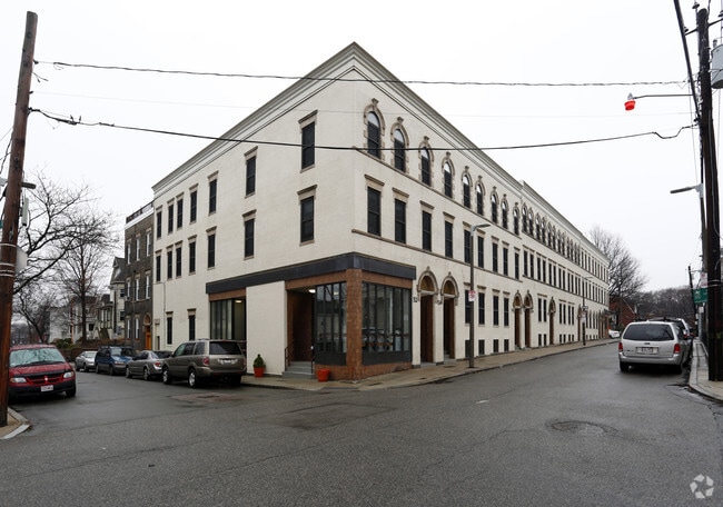
64 Highland St
Governmentalpublicusegeneral
SUFFOLK
E
Massachusetts
B and X Area of moderate flood hazard, usually the area between the limits of the 100-year and 500-year floods.
0.03 AC
0
Highland Park
2025
Boston
081400
Boston-Cambridge-Newton, MA-NH
3,087 SF
ROXB-000000-000009-003665
NEARBY LISTINGS FOR SALE OR LEASE
DEMOGRAPHICS near 64 Highland St
1 mile
3 mile
5 mile
2025 Total Population
77,281
519,657
944,765
2030 Population
79,280
534,953
971,265
Pop Growth 2025-2030
+ 2.59%
+ 2.94%
+ 2.80%
Average Age
35
37
38
2025 Total Households
26,155
214,720
390,994
HH Growth 2025-2030
+ 2.68%
+ 3.30%
+ 3.14%
Median Household Inc
$54,312
$97,708
$108,432
Avg Household Size
2.30
2.10
2.20
2025 Avg HH Vehicles
1.00
1.00
1.00
Median Home Value
$712,304
$900,183
$854,755
Median Year Built
1961
1953
1949
Nearby Places
Map Layers
Map Styles
 Street
 Aerial
Layers
 Traffic
 Biking
Places
Listings with unknown addresses are not visible on the map
- Restaurants
- Banks
- Shops
- Fitness
- Groceries
PUBLIC TRANSPORTATION
TRANSIT/SUBWAY
Roxbury Crossing Station (Orange Line - Massachusetts Bay Transportation Authority Subway (The T))
Drive
Walk
Distance
Roxbury Crossing Station (Orange Line - Massachusetts Bay Transportation Authority Subway (The T))
2 min
8 min
0.4 mi
Jackson Square Station (Orange Line - Massachusetts Bay Transportation Authority Subway (The T))
Drive
Walk
Distance
Jackson Square Station (Orange Line - Massachusetts Bay Transportation Authority Subway (The T))
3 min
12 min
0.6 mi
Ruggles Station (Orange Line - Massachusetts Bay Transportation Authority Subway (The T))
Drive
Walk
Distance
Ruggles Station (Orange Line - Massachusetts Bay Transportation Authority Subway (The T))
5 min
16 min
0.8 mi
Longwood Medical Area Station (Green Line - E - Massachusetts Bay Transportation Authority Subway (The T))
Drive
Walk
Distance
Longwood Medical Area Station (Green Line - E - Massachusetts Bay Transportation Authority Subway (The T))
4 min
17 min
0.9 mi
Brigham Circle Station (Green Line - E - Massachusetts Bay Transportation Authority Subway (The T))
Drive
Walk
Distance
Brigham Circle Station (Green Line - E - Massachusetts Bay Transportation Authority Subway (The T))
4 min
19 min
1.0 mi
COMMUTER RAIL
Ruggles Station (Orange Line - Massachusetts Bay Transportation Authority Subway (The T))
Drive
Walk
Distance
Ruggles Station (Orange Line - Massachusetts Bay Transportation Authority Subway (The T))
4 min
17 min
0.9 mi
Drive
Walk
Distance
4 min
1.7 mi
AIRPORT
General Edward Lawrence Logan International
Drive
Walk
Distance
General Edward Lawrence Logan International
15 min
6.3 mi
Freight Ports
Port of Boston
Drive
Walk
Distance
Port of Boston
11 min
4.7 mi
Nearby Properties
Address
Land Use
TOTAL SIZE
Lot Size
Zoning
Address
Land Use
TOTAL SIZE
Lot Size
Zoning
909,764 SF
25.13 AC
E
Address
Land Use
TOTAL SIZE
Lot Size
Zoning
610,560 SF
4.01 AC
E
Address
Land Use
TOTAL SIZE
Lot Size
Zoning
439,500 SF
9.21 AC
E
Address
Land Use
TOTAL SIZE
Lot Size
Zoning
6.39 AC
C
Address
Land Use
TOTAL SIZE
Lot Size
Zoning
596,972 SF
7.32 AC
E
Address
Land Use
TOTAL SIZE
Lot Size
Zoning
173,400 SF
1.14 AC
MXD
Address
Land Use
TOTAL SIZE
Lot Size
Zoning
334,522 SF
1.26 AC
C
Address
Land Use
TOTAL SIZE
Lot Size
Zoning
312,269 SF
0.43 AC
C
Address
Land Use
TOTAL SIZE
Lot Size
Zoning
230,394 SF
0.60 AC
MXD
Address
Land Use
TOTAL SIZE
Lot Size
Zoning
46,259 SF
1.05 AC
E
Address
Land Use
TOTAL SIZE
Lot Size
Zoning
118,759 SF
0.92 AC
C
Address
Land Use
TOTAL SIZE
Lot Size
Zoning
3.52 AC
C-3
Address
Land Use
TOTAL SIZE
Lot Size
Zoning
377,634 SF
4.86 AC
E
Address
Land Use
TOTAL SIZE
Lot Size
Zoning
1.13 AC
C
Address
Land Use
TOTAL SIZE
Lot Size
Zoning
239,377 SF
0.71 AC
MXD
Address
Land Use
TOTAL SIZE
Lot Size
Zoning
3.75 AC
C
Address
Land Use
TOTAL SIZE
Lot Size
Zoning
227,107 SF
7.70 AC
E
Address
Land Use
TOTAL SIZE
Lot Size
Zoning
2.81 AC
O-2
Address
Land Use
TOTAL SIZE
Lot Size
Zoning
448,796 SF
1.84 AC
C
Address
Land Use
TOTAL SIZE
Lot Size
Zoning
254,208 SF
3.83 AC
E
Address
Land Use
TOTAL SIZE
Lot Size
Zoning
341,500 SF
1.18 AC
RC
Address
Land Use
TOTAL SIZE
Lot Size
Zoning
252,392 SF
0.52 AC
C
Address
Land Use
TOTAL SIZE
Lot Size
Zoning
262,120 SF
0.62 AC
C
Address
Land Use
TOTAL SIZE
Lot Size
Zoning
325,020 SF
0.62 AC
RC
Address
Land Use
TOTAL SIZE
Lot Size
Zoning
237,935 SF
1.27 AC
C-3
Address
Land Use
TOTAL SIZE
Lot Size
Zoning
619,050 SF
0.45 AC
C
Address
Land Use
TOTAL SIZE
Lot Size
Zoning
259,990 SF
2.84 AC
E
Address
Land Use
TOTAL SIZE
Lot Size
Zoning
6.14 AC
C
Address
Land Use
TOTAL SIZE
Lot Size
Zoning
547,851 SF
8.14 AC
E
Address
Land Use
TOTAL SIZE
Lot Size
Zoning
305,455 SF
0.54 AC
RC
The World's #1 Commercial Real Estate Marketplace
Connect with us
© 2026 CoStar Group
The information above has been obtained from sources believed reliable. While we do not doubt its accuracy we have not verified it and make no guarantee, warranty or representation about it. It is your responsibility to independently confirm its accuracy and completeness. Any projections, opinions, assumptions, or estimates used are for example only and do not represent the current or future performance of the property. The value of this transaction to you depends on tax and other factors which should be evaluated by your tax, financial, and legal advisors. You and your advisors should conduct a careful, independent investigation of the property to determine to your satisfaction the suitability of the property for your needs.