Property Record
6565 W Emerald St, Boise, ID 83704
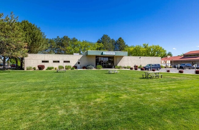


This Property Is For Sale
Property Detail
6565 W Emerald St
R1097503350
W 249 OF LOT 33 BROSE 1ST SUB #94099228 #94099227 #94099226
Commercialbuilding
Ada
L-OD
Idaho
B and X Area of moderate flood hazard, usually the area between the limits of the 100-year and 500-year floods.
33
0
1.70 AC
2025
Central Boise
002000
Boise City/Nampa
12,864 SF
Boise City, ID
NEARBY LISTINGS FOR SALE OR LEASE
DEMOGRAPHICS near 6565 W Emerald St
1 mile
3 mile
5 mile
2024 Total Population
14,081
113,331
249,593
2029 Population
14,636
118,545
261,344
Pop Growth 2024-2029
+ 3.94%
+ 4.60%
+ 4.71%
Average Age
38
39
40
2024 Total Households
6,166
48,346
104,792
HH Growth 2024-2029
+ 4.43%
+ 5.09%
+ 5.21%
Median Household Inc
$58,728
$67,248
$79,474
Avg Household Size
2.10
2.20
2.30
2024 Avg HH Vehicles
2.00
2.00
2.00
Median Home Value
$384,289
$443,129
$483,033
Median Year Built
1983
1982
1989
Nearby Places
Map Layers
Map Styles
 Street
 Aerial
Transit
 Traffic
 Biking
Places
Listings with unknown addresses are not visible on the map
- Restaurants
- Banks
- Shops
- Fitness
- Groceries
PUBLIC TRANSPORTATION
AIRPORT
Boise Air Trml/Gowen Field
Drive
Walk
Distance
Boise Air Trml/Gowen Field
15 min
6.3 mi
Nearby Properties
Address
Land Use
TOTAL SIZE
Lot Size
Zoning
Address
Land Use
TOTAL SIZE
Lot Size
Zoning
369,584 SF
1 AC
C-5DD
Address
Land Use
TOTAL SIZE
Lot Size
Zoning
646,787 SF
27.37 AC
C-2D
Address
Land Use
TOTAL SIZE
Lot Size
Zoning
434,370 SF
0.56 AC
C-5DD
Address
Land Use
TOTAL SIZE
Lot Size
Zoning
129,663 SF
0.92 AC
C-5DD
Address
Land Use
TOTAL SIZE
Lot Size
Zoning
13.90 AC
R-2D
Address
Land Use
TOTAL SIZE
Lot Size
Zoning
4.02 AC
C-2
Address
Land Use
TOTAL SIZE
Lot Size
Zoning
279,694 SF
2.09 AC
R-ODD/DA
Address
Land Use
TOTAL SIZE
Lot Size
Zoning
258,747 SF
3.30 AC
R-OD/DA
Address
Land Use
TOTAL SIZE
Lot Size
Zoning
402,504 SF
5.78 AC
C-5DD
Address
Land Use
TOTAL SIZE
Lot Size
Zoning
334,334 SF
3.21 AC
R-OD
Address
Land Use
TOTAL SIZE
Lot Size
Zoning
207,033 SF
10.67 AC
L-OD
Address
Land Use
TOTAL SIZE
Lot Size
Zoning
204,396 SF
0.82 AC
C-5DDC
Address
Land Use
TOTAL SIZE
Lot Size
Zoning
366,126 SF
0.82 AC
C-5DD
Address
Land Use
TOTAL SIZE
Lot Size
Zoning
225,032 SF
12.75 AC
R-3D
Address
Land Use
TOTAL SIZE
Lot Size
Zoning
359,820 SF
1.79 AC
C-5DD
Address
Land Use
TOTAL SIZE
Lot Size
Zoning
249,800 SF
12.99 AC
C-2D
Address
Land Use
TOTAL SIZE
Lot Size
Zoning
245,000 SF
12.28 AC
R-2D
Address
Land Use
TOTAL SIZE
Lot Size
Zoning
319,052 SF
24.33 AC
C-2D
Address
Land Use
TOTAL SIZE
Lot Size
Zoning
216,371 SF
0.78 AC
C-5DDC
Address
Land Use
TOTAL SIZE
Lot Size
Zoning
151,285 SF
9.54 AC
R-1C
Address
Land Use
TOTAL SIZE
Lot Size
Zoning
189,100 SF
0.60 AC
C-5DD
Address
Land Use
TOTAL SIZE
Lot Size
Zoning
222,379 SF
1.37 AC
M
Address
Land Use
TOTAL SIZE
Lot Size
Zoning
211,039 SF
12.21 AC
C-3D
Address
Land Use
TOTAL SIZE
Lot Size
Zoning
259,231 SF
1.72 AC
C-5DD
Address
Land Use
TOTAL SIZE
Lot Size
Zoning
247,435 SF
2.90 AC
C-2DC
Address
Land Use
TOTAL SIZE
Lot Size
Zoning
235,872 SF
1.94 AC
C-5DD
Address
Land Use
TOTAL SIZE
Lot Size
Zoning
162,432 SF
8.31 AC
R-3D
Address
Land Use
TOTAL SIZE
Lot Size
Zoning
72,579 SF
4.48 AC
M-1D
Address
Land Use
TOTAL SIZE
Lot Size
Zoning
125,241 SF
1.42 AC
C-5DD
Address
Land Use
TOTAL SIZE
Lot Size
Zoning
246,944 SF
2.29 AC
R-OD
The World's #1 Commercial Real Estate Marketplace
Connect with us
© 2026 CoStar Group
The information above has been obtained from sources believed reliable. While we do not doubt its accuracy we have not verified it and make no guarantee, warranty or representation about it. It is your responsibility to independently confirm its accuracy and completeness. Any projections, opinions, assumptions, or estimates used are for example only and do not represent the current or future performance of the property. The value of this transaction to you depends on tax and other factors which should be evaluated by your tax, financial, and legal advisors. You and your advisors should conduct a careful, independent investigation of the property to determine to your satisfaction the suitability of the property for your needs.