Property Record
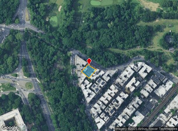
66 W Gun Hill Rd, Bronx, NY 10467


NEARBY LISTINGS FOR SALE OR LEASE
Property Detail
66 W Gun Hill Rd
03324-0013
Partition Map Dickinsin Estate
Apartment
Bronx
X
New York
34003C0220H
13
2024
0.26 AC
2025
Norwood
042100
Westchester/So Connecticut
51,450 SF
New York-Jersey City-White Plains, NY-NJ
DEMOGRAPHICS near 66 W Gun Hill Rd
1 Mile
3 Mile
5 Mile
2024 Total Population
100,724
816,857
1,758,075
2029 Population
94,925
758,701
1,641,597
Pop Growth 2024-2029
(5.76%)
(7.12%)
(6.63%)
Average Age
38
39
39
2024 Total Households
36,761
294,328
638,063
HH Growth 2024-2029
(6.36%)
(7.71%)
(7.10%)
Median Household Inc
$46,390
$49,572
$48,711
Avg Household Size
2.60
2.60
2.60
2024 Avg HH Vehicles
.00
1.00
1.00
Median Home Value
$225,880
$492,060
$496,236
Median Year Built
1948
1949
1951
Nearby Places
Map Layers
Map Styles
 Street
 Aerial
- Restaurants
- Banks
- Shops
- Fitness
- Groceries
PUBLIC TRANSPORTATION
TRANSIT/SUBWAY
Woodlawn (4 - New York MTA Subway (The Subway))
DRIVE
WALK
Distance
Woodlawn (4 - New York MTA Subway (The Subway))
1 min
9 min
0.4 mi
Mosholu Parkway (4 - New York MTA Subway (The Subway))
DRIVE
WALK
Distance
Mosholu Parkway (4 - New York MTA Subway (The Subway))
1 min
10 min
0.5 mi
Bedford Park Boulevard (B - New York MTA Subway (The Subway), D - New York MTA Subway (The Subway))
DRIVE
WALK
Distance
Bedford Park Boulevard (B - New York MTA Subway (The Subway), D - New York MTA Subway (The Subway))
2 min
16 min
0.8 mi
205 Street-Norwood (D - New York MTA Subway (The Subway))
DRIVE
WALK
Distance
205 Street-Norwood (D - New York MTA Subway (The Subway))
2 min
16 min
0.8 mi
COMMUTER RAIL
Williams Bridge Station (Harlem Line - Metro-North Commuter Railroad Company (Metro-North))
DRIVE
WALK
Distance
Williams Bridge Station (Harlem Line - Metro-North Commuter Railroad Company (Metro-North))
2 min
16 min
0.8 mi
Botanical Garden Station (Harlem Line - Metro-North Commuter Railroad Company (Metro-North))
DRIVE
WALK
Distance
Botanical Garden Station (Harlem Line - Metro-North Commuter Railroad Company (Metro-North))
3 min
1.5 mi
AIRPORT
LaGuardia
DRIVE
WALK
Distance
LaGuardia
24 min
12.8 mi
John F Kennedy International
DRIVE
WALK
Distance
John F Kennedy International
35 min
21.1 mi
Westchester County
DRIVE
WALK
Distance
Westchester County
33 min
21.4 mi
Freight Ports
NY - Red Hook Container Terminal
DRIVE
WALK
Distance
NY - Red Hook Container Terminal
37 min
21.0 mi
Nearby Properties
Address
Land Use
TOTAL SIZE
Lot Size
Zoning
Address
Land Use
TOTAL SIZE
Lot Size
Zoning
1,299,700 SF
29.82 AC
R6
Address
Land Use
TOTAL SIZE
Lot Size
Zoning
1,743,584 SF
77.87 AC
R6
Address
Land Use
TOTAL SIZE
Lot Size
Zoning
1,427,393 SF
39.94 AC
R4
Address
Land Use
TOTAL SIZE
Lot Size
Zoning
481,172 SF
205.58 AC
PARK
Address
Land Use
TOTAL SIZE
Lot Size
Zoning
1,132,500 SF
62.44 AC
R6
Address
Land Use
TOTAL SIZE
Lot Size
Zoning
895,256 SF
8.32 AC
R7-1
Address
Land Use
TOTAL SIZE
Lot Size
Zoning
1,237,424 SF
21.25 AC
R6
Address
Land Use
TOTAL SIZE
Lot Size
Zoning
204,200 SF
1.68 AC
R7-1
Address
Land Use
TOTAL SIZE
Lot Size
Zoning
390,750 SF
265 AC
PARK
Address
Land Use
TOTAL SIZE
Lot Size
Zoning
617,567 SF
3.19 AC
R7-1
Address
Land Use
TOTAL SIZE
Lot Size
Zoning
631,237 SF
30.93 AC
R5
Address
Land Use
TOTAL SIZE
Lot Size
Zoning
707,353 SF
29.34 AC
R6
Address
Land Use
TOTAL SIZE
Lot Size
Zoning
1,392,950 SF
19.67 AC
M2-1
Address
Land Use
TOTAL SIZE
Lot Size
Zoning
259.87 AC
PARK
Address
Land Use
TOTAL SIZE
Lot Size
Zoning
393,924 SF
4.50 AC
R7-2
Address
Land Use
TOTAL SIZE
Lot Size
Zoning
4,928 SF
64.19 AC
PARK
Address
Land Use
TOTAL SIZE
Lot Size
Zoning
224,037 SF
0.82 AC
C45X
Address
Land Use
TOTAL SIZE
Lot Size
Zoning
269,100 SF
1.63 AC
R4
Address
Land Use
TOTAL SIZE
Lot Size
Zoning
87,000 SF
455.70 AC
PARK
Address
Land Use
TOTAL SIZE
Lot Size
Zoning
450,784 SF
42.36 AC
R4
Address
Land Use
TOTAL SIZE
Lot Size
Zoning
18,445 SF
510.83 AC
PARK
Address
Land Use
TOTAL SIZE
Lot Size
Zoning
251,884 SF
21.53 AC
R6
Address
Land Use
TOTAL SIZE
Lot Size
Zoning
1,028,976 SF
23.03 AC
R5
Address
Land Use
TOTAL SIZE
Lot Size
Zoning
406,549 SF
3.22 AC
C4-4
Address
Land Use
TOTAL SIZE
Lot Size
Zoning
677,078 SF
4.91 AC
R6
Address
Land Use
TOTAL SIZE
Lot Size
Zoning
614,887 SF
14.77 AC
R4
Address
Land Use
TOTAL SIZE
Lot Size
Zoning
593,427 SF
3.67 AC
R7-2
Address
Land Use
TOTAL SIZE
Lot Size
Zoning
1,038,034 SF
23.41 AC
R5
Address
Land Use
TOTAL SIZE
Lot Size
Zoning
244,650 SF
2 AC
R7-1
Address
Land Use
TOTAL SIZE
Lot Size
Zoning
280,539 SF
3.11 AC
R6
The World's #1 Commercial Real Estate Marketplace
Connect with us
© 2025 CoStar Group
The information above has been obtained from sources believed reliable. While we do not doubt its accuracy we have not verified it and make no guarantee, warranty or representation about it. It is your responsibility to independently confirm its accuracy and completeness. Any projections, opinions, assumptions, or estimates used are for example only and do not represent the current or future performance of the property. The value of this transaction to you depends on tax and other factors which should be evaluated by your tax, financial, and legal advisors. You and your advisors should conduct a careful, independent investigation of the property to determine to your satisfaction the suitability of the property for your needs.