Property Record
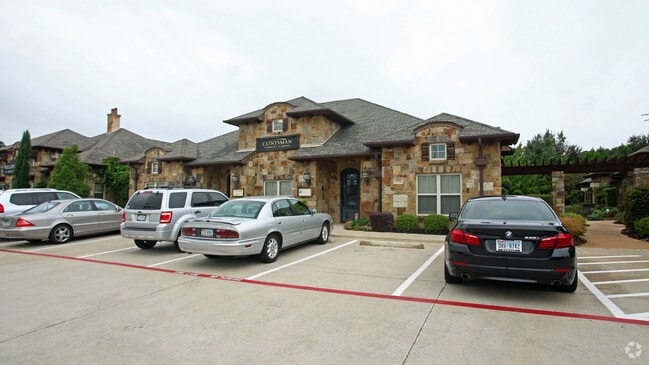
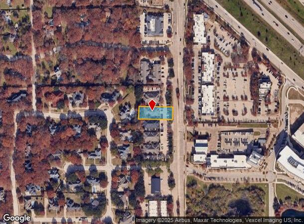
660 N Carroll Ave, Southlake, TX 76092
NEARBY LISTINGS FOR SALE OR LEASE
Property Detail
660 N Carroll Ave
Dallas-Fort Worth-Arlington, TX
Carroll Terrace
40690369
CARROLL TERRACE BLOCK 1 LOT 4
Commercialnec
Tarrant
X
Texas
48121C0660G
4
2024
0.43 AC
2025
Westlake/Grapevine
113956
Dallas/Ft Worth
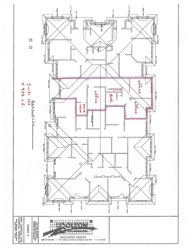
5,918 SF
DEMOGRAPHICS near 660 N Carroll Ave
1 Mile
3 Mile
5 Mile
2024 Total Population
3,413
53,020
122,989
2029 Population
3,599
55,586
130,907
Pop Growth 2024-2029
+ 5.45%
+ 4.84%
+ 6.44%
Average Age
40
39
41
2024 Total Households
1,045
18,023
43,561
HH Growth 2024-2029
+ 5.55%
+ 4.92%
+ 6.59%
Median Household Inc
$248,406
$158,487
$151,715
Avg Household Size
3.30
2.90
2.80
2024 Avg HH Vehicles
3.00
2.00
2.00
Median Home Value
$863,598
$666,009
$608,467
Median Year Built
1995
1992
1994
Nearby Places
Map Layers
Map Styles
 Street
 Aerial
- Restaurants
- Banks
- Shops
- Fitness
- Groceries
PUBLIC TRANSPORTATION
AIRPORT
Dallas-Fort Worth International
DRIVE
WALK
Distance
Dallas-Fort Worth International
13 min
9.2 mi
Dallas Love Field
DRIVE
WALK
Distance
Dallas Love Field
31 min
22.9 mi
SALE & LEASE HISTORY
LISTING DATE
SALE/LEASE

Jun 24, 2021
For Lease
Dec 10, 2019
For Lease
Nearby Properties
Address
Land Use
TOTAL SIZE
Lot Size
Zoning
Address
Land Use
TOTAL SIZE
Lot Size
Zoning
332,665 SF
9.83 AC
Address
Land Use
TOTAL SIZE
Lot Size
Zoning
321,993 SF
18.20 AC
Address
Land Use
TOTAL SIZE
Lot Size
Zoning
255,937 SF
55.03 AC
Address
Land Use
TOTAL SIZE
Lot Size
Zoning
203,458 SF
16.58 AC
Address
Land Use
TOTAL SIZE
Lot Size
Zoning
314,692 SF
78.63 AC
Address
Land Use
TOTAL SIZE
Lot Size
Zoning
645,587 SF
12.57 AC
Address
Land Use
TOTAL SIZE
Lot Size
Zoning
242,000 SF
3.72 AC
Address
Land Use
TOTAL SIZE
Lot Size
Zoning
261,466 SF
6.83 AC
Address
Land Use
TOTAL SIZE
Lot Size
Zoning
196,350 SF
12.05 AC
Address
Land Use
TOTAL SIZE
Lot Size
Zoning
247,505 SF
32 AC
Address
Land Use
TOTAL SIZE
Lot Size
Zoning
306,052 SF
1.92 AC
Address
Land Use
TOTAL SIZE
Lot Size
Zoning
255,288 SF
10.57 AC
Address
Land Use
TOTAL SIZE
Lot Size
Zoning
191,001 SF
17.58 AC
Address
Land Use
TOTAL SIZE
Lot Size
Zoning
206,950 SF
12.13 AC
Address
Land Use
TOTAL SIZE
Lot Size
Zoning
89,500 SF
8.47 AC
Address
Land Use
TOTAL SIZE
Lot Size
Zoning
597,855 SF
Address
Land Use
TOTAL SIZE
Lot Size
Zoning
136,358 SF
16.51 AC
Address
Land Use
TOTAL SIZE
Lot Size
Zoning
167,847 SF
8.39 AC
Address
Land Use
TOTAL SIZE
Lot Size
Zoning
100.88 AC
Address
Land Use
TOTAL SIZE
Lot Size
Zoning
219,109 SF
24.78 AC
Address
Land Use
TOTAL SIZE
Lot Size
Zoning
195,324 SF
7.48 AC
Address
Land Use
TOTAL SIZE
Lot Size
Zoning
122,466 SF
43.83 AC
Address
Land Use
TOTAL SIZE
Lot Size
Zoning
143,500 SF
1.79 AC
Address
Land Use
TOTAL SIZE
Lot Size
Zoning
338,952 SF
24.11 AC
Address
Land Use
TOTAL SIZE
Lot Size
Zoning
121,348 SF
13.78 AC
Address
Land Use
TOTAL SIZE
Lot Size
Zoning
188,500 SF
6.28 AC
Address
Land Use
TOTAL SIZE
Lot Size
Zoning
196,302 SF
12.78 AC
Address
Land Use
TOTAL SIZE
Lot Size
Zoning
155,000 SF
24.66 AC
Address
Land Use
TOTAL SIZE
Lot Size
Zoning
133,430 SF
19.75 AC
Address
Land Use
TOTAL SIZE
Lot Size
Zoning
153.50 AC
The World's #1 Commercial Real Estate Marketplace
Connect with us
© 2025 CoStar Group
The information above has been obtained from sources believed reliable. While we do not doubt its accuracy we have not verified it and make no guarantee, warranty or representation about it. It is your responsibility to independently confirm its accuracy and completeness. Any projections, opinions, assumptions, or estimates used are for example only and do not represent the current or future performance of the property. The value of this transaction to you depends on tax and other factors which should be evaluated by your tax, financial, and legal advisors. You and your advisors should conduct a careful, independent investigation of the property to determine to your satisfaction the suitability of the property for your needs.