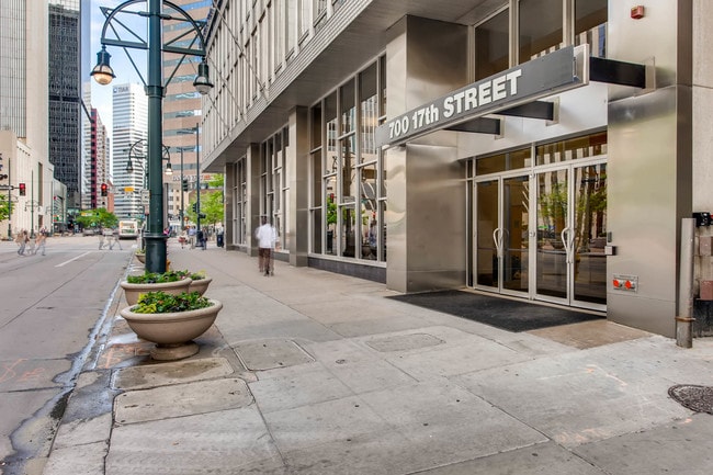
Property Record
700 17Th St, Denver, CO 80202


Property Detail
700 17Th St
2345-27-011
EAST DENVER B140 L29 TO 32
Officebuilding
DENVER
D-C
Colorado
B and X Area of moderate flood hazard, usually the area between the limits of the 100-year and 500-year floods.
29-32
2024
0.29 AC
2025
CBD
001706
Denver
203,569 SF
Denver-Aurora-Centennial, CO
NEARBY LISTINGS FOR SALE OR LEASE
DEMOGRAPHICS near 700 17Th St
1 mile
3 mile
5 mile
2025 Total Population
54,249
247,686
494,150
2030 Population
56,324
255,763
506,231
Pop Growth 2025-2030
+ 3.82%
+ 3.26%
+ 2.44%
Average Age
38
38
38
2025 Total Households
32,632
130,661
233,297
HH Growth 2025-2030
+ 3.98%
+ 3.39%
+ 2.66%
Median Household Inc
$93,790
$103,377
$98,677
Avg Household Size
1.50
1.80
2.00
2025 Avg HH Vehicles
1.00
1.00
2.00
Median Home Value
$718,593
$766,659
$735,142
Median Year Built
2001
1973
1967
Nearby Places
Map Layers
Map Styles
 Street
 Aerial
Layers
 Traffic
 Biking
Places
Listings with unknown addresses are not visible on the map
- Restaurants
- Banks
- Shops
- Fitness
- Groceries
PUBLIC TRANSPORTATION
TRANSIT/SUBWAY
18th-California (D Line - Denver Regional Transportation District Light Rail (TheRide), F Line - Denver Regional Transportation District Light Rail (TheRide), H Line - Denver Regional Transportation District Light Rail (TheRide))
Drive
Walk
Distance
18th-California (D Line - Denver Regional Transportation District Light Rail (TheRide), F Line - Denver Regional Transportation District Light Rail (TheRide), H Line - Denver Regional Transportation District Light Rail (TheRide))
1 min
2 min
0.1 mi
16th-Stout (D Line - Denver Regional Transportation District Light Rail (TheRide), F Line - Denver Regional Transportation District Light Rail (TheRide), H Line - Denver Regional Transportation District Light Rail (TheRide))
Drive
Walk
Distance
16th-Stout (D Line - Denver Regional Transportation District Light Rail (TheRide), F Line - Denver Regional Transportation District Light Rail (TheRide), H Line - Denver Regional Transportation District Light Rail (TheRide))
2 min
2 min
0.1 mi
16th-California (D Line - Denver Regional Transportation District Light Rail (TheRide), F Line - Denver Regional Transportation District Light Rail (TheRide), H Line - Denver Regional Transportation District Light Rail (TheRide))
Drive
Walk
Distance
16th-California (D Line - Denver Regional Transportation District Light Rail (TheRide), F Line - Denver Regional Transportation District Light Rail (TheRide), H Line - Denver Regional Transportation District Light Rail (TheRide))
0 min
3 min
0.2 mi
18th-Stout (D Line - Denver Regional Transportation District Light Rail (TheRide), F Line - Denver Regional Transportation District Light Rail (TheRide), H Line - Denver Regional Transportation District Light Rail (TheRide))
Drive
Walk
Distance
18th-Stout (D Line - Denver Regional Transportation District Light Rail (TheRide), F Line - Denver Regional Transportation District Light Rail (TheRide), H Line - Denver Regional Transportation District Light Rail (TheRide))
1 min
4 min
0.2 mi
20th-Welton (D Line - Denver Regional Transportation District Light Rail (TheRide))
Drive
Walk
Distance
20th-Welton (D Line - Denver Regional Transportation District Light Rail (TheRide))
1 min
7 min
0.3 mi
COMMUTER RAIL
Drive
Walk
Distance
3 min
13 min
0.7 mi
Union Station: LoDo-Coors Field-16th Street Mall (C Line - Denver Regional Transportation District Light Rail (TheRide), E Line - Denver Regional Transportation District Light Rail (TheRide), W Line - Denver Regional Transportation District Light Rail (TheRide))
Drive
Walk
Distance
Union Station: LoDo-Coors Field-16th Street Mall (C Line - Denver Regional Transportation District Light Rail (TheRide), E Line - Denver Regional Transportation District Light Rail (TheRide), W Line - Denver Regional Transportation District Light Rail (TheRide))
3 min
16 min
0.8 mi
AIRPORT
Denver International
Drive
Walk
Distance
Denver International
35 min
24.0 mi
SALE & LEASE HISTORY
LISTING DATE
SALE/LEASE

Oct 05, 2017
For Lease
Nov 01, 2017
For Lease
May 10, 2018
For Lease
Mar 28, 2025
For Sale
Mar 05, 2019
For Lease
Jul 27, 2022
For Lease
Aug 24, 2020
For Lease
Aug 20, 2020
For Lease
Aug 03, 2018
For Lease
Apr 01, 2021
For Lease
Nearby Properties
Address
Land Use
TOTAL SIZE
Lot Size
Zoning
Address
Land Use
TOTAL SIZE
Lot Size
Zoning
921,863 SF
2.01 AC
C-MX
Address
Land Use
TOTAL SIZE
Lot Size
Zoning
1,882,179 SF
21.15 AC
D-TD
Address
Land Use
TOTAL SIZE
Lot Size
Zoning
552,279 SF
2.22 AC
C-RX
Address
Land Use
TOTAL SIZE
Lot Size
Zoning
1,721,086 SF
21.34 AC
C-MU-30
Address
Land Use
TOTAL SIZE
Lot Size
Zoning
798,837 SF
1.67 AC
C-MX
Address
Land Use
TOTAL SIZE
Lot Size
Zoning
598,652 SF
1.38 AC
G-TR
Address
Land Use
TOTAL SIZE
Lot Size
Zoning
565,418 SF
4.07 AC
C-RX
Address
Land Use
TOTAL SIZE
Lot Size
Zoning
657,947 SF
5.02 AC
C-RX
Address
Land Use
TOTAL SIZE
Lot Size
Zoning
729,679 SF
C-MX
Address
Land Use
TOTAL SIZE
Lot Size
Zoning
857,233 SF
10.26 AC
CMP-H
Address
Land Use
TOTAL SIZE
Lot Size
Zoning
856,519 SF
10.04 AC
B-3
Address
Land Use
TOTAL SIZE
Lot Size
Zoning
6,252 SF
1.05 AC
C-MX
Address
Land Use
TOTAL SIZE
Lot Size
Zoning
1,096,923 SF
16.14 AC
CMP-H
Address
Land Use
TOTAL SIZE
Lot Size
Zoning
624,481 SF
1.87 AC
C-MX
Address
Land Use
TOTAL SIZE
Lot Size
Zoning
451,860 SF
1 AC
C-MX
Address
Land Use
TOTAL SIZE
Lot Size
Zoning
794,383 SF
0.90 AC
D-TD
Address
Land Use
TOTAL SIZE
Lot Size
Zoning
694,425 SF
1.92 AC
C-MX
Address
Land Use
TOTAL SIZE
Lot Size
Zoning
411,402 SF
6.34 AC
C-RX
Address
Land Use
TOTAL SIZE
Lot Size
Zoning
405,436 SF
2.45 AC
C-MX
Address
Land Use
TOTAL SIZE
Lot Size
Zoning
299,368 SF
0.71 AC
C-MX
Address
Land Use
TOTAL SIZE
Lot Size
Zoning
297,776 SF
2.88 AC
C-MX
Address
Land Use
TOTAL SIZE
Lot Size
Zoning
311,406 SF
1.74 AC
C-MX
Address
Land Use
TOTAL SIZE
Lot Size
Zoning
294,950 SF
6.91 AC
C-RX-12
Address
Land Use
TOTAL SIZE
Lot Size
Zoning
310,267 SF
1.69 AC
C-MX
Address
Land Use
TOTAL SIZE
Lot Size
Zoning
402,700 SF
1.15 AC
C-RX
Address
Land Use
TOTAL SIZE
Lot Size
Zoning
411,031 SF
1.66 AC
I-MX
Address
Land Use
TOTAL SIZE
Lot Size
Zoning
352,226 SF
1.01 AC
ASQ
Address
Land Use
TOTAL SIZE
Lot Size
Zoning
296,778 SF
2.28 AC
U-MS
Address
Land Use
TOTAL SIZE
Lot Size
Zoning
341,972 SF
1.21 AC
G-TR
Address
Land Use
TOTAL SIZE
Lot Size
Zoning
1,048,471 SF
2.44 AC
PUD
The World's #1 Commercial Real Estate Marketplace
Connect with us
© 2026 CoStar Group
The information above has been obtained from sources believed reliable. While we do not doubt its accuracy we have not verified it and make no guarantee, warranty or representation about it. It is your responsibility to independently confirm its accuracy and completeness. Any projections, opinions, assumptions, or estimates used are for example only and do not represent the current or future performance of the property. The value of this transaction to you depends on tax and other factors which should be evaluated by your tax, financial, and legal advisors. You and your advisors should conduct a careful, independent investigation of the property to determine to your satisfaction the suitability of the property for your needs.