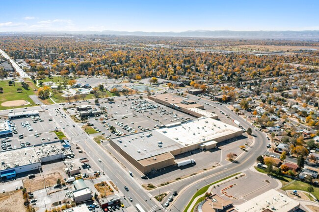
Property Record
757 Peoria St, Aurora, CO 80011


NEARBY LISTINGS FOR SALE OR LEASE
Property Detail
757 Peoria St
Denver-Aurora-Lakewood, CO
Burns Aurora 1St Add 5Th Flg
1973-02-4-14-001
SUBDIVISIONCD 008200 SUBDIVISIONNAME BURNS AURORA 1ST ADD 5TH FLG BLOCK 038 LOT 001 LOT 1 RESERVED LOT 2 & LOT 3 EX RDS & EX THAT PART OF LOT 1 BEG AT INTERS OF ELY LINE OF DEL MAR CT & N LINE OF DEL MAR PKWY EXTENDED TH E 138 FT TH N 126 FT TH NWLY
Storebuilding
Arapahoe
X
Colorado
08005C0176K
001,1
2023
15 AC
2024
Aurora
007400
Denver
218,260 SF
DEMOGRAPHICS near 757 Peoria St
1 Mile
3 Mile
5 Mile
2024 Total Population
24,752
189,199
438,535
2029 Population
24,825
192,258
444,050
Pop Growth 2024-2029
+ 0.29%
+ 1.62%
+ 1.26%
Average Age
36
36
37
2024 Total Households
8,232
71,384
172,644
HH Growth 2024-2029
+ 0.35%
+ 1.65%
+ 1.26%
Median Household Inc
$57,509
$58,645
$68,116
Avg Household Size
2.80
2.50
2.40
2024 Avg HH Vehicles
2.00
2.00
2.00
Median Home Value
$349,486
$378,447
$414,494
Median Year Built
1968
1979
1980
Nearby Places
Map Layers
Map Styles
 Street
 Aerial
- Restaurants
- Banks
- Shops
- Fitness
- Groceries
PUBLIC TRANSPORTATION
COMMUTER RAIL
Peoria Station Track 1 (Union Station to Denver Airport Station - Regional Transportation District)
DRIVE
WALK
Distance
Peoria Station Track 1 (Union Station to Denver Airport Station - Regional Transportation District)
7 min
3.5 mi
Peoria Station Track 2 (Union Station to Denver Airport Station - Regional Transportation District)
DRIVE
WALK
Distance
Peoria Station Track 2 (Union Station to Denver Airport Station - Regional Transportation District)
7 min
3.5 mi
AIRPORT
Denver International
DRIVE
WALK
Distance
Denver International
24 min
18.2 mi
Freight Ports
Tulsa Port Of Catoosa
DRIVE
WALK
Distance
Tulsa Port Of Catoosa
720 min
700.4 mi
SALE & LEASE HISTORY
LISTING DATE
SALE/LEASE

Jul 24, 2018
For Lease
Nearby Properties
Address
Land Use
TOTAL SIZE
Lot Size
Zoning
Address
Land Use
TOTAL SIZE
Lot Size
Zoning
368,450 SF
48.59 AC
Address
Land Use
TOTAL SIZE
Lot Size
Zoning
353,829 SF
4.51 AC
Address
Land Use
TOTAL SIZE
Lot Size
Zoning
880,442 SF
67.95 AC
I-B
Address
Land Use
TOTAL SIZE
Lot Size
Zoning
525,050 SF
105.06 AC
Address
Land Use
TOTAL SIZE
Lot Size
Zoning
496,493 SF
33.45 AC
Address
Land Use
TOTAL SIZE
Lot Size
Zoning
273,184 SF
1.89 AC
Address
Land Use
TOTAL SIZE
Lot Size
Zoning
390,822 SF
13.47 AC
O-1
Address
Land Use
TOTAL SIZE
Lot Size
Zoning
315,058 SF
36.85 AC
RPCZD
Address
Land Use
TOTAL SIZE
Lot Size
Zoning
269,622 SF
12.90 AC
Address
Land Use
TOTAL SIZE
Lot Size
Zoning
672,521 SF
0.61 AC
RB3
Address
Land Use
TOTAL SIZE
Lot Size
Zoning
384,886 SF
18.66 AC
R-2-A
Address
Land Use
TOTAL SIZE
Lot Size
Zoning
277,985 SF
19.07 AC
Address
Land Use
TOTAL SIZE
Lot Size
Zoning
178,235 SF
1.38 AC
RFBAD
Address
Land Use
TOTAL SIZE
Lot Size
Zoning
201,600 SF
44.67 AC
R1
Address
Land Use
TOTAL SIZE
Lot Size
Zoning
368,676 SF
17.71 AC
R-2-A
Address
Land Use
TOTAL SIZE
Lot Size
Zoning
540,380 SF
26.03 AC
RR3
Address
Land Use
TOTAL SIZE
Lot Size
Zoning
111,358 SF
1.21 AC
Address
Land Use
TOTAL SIZE
Lot Size
Zoning
277,005 SF
16.37 AC
Address
Land Use
TOTAL SIZE
Lot Size
Zoning
102,833 SF
14.27 AC
R-MU-20
Address
Land Use
TOTAL SIZE
Lot Size
Zoning
142,708 SF
14.61 AC
Address
Land Use
TOTAL SIZE
Lot Size
Zoning
364,024 SF
23.23 AC
PUD
Address
Land Use
TOTAL SIZE
Lot Size
Zoning
220,395 SF
7.93 AC
Address
Land Use
TOTAL SIZE
Lot Size
Zoning
386,285 SF
2.72 AC
Address
Land Use
TOTAL SIZE
Lot Size
Zoning
290,147 SF
22.02 AC
Address
Land Use
TOTAL SIZE
Lot Size
Zoning
366,800 SF
20.21 AC
Address
Land Use
TOTAL SIZE
Lot Size
Zoning
82,764 SF
9.71 AC
C-MU-20
Address
Land Use
TOTAL SIZE
Lot Size
Zoning
176,751 SF
28.75 AC
Address
Land Use
TOTAL SIZE
Lot Size
Zoning
327,476 SF
7.91 AC
R-3-X
Address
Land Use
TOTAL SIZE
Lot Size
Zoning
94,638 SF
10.24 AC
R-MU-20
The World's #1 Commercial Real Estate Marketplace
Connect with us
© 2025 CoStar Group
The information above has been obtained from sources believed reliable. While we do not doubt its accuracy we have not verified it and make no guarantee, warranty or representation about it. It is your responsibility to independently confirm its accuracy and completeness. Any projections, opinions, assumptions, or estimates used are for example only and do not represent the current or future performance of the property. The value of this transaction to you depends on tax and other factors which should be evaluated by your tax, financial, and legal advisors. You and your advisors should conduct a careful, independent investigation of the property to determine to your satisfaction the suitability of the property for your needs.