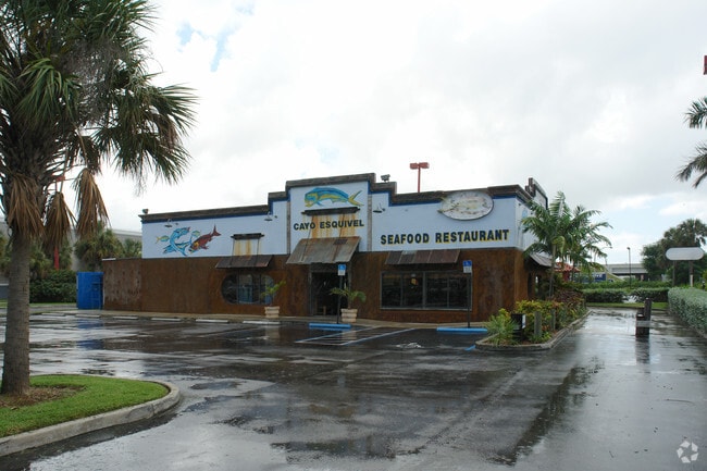
Property Record
7725 Bird Rd, Miami, FL 33155


Property Detail
7725 Bird Rd
30-4015-041-0161
TROPICAIRE CENTER PB 146-43 T-18724 PORT TR A DESC COMM X W LNE E1/2 OF SE1/4 OF SEC 1/4 SEC & 159.88 FT N OF N/R/W/L SW 40 ST TH N 4 DEG W716.71FT N 86 DEG E 593.32FT S 16 DEG E171.45FT SELY A/D 55.96FT S 4 DEG E 534.36FT W144.48FT S 43 DEG W 42.30F
Regionalshoppingcenterormallwithanchorstore
Miami-Dade
6072
Florida
B and X Area of moderate flood hazard, usually the area between the limits of the 100-year and 500-year floods.
11.71 AC
2024
West Miami
2025
South Florida
007708
Miami-Miami Beach-Kendall, FL
123,712 SF
NEARBY LISTINGS FOR SALE OR LEASE
DEMOGRAPHICS near 7725 Bird Rd
1 mile
3 mile
5 mile
2025 Total Population
12,889
173,319
475,271
2030 Population
13,756
184,256
506,791
Pop Growth 2025-2030
+ 6.73%
+ 6.31%
+ 6.63%
Average Age
45
44
43
2025 Total Households
4,674
61,800
175,507
HH Growth 2025-2030
+ 6.85%
+ 6.40%
+ 6.80%
Median Household Inc
$81,056
$85,067
$79,665
Avg Household Size
2.60
2.70
2.60
2025 Avg HH Vehicles
2.00
2.00
2.00
Median Home Value
$595,824
$621,641
$601,388
Median Year Built
1963
1968
1974
Nearby Places
Map Layers
Map Styles
 Street
 Aerial
Layers
 Traffic
 Biking
Places
Listings with unknown addresses are not visible on the map
- Restaurants
- Banks
- Shops
- Fitness
- Groceries
PUBLIC TRANSPORTATION
COMMUTER RAIL
South Miami (Metrorail Green Line - Miami-Dade Transit (Metrorail/Metromover))
Drive
Walk
Distance
South Miami (Metrorail Green Line - Miami-Dade Transit (Metrorail/Metromover))
9 min
4.5 mi
University (Metrorail Green Line - Miami-Dade Transit (Metrorail/Metromover))
Drive
Walk
Distance
University (Metrorail Green Line - Miami-Dade Transit (Metrorail/Metromover))
11 min
4.7 mi
AIRPORT
Miami International
Drive
Walk
Distance
Miami International
16 min
7.4 mi
Fort Lauderdale/Hollywood International
Drive
Walk
Distance
Fort Lauderdale/Hollywood International
47 min
33.6 mi
Freight Ports
Port of Miami
Drive
Walk
Distance
Port of Miami
25 min
14.5 mi
Nearby Properties
Address
Land Use
TOTAL SIZE
Lot Size
Zoning
Address
Land Use
TOTAL SIZE
Lot Size
Zoning
2,238,641 SF
39 AC
6114
Address
Land Use
TOTAL SIZE
Lot Size
Zoning
883,561 SF
5.63 AC
8200
Address
Land Use
TOTAL SIZE
Lot Size
Zoning
1,647,481 SF
23.04 AC
5000
Address
Land Use
TOTAL SIZE
Lot Size
Zoning
877,136 SF
2.96 AC
6112
Address
Land Use
TOTAL SIZE
Lot Size
Zoning
465,663 SF
11.29 AC
4100
Address
Land Use
TOTAL SIZE
Lot Size
Zoning
715,755 SF
2.66 AC
5005
Address
Land Use
TOTAL SIZE
Lot Size
Zoning
973,728 SF
76.18 AC
8200
Address
Land Use
TOTAL SIZE
Lot Size
Zoning
764,501 SF
1.81 AC
6114
Address
Land Use
TOTAL SIZE
Lot Size
Zoning
644,929 SF
1.10 AC
6114
Address
Land Use
TOTAL SIZE
Lot Size
Zoning
671,088 SF
19.84 AC
6400
Address
Land Use
TOTAL SIZE
Lot Size
Zoning
759,863 SF
7.02 AC
6506
Address
Land Use
TOTAL SIZE
Lot Size
Zoning
423,104 SF
2.58 AC
6200
Address
Land Use
TOTAL SIZE
Lot Size
Zoning
500,332 SF
3.46 AC
6000
Address
Land Use
TOTAL SIZE
Lot Size
Zoning
532,779 SF
0000
Address
Land Use
TOTAL SIZE
Lot Size
Zoning
365,003 SF
15.05 AC
8200
Address
Land Use
TOTAL SIZE
Lot Size
Zoning
535,679 SF
2.73 AC
6000
Address
Land Use
TOTAL SIZE
Lot Size
Zoning
14.30 AC
0700
Address
Land Use
TOTAL SIZE
Lot Size
Zoning
859,337 SF
0.13 AC
7100
Address
Land Use
TOTAL SIZE
Lot Size
Zoning
516,656 SF
9.65 AC
6300
Address
Land Use
TOTAL SIZE
Lot Size
Zoning
432,416 SF
1.67 AC
5004
Address
Land Use
TOTAL SIZE
Lot Size
Zoning
369,180 SF
2.07 AC
6200
Address
Land Use
TOTAL SIZE
Lot Size
Zoning
353,267 SF
30.40 AC
6400
Address
Land Use
TOTAL SIZE
Lot Size
Zoning
667,273 SF
38.34 AC
6400
Address
Land Use
TOTAL SIZE
Lot Size
Zoning
367,347 SF
2.07 AC
6200
Address
Land Use
TOTAL SIZE
Lot Size
Zoning
540,199 SF
24.93 AC
6400
Address
Land Use
TOTAL SIZE
Lot Size
Zoning
705,929 SF
7.05 AC
9600
Address
Land Use
TOTAL SIZE
Lot Size
Zoning
251,834 SF
31.85 AC
6200
Address
Land Use
TOTAL SIZE
Lot Size
Zoning
355,688 SF
1.78 AC
6200
Address
Land Use
TOTAL SIZE
Lot Size
Zoning
370,938 SF
1.58 AC
6112
Address
Land Use
TOTAL SIZE
Lot Size
Zoning
321,726 SF
1.35 AC
6200
The World's #1 Commercial Real Estate Marketplace
Connect with us
© 2026 CoStar Group
The information above has been obtained from sources believed reliable. While we do not doubt its accuracy we have not verified it and make no guarantee, warranty or representation about it. It is your responsibility to independently confirm its accuracy and completeness. Any projections, opinions, assumptions, or estimates used are for example only and do not represent the current or future performance of the property. The value of this transaction to you depends on tax and other factors which should be evaluated by your tax, financial, and legal advisors. You and your advisors should conduct a careful, independent investigation of the property to determine to your satisfaction the suitability of the property for your needs.