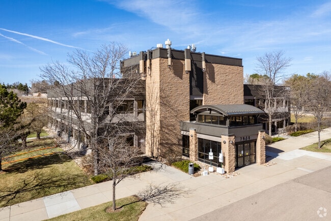
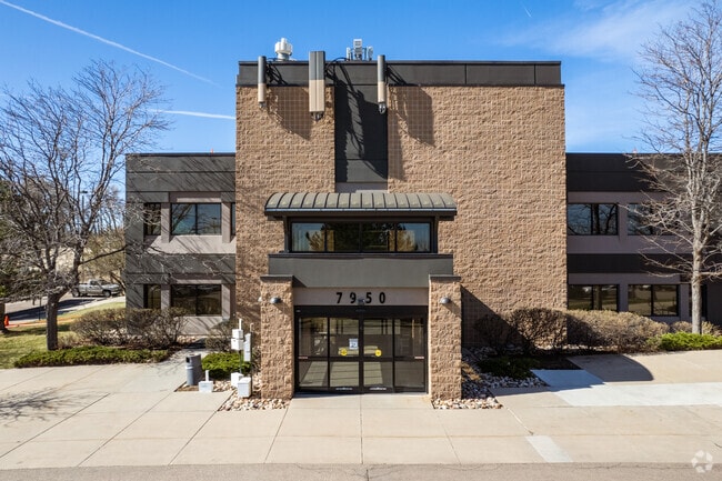
Property Record
7950 Kipling St, Arvada, CO 80005


Current Lease Availabilities
Property Detail
7950 Kipling St
Denver-Aurora-Centennial, CO
SECTION 34 TOWNSHIP 02 RANGE 69 QTR NW SUBDIVISIONCD 046250 SUBDIVISIONNAME ARVADA FAMILY HEALTH CARE CENTER 2ND FLG MINOR BLOCK LOT 0001 SIZE: 182952 TRACT VALUE: 4.200
29-342-05-089
JEFFERSON
Commercialnec
Colorado
B and X Area of moderate flood hazard, usually the area between the limits of the 100-year and 500-year floods.
1
2023
4.20 AC
2024
Northwest Denver
010206
Denver
34,721 SF
NEARBY LISTINGS FOR SALE OR LEASE
DEMOGRAPHICS near 7950 Kipling St
1 mile
3 mile
5 mile
2024 Total Population
10,372
103,264
246,746
2029 Population
10,187
102,183
248,029
Pop Growth 2024-2029
(1.78%)
(1.05%)
+ 0.52%
Average Age
45
42
41
2024 Total Households
4,062
41,292
98,871
HH Growth 2024-2029
(1.92%)
(1.09%)
+ 0.53%
Median Household Inc
$132,330
$104,629
$101,249
Avg Household Size
2.50
2.40
2.40
2024 Avg HH Vehicles
2.00
2.00
2.00
Median Home Value
$706,884
$653,498
$641,398
Median Year Built
1976
1976
1979
Nearby Places
Map Layers
Map Styles
 Street
 Aerial
Transit
 Traffic
 Biking
Places
Listings with unknown addresses are not visible on the map
- Restaurants
- Banks
- Shops
- Fitness
- Groceries
PUBLIC TRANSPORTATION
COMMUTER RAIL
Drive
Walk
Distance
9 min
4.3 mi
Drive
Walk
Distance
10 min
4.3 mi
AIRPORT
Denver International
Drive
Walk
Distance
Denver International
44 min
32.2 mi
Nearby Properties
Address
Land Use
TOTAL SIZE
Lot Size
Zoning
Address
Land Use
TOTAL SIZE
Lot Size
Zoning
269,013 SF
31.89 AC
Address
Land Use
TOTAL SIZE
Lot Size
Zoning
253,643 SF
50.87 AC
A2
Address
Land Use
TOTAL SIZE
Lot Size
Zoning
53,602 SF
2.37 AC
Address
Land Use
TOTAL SIZE
Lot Size
Zoning
70,338 SF
2.57 AC
Address
Land Use
TOTAL SIZE
Lot Size
Zoning
114,230 SF
2.88 AC
Address
Land Use
TOTAL SIZE
Lot Size
Zoning
215,878 SF
11.82 AC
A2
Address
Land Use
TOTAL SIZE
Lot Size
Zoning
262,699 SF
13.10 AC
A2
Address
Land Use
TOTAL SIZE
Lot Size
Zoning
559,786 SF
26.52 AC
Address
Land Use
TOTAL SIZE
Lot Size
Zoning
115,054 SF
21.38 AC
Address
Land Use
TOTAL SIZE
Lot Size
Zoning
101,761 SF
4.34 AC
Address
Land Use
TOTAL SIZE
Lot Size
Zoning
115,723 SF
24.06 AC
Address
Land Use
TOTAL SIZE
Lot Size
Zoning
162,509 SF
11.84 AC
Address
Land Use
TOTAL SIZE
Lot Size
Zoning
149,115 SF
18 AC
Address
Land Use
TOTAL SIZE
Lot Size
Zoning
264,405 SF
10.82 AC
Address
Land Use
TOTAL SIZE
Lot Size
Zoning
91,734 SF
9.69 AC
Address
Land Use
TOTAL SIZE
Lot Size
Zoning
116,262 SF
8.14 AC
Address
Land Use
TOTAL SIZE
Lot Size
Zoning
253,558 SF
10.26 AC
A2
Address
Land Use
TOTAL SIZE
Lot Size
Zoning
248,096 SF
19.67 AC
Address
Land Use
TOTAL SIZE
Lot Size
Zoning
232,893 SF
6.79 AC
A2
Address
Land Use
TOTAL SIZE
Lot Size
Zoning
150,962 SF
4.20 AC
Address
Land Use
TOTAL SIZE
Lot Size
Zoning
225,274 SF
5.37 AC
Address
Land Use
TOTAL SIZE
Lot Size
Zoning
258,995 SF
1.23 AC
Address
Land Use
TOTAL SIZE
Lot Size
Zoning
113,903 SF
12.25 AC
Address
Land Use
TOTAL SIZE
Lot Size
Zoning
170,136 SF
13.62 AC
Address
Land Use
TOTAL SIZE
Lot Size
Zoning
33,506 SF
9.98 AC
A2
Address
Land Use
TOTAL SIZE
Lot Size
Zoning
212,974 SF
26.65 AC
A1
Address
Land Use
TOTAL SIZE
Lot Size
Zoning
213,280 SF
9.32 AC
A2
Address
Land Use
TOTAL SIZE
Lot Size
Zoning
82,055 SF
19.39 AC
Address
Land Use
TOTAL SIZE
Lot Size
Zoning
68,300 SF
6 AC
Address
Land Use
TOTAL SIZE
Lot Size
Zoning
83,684 SF
8.15 AC
The World's #1 Commercial Real Estate Marketplace
Connect with us
© 2026 CoStar Group
The information above has been obtained from sources believed reliable. While we do not doubt its accuracy we have not verified it and make no guarantee, warranty or representation about it. It is your responsibility to independently confirm its accuracy and completeness. Any projections, opinions, assumptions, or estimates used are for example only and do not represent the current or future performance of the property. The value of this transaction to you depends on tax and other factors which should be evaluated by your tax, financial, and legal advisors. You and your advisors should conduct a careful, independent investigation of the property to determine to your satisfaction the suitability of the property for your needs.