Property Record
8020 Lee Dr, Arvada, CO 80005
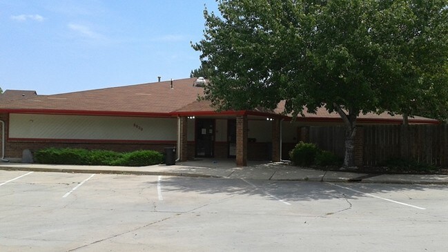

Property Detail
8020 Lee Dr
Denver-Aurora-Centennial, CO
SECTION 28 TOWNSHIP 02 RANGE 69 QTR SE SUBDIVISIONCD 437000 SUBDIVISIONNAME LAKECREST OFFICE PARK BLOCK LOT 0001 SIZE: 25670 TRACT VALUE: .589
29-284-10-001
JEFFERSON
Commercialnec
Colorado
B and X Area of moderate flood hazard, usually the area between the limits of the 100-year and 500-year floods.
1
2025
0.59 AC
2025
Northwest Denver
009815
Denver
4,995 SF
NEARBY LISTINGS FOR SALE OR LEASE
DEMOGRAPHICS near 8020 Lee Dr
1 mile
3 mile
5 mile
2025 Total Population
9,722
99,610
237,808
2030 Population
9,543
98,541
238,763
Pop Growth 2025-2030
(1.84%)
(1.07%)
+ 0.40%
Average Age
45
42
41
2025 Total Households
3,792
39,640
95,490
HH Growth 2025-2030
(1.98%)
(1.12%)
+ 0.42%
Median Household Inc
$134,040
$106,947
$102,200
Avg Household Size
2.50
2.40
2.40
2025 Avg HH Vehicles
2.00
2.00
2.00
Median Home Value
$708,695
$658,747
$646,127
Median Year Built
1976
1977
1979
Nearby Places
Map Layers
Map Styles
 Street
 Aerial
Layers
 Traffic
 Biking
Places
Listings with unknown addresses are not visible on the map
- Restaurants
- Banks
- Shops
- Fitness
- Groceries
PUBLIC TRANSPORTATION
COMMUTER RAIL
Drive
Walk
Distance
9 min
4.5 mi
Drive
Walk
Distance
9 min
4.5 mi
AIRPORT
Denver International
Drive
Walk
Distance
Denver International
44 min
32.3 mi
SALE & LEASE HISTORY
LISTING DATE
SALE/LEASE

Apr 24, 2017
For Lease
Apr 02, 2018
For Lease
Nearby Properties
Address
Land Use
TOTAL SIZE
Lot Size
Zoning
Address
Land Use
TOTAL SIZE
Lot Size
Zoning
559,786 SF
26.52 AC
Address
Land Use
TOTAL SIZE
Lot Size
Zoning
248,096 SF
19.67 AC
Address
Land Use
TOTAL SIZE
Lot Size
Zoning
103,174 SF
1.23 AC
Address
Land Use
TOTAL SIZE
Lot Size
Zoning
97,944 SF
6.34 AC
Address
Land Use
TOTAL SIZE
Lot Size
Zoning
59,824 SF
0.96 AC
Address
Land Use
TOTAL SIZE
Lot Size
Zoning
269,013 SF
31.89 AC
Address
Land Use
TOTAL SIZE
Lot Size
Zoning
46,922 SF
2.35 AC
Address
Land Use
TOTAL SIZE
Lot Size
Zoning
253,643 SF
50.87 AC
A2
Address
Land Use
TOTAL SIZE
Lot Size
Zoning
29,986 SF
2.88 AC
Address
Land Use
TOTAL SIZE
Lot Size
Zoning
361,013 SF
2.88 AC
Address
Land Use
TOTAL SIZE
Lot Size
Zoning
54,191 SF
2.37 AC
Address
Land Use
TOTAL SIZE
Lot Size
Zoning
25,711 SF
2.57 AC
Address
Land Use
TOTAL SIZE
Lot Size
Zoning
212,427 SF
21.38 AC
Address
Land Use
TOTAL SIZE
Lot Size
Zoning
162,509 SF
11.84 AC
Address
Land Use
TOTAL SIZE
Lot Size
Zoning
345,445 SF
8.41 AC
Address
Land Use
TOTAL SIZE
Lot Size
Zoning
262,699 SF
13.10 AC
A2
Address
Land Use
TOTAL SIZE
Lot Size
Zoning
215,878 SF
11.82 AC
A2
Address
Land Use
TOTAL SIZE
Lot Size
Zoning
101,761 SF
4.34 AC
Address
Land Use
TOTAL SIZE
Lot Size
Zoning
115,723 SF
24.06 AC
Address
Land Use
TOTAL SIZE
Lot Size
Zoning
116,262 SF
8.14 AC
Address
Land Use
TOTAL SIZE
Lot Size
Zoning
113,903 SF
12.25 AC
Address
Land Use
TOTAL SIZE
Lot Size
Zoning
264,405 SF
10.82 AC
Address
Land Use
TOTAL SIZE
Lot Size
Zoning
150,962 SF
4.20 AC
Address
Land Use
TOTAL SIZE
Lot Size
Zoning
253,558 SF
10.26 AC
A2
Address
Land Use
TOTAL SIZE
Lot Size
Zoning
232,893 SF
6.79 AC
A2
Address
Land Use
TOTAL SIZE
Lot Size
Zoning
170,136 SF
13.62 AC
Address
Land Use
TOTAL SIZE
Lot Size
Zoning
149,115 SF
18 AC
Address
Land Use
TOTAL SIZE
Lot Size
Zoning
175,943 SF
42.20 AC
Address
Land Use
TOTAL SIZE
Lot Size
Zoning
33,506 SF
9.98 AC
A2
Address
Land Use
TOTAL SIZE
Lot Size
Zoning
213,280 SF
9.32 AC
A2
The World's #1 Commercial Real Estate Marketplace
Connect with us
© 2026 CoStar Group
The information above has been obtained from sources believed reliable. While we do not doubt its accuracy we have not verified it and make no guarantee, warranty or representation about it. It is your responsibility to independently confirm its accuracy and completeness. Any projections, opinions, assumptions, or estimates used are for example only and do not represent the current or future performance of the property. The value of this transaction to you depends on tax and other factors which should be evaluated by your tax, financial, and legal advisors. You and your advisors should conduct a careful, independent investigation of the property to determine to your satisfaction the suitability of the property for your needs.