Property Record
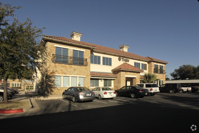
804 W Saint Elmo Rd, Austin, TX 78745


Property Detail
804 W Saint Elmo Rd
Austin-Round Rock-San Marcos, TX
UNT A-1 POST OAK CENTRE SOUTH OFFICE CONDOMINIUMS AMENDED PLUS 9.664 % INT IN COM AREA
553470
TRAVIS
Commercialcondominium
Texas
B and X Area of moderate flood hazard, usually the area between the limits of the 100-year and 500-year floods.
a-1
2025
0.43 AC
2025
South
002409
Austin
4,935 SF
NEARBY LISTINGS FOR SALE OR LEASE
DEMOGRAPHICS near 804 W Saint Elmo Rd
1 mile
3 mile
5 mile
2025 Total Population
18,799
149,584
358,398
2030 Population
19,791
156,782
376,018
Pop Growth 2025-2030
+ 5.28%
+ 4.81%
+ 4.92%
Average Age
38
37
37
2025 Total Households
8,996
70,912
161,703
HH Growth 2025-2030
+ 5.86%
+ 5.49%
+ 5.74%
Median Household Inc
$90,982
$84,763
$89,504
Avg Household Size
1.90
2.00
2.10
2025 Avg HH Vehicles
2.00
2.00
2.00
Median Home Value
$648,006
$657,917
$638,983
Median Year Built
1982
1988
1998
Nearby Places
Map Layers
Map Styles
 Street
 Aerial
Layers
 Traffic
 Biking
Places
Listings with unknown addresses are not visible on the map
- Restaurants
- Banks
- Shops
- Fitness
- Groceries
PUBLIC TRANSPORTATION
COMMUTER RAIL
Austin (Texas Eagle - Amtrak)
Drive
Walk
Distance
Austin (Texas Eagle - Amtrak)
12 min
4.6 mi
AIRPORT
Austin-Bergstrom International
Drive
Walk
Distance
Austin-Bergstrom International
21 min
9.8 mi
Freight Ports
Calhoun Port
Drive
Walk
Distance
Calhoun Port
187 min
153.3 mi
Nearby Properties
Address
Land Use
TOTAL SIZE
Lot Size
Zoning
Address
Land Use
TOTAL SIZE
Lot Size
Zoning
498,684 SF
61.86 AC
Address
Land Use
TOTAL SIZE
Lot Size
Zoning
47.20 AC
Address
Land Use
TOTAL SIZE
Lot Size
Zoning
Address
Land Use
TOTAL SIZE
Lot Size
Zoning
27.45 AC
Address
Land Use
TOTAL SIZE
Lot Size
Zoning
8,213 SF
36.95 AC
Address
Land Use
TOTAL SIZE
Lot Size
Zoning
442,023 SF
8.97 AC
Address
Land Use
TOTAL SIZE
Lot Size
Zoning
372,000 SF
1.35 AC
Address
Land Use
TOTAL SIZE
Lot Size
Zoning
368,349 SF
17.13 AC
Address
Land Use
TOTAL SIZE
Lot Size
Zoning
456,650 SF
15 AC
Address
Land Use
TOTAL SIZE
Lot Size
Zoning
551,881 SF
34.85 AC
Address
Land Use
TOTAL SIZE
Lot Size
Zoning
224,624 SF
4.61 AC
Address
Land Use
TOTAL SIZE
Lot Size
Zoning
454,740 SF
27.77 AC
Address
Land Use
TOTAL SIZE
Lot Size
Zoning
300,530 SF
3.62 AC
Address
Land Use
TOTAL SIZE
Lot Size
Zoning
413,880 SF
30.21 AC
Address
Land Use
TOTAL SIZE
Lot Size
Zoning
316,847 SF
10.35 AC
Address
Land Use
TOTAL SIZE
Lot Size
Zoning
342,956 SF
6.15 AC
Address
Land Use
TOTAL SIZE
Lot Size
Zoning
69.49 AC
Address
Land Use
TOTAL SIZE
Lot Size
Zoning
539,533 SF
26.50 AC
Address
Land Use
TOTAL SIZE
Lot Size
Zoning
398,436 SF
30.81 AC
Address
Land Use
TOTAL SIZE
Lot Size
Zoning
249,337 SF
2.71 AC
Address
Land Use
TOTAL SIZE
Lot Size
Zoning
386,952 SF
6.77 AC
Address
Land Use
TOTAL SIZE
Lot Size
Zoning
401,771 SF
59.77 AC
Address
Land Use
TOTAL SIZE
Lot Size
Zoning
198,532 SF
2.06 AC
Address
Land Use
TOTAL SIZE
Lot Size
Zoning
263,050 SF
4.04 AC
Address
Land Use
TOTAL SIZE
Lot Size
Zoning
256,182 SF
3.63 AC
Address
Land Use
TOTAL SIZE
Lot Size
Zoning
281,588 SF
6.29 AC
Address
Land Use
TOTAL SIZE
Lot Size
Zoning
258,637 SF
3.03 AC
Address
Land Use
TOTAL SIZE
Lot Size
Zoning
270,600 SF
3.90 AC
Address
Land Use
TOTAL SIZE
Lot Size
Zoning
366,275 SF
39.95 AC
Address
Land Use
TOTAL SIZE
Lot Size
Zoning
372,125 SF
26.22 AC
The World's #1 Commercial Real Estate Marketplace
Connect with us
© 2026 CoStar Group
The information above has been obtained from sources believed reliable. While we do not doubt its accuracy we have not verified it and make no guarantee, warranty or representation about it. It is your responsibility to independently confirm its accuracy and completeness. Any projections, opinions, assumptions, or estimates used are for example only and do not represent the current or future performance of the property. The value of this transaction to you depends on tax and other factors which should be evaluated by your tax, financial, and legal advisors. You and your advisors should conduct a careful, independent investigation of the property to determine to your satisfaction the suitability of the property for your needs.