Property Record
8720 W University Dr, Mckinney, TX 75071


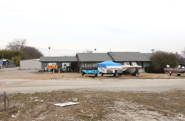

Property Detail
8720 W University Dr
R-12297-00A-0010-1
WALNUT GROVE SHOPS SUBDIVISION, BLK A, LOT 1
Commercialacreage
COLLIN
COMM
Texas
B and X Area of moderate flood hazard, usually the area between the limits of the 100-year and 500-year floods.
1
2025
0.44 AC
2025
Allen/McKinney
030301
Dallas/Ft Worth
4,154 SF
Dallas-Fort Worth-Arlington, TX
NEARBY LISTINGS FOR SALE OR LEASE
DEMOGRAPHICS near 8720 W University Dr
1 mile
3 mile
5 mile
2025 Total Population
6,096
90,760
238,109
2030 Population
6,976
103,354
273,248
Pop Growth 2025-2030
+ 14.44%
+ 13.88%
+ 14.76%
Average Age
37
37
37
2025 Total Households
2,054
29,718
76,819
HH Growth 2025-2030
+ 14.65%
+ 14.08%
+ 14.95%
Median Household Inc
$166,451
$158,746
$157,399
Avg Household Size
3.00
3.00
3.10
2025 Avg HH Vehicles
2.00
2.00
2.00
Median Home Value
$611,016
$620,222
$630,713
Median Year Built
2009
2010
2010
Nearby Places
Map Layers
Map Styles
 Street
 Aerial
Transit
 Traffic
 Biking
Places
Listings with unknown addresses are not visible on the map
- Restaurants
- Banks
- Shops
- Fitness
- Groceries
PUBLIC TRANSPORTATION
AIRPORT
Dallas-Fort Worth International
Drive
Walk
Distance
Dallas-Fort Worth International
42 min
33.8 mi
Dallas Love Field
Drive
Walk
Distance
Dallas Love Field
45 min
35.6 mi
Freight Ports
Port of Shreveport
Drive
Walk
Distance
Port of Shreveport
246 min
226.2 mi
SALE & LEASE HISTORY
LISTING DATE
SALE/LEASE

Aug 20, 2020
For Sale
Nearby Properties
Address
Land Use
TOTAL SIZE
Lot Size
Zoning
Address
Land Use
TOTAL SIZE
Lot Size
Zoning
469,170 SF
56.84 AC
Address
Land Use
TOTAL SIZE
Lot Size
Zoning
882,734 SF
98.26 AC
Address
Land Use
TOTAL SIZE
Lot Size
Zoning
621,249 SF
80.03 AC
Address
Land Use
TOTAL SIZE
Lot Size
Zoning
681,949 SF
71.30 AC
Address
Land Use
TOTAL SIZE
Lot Size
Zoning
641,090 SF
60.44 AC
Address
Land Use
TOTAL SIZE
Lot Size
Zoning
490,246 SF
24.39 AC
MF-M
Address
Land Use
TOTAL SIZE
Lot Size
Zoning
398,732 SF
25.88 AC
MF-M
Address
Land Use
TOTAL SIZE
Lot Size
Zoning
505,541 SF
19.78 AC
SFR
Address
Land Use
TOTAL SIZE
Lot Size
Zoning
218,013 SF
32.85 AC
AG
Address
Land Use
TOTAL SIZE
Lot Size
Zoning
274,184 SF
20.34 AC
COMM
Address
Land Use
TOTAL SIZE
Lot Size
Zoning
348,136 SF
23.07 AC
MF-L
Address
Land Use
TOTAL SIZE
Lot Size
Zoning
275,288 SF
19.40 AC
MF-M
Address
Land Use
TOTAL SIZE
Lot Size
Zoning
251,455 SF
35.62 AC
Address
Land Use
TOTAL SIZE
Lot Size
Zoning
282,528 SF
5.14 AC
MF-R
Address
Land Use
TOTAL SIZE
Lot Size
Zoning
264,070 SF
15.74 AC
MF-M
Address
Land Use
TOTAL SIZE
Lot Size
Zoning
197,115 SF
10.37 AC
MF-M
Address
Land Use
TOTAL SIZE
Lot Size
Zoning
243,827 SF
13.23 AC
MF
Address
Land Use
TOTAL SIZE
Lot Size
Zoning
201,902 SF
11.22 AC
MF-M
Address
Land Use
TOTAL SIZE
Lot Size
Zoning
118,608 SF
5.24 AC
Address
Land Use
TOTAL SIZE
Lot Size
Zoning
98,872 SF
10.77 AC
Address
Land Use
TOTAL SIZE
Lot Size
Zoning
91,545 SF
9.08 AC
Address
Land Use
TOTAL SIZE
Lot Size
Zoning
105,321 SF
12.29 AC
Address
Land Use
TOTAL SIZE
Lot Size
Zoning
126,334 SF
26.04 AC
Address
Land Use
TOTAL SIZE
Lot Size
Zoning
113,730 SF
Address
Land Use
TOTAL SIZE
Lot Size
Zoning
100,900 SF
10.08 AC
Address
Land Use
TOTAL SIZE
Lot Size
Zoning
202,093 SF
23.07 AC
Address
Land Use
TOTAL SIZE
Lot Size
Zoning
81,464 SF
19.93 AC
Address
Land Use
TOTAL SIZE
Lot Size
Zoning
73,256 SF
4.97 AC
Address
Land Use
TOTAL SIZE
Lot Size
Zoning
160,555 SF
5.01 AC
Address
Land Use
TOTAL SIZE
Lot Size
Zoning
144,257 SF
20.21 AC
The World's #1 Commercial Real Estate Marketplace
Connect with us
© 2026 CoStar Group
The information above has been obtained from sources believed reliable. While we do not doubt its accuracy we have not verified it and make no guarantee, warranty or representation about it. It is your responsibility to independently confirm its accuracy and completeness. Any projections, opinions, assumptions, or estimates used are for example only and do not represent the current or future performance of the property. The value of this transaction to you depends on tax and other factors which should be evaluated by your tax, financial, and legal advisors. You and your advisors should conduct a careful, independent investigation of the property to determine to your satisfaction the suitability of the property for your needs.