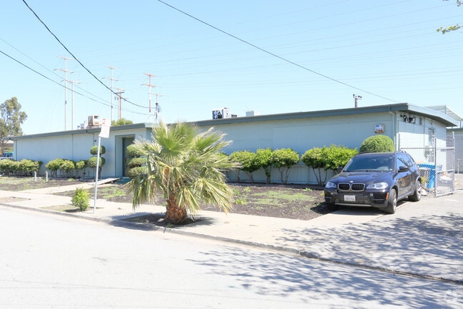
Property Record
890 7Th Ave, San Bruno, CA 94066


Current Lease Availabilities
Property Detail
890 7Th Ave
020-155-010
LOTS 1 2 3 4 5 & 6 BLOCK 32 BELLE AIR PARK RSM 5/10
Miscellaneous
San Mateo
R10000
California
AE The base floodplain where base flood elevations are provided. AE Zones are now used on new format FIRMs instead of A1-A30 Zones.
1
2024
0.34 AC
2025
San Bruno/Millbrae
604200
San Francisco
4,370 SF
San Francisco-San Mateo-Redwood City, CA
NEARBY LISTINGS FOR SALE OR LEASE
DEMOGRAPHICS near 890 7Th Ave
1 mile
3 mile
5 mile
2025 Total Population
12,590
111,838
222,910
2030 Population
12,669
112,304
224,047
Pop Growth 2025-2030
+ 0.63%
+ 0.42%
+ 0.51%
Average Age
41
43
43
2025 Total Households
4,124
38,553
77,622
HH Growth 2025-2030
+ 1.14%
+ 0.34%
+ 0.49%
Median Household Inc
$136,530
$134,098
$141,138
Avg Household Size
2.90
2.80
2.80
2025 Avg HH Vehicles
2.00
2.00
2.00
Median Home Value
$1,024,353
$1,085,807
$1,081,341
Median Year Built
1956
1961
1965
Nearby Places
Map Layers
Map Styles
 Street
 Aerial
Layers
 Traffic
 Biking
Places
Listings with unknown addresses are not visible on the map
- Restaurants
- Banks
- Shops
- Fitness
- Groceries
PUBLIC TRANSPORTATION
TRANSIT/SUBWAY
San Bruno Station (Dublin/Pleasanton - Millbrae - Bay Area Rapid Transit (BART), Pittsburg/Bay Point - San Francisco International - Bay Area Rapid Transit (BART), Richmond - Millbrae - Bay Area Rapid Transit (BART))
Drive
Walk
Distance
San Bruno Station (Dublin/Pleasanton - Millbrae - Bay Area Rapid Transit (BART), Pittsburg/Bay Point - San Francisco International - Bay Area Rapid Transit (BART), Richmond - Millbrae - Bay Area Rapid Transit (BART))
4 min
16 min
0.8 mi
COMMUTER RAIL
Drive
Walk
Distance
2 min
10 min
0.5 mi
Drive
Walk
Distance
5 min
2.4 mi
AIRPORT
San Francisco International
Drive
Walk
Distance
San Francisco International
6 min
2.4 mi
Metro Oakland International
Drive
Walk
Distance
Metro Oakland International
43 min
32.7 mi
Norman Y Mineta San Jose International
Drive
Walk
Distance
Norman Y Mineta San Jose International
43 min
34.1 mi
Nearby Properties
Address
Land Use
TOTAL SIZE
Lot Size
Zoning
Address
Land Use
TOTAL SIZE
Lot Size
Zoning
780,375 SF
23.23 AC
Address
Land Use
TOTAL SIZE
Lot Size
Zoning
Address
Land Use
TOTAL SIZE
Lot Size
Zoning
2,008 SF
16.83 AC
Address
Land Use
TOTAL SIZE
Lot Size
Zoning
574,675 SF
10.07 AC
Address
Land Use
TOTAL SIZE
Lot Size
Zoning
Address
Land Use
TOTAL SIZE
Lot Size
Zoning
6.67 AC
PD0000
Address
Land Use
TOTAL SIZE
Lot Size
Zoning
350,036 SF
2.91 AC
Address
Land Use
TOTAL SIZE
Lot Size
Zoning
323,091 SF
14.83 AC
Address
Land Use
TOTAL SIZE
Lot Size
Zoning
Address
Land Use
TOTAL SIZE
Lot Size
Zoning
24,070 SF
6.44 AC
M2000H
Address
Land Use
TOTAL SIZE
Lot Size
Zoning
529,342 SF
5.28 AC
Address
Land Use
TOTAL SIZE
Lot Size
Zoning
161,850 SF
7.48 AC
Address
Land Use
TOTAL SIZE
Lot Size
Zoning
4,047 SF
4.25 AC
Address
Land Use
TOTAL SIZE
Lot Size
Zoning
293,445 SF
6.70 AC
MH00M2
Address
Land Use
TOTAL SIZE
Lot Size
Zoning
10,000 SF
0.48 AC
ML00M1
Address
Land Use
TOTAL SIZE
Lot Size
Zoning
528,605 SF
17.06 AC
M2000H
Address
Land Use
TOTAL SIZE
Lot Size
Zoning
152,145 SF
6.10 AC
MH00M2
Address
Land Use
TOTAL SIZE
Lot Size
Zoning
176,096 SF
2.74 AC
Address
Land Use
TOTAL SIZE
Lot Size
Zoning
2,016 SF
3.61 AC
Address
Land Use
TOTAL SIZE
Lot Size
Zoning
2,007 SF
7.66 AC
Address
Land Use
TOTAL SIZE
Lot Size
Zoning
112,912 SF
5.96 AC
MH00M2
Address
Land Use
TOTAL SIZE
Lot Size
Zoning
254,775 SF
17.01 AC
Address
Land Use
TOTAL SIZE
Lot Size
Zoning
198,375 SF
5.52 AC
PD0000
Address
Land Use
TOTAL SIZE
Lot Size
Zoning
5.02 AC
Address
Land Use
TOTAL SIZE
Lot Size
Zoning
126,971 SF
3.04 AC
Address
Land Use
TOTAL SIZE
Lot Size
Zoning
19,657 SF
0.69 AC
Address
Land Use
TOTAL SIZE
Lot Size
Zoning
Address
Land Use
TOTAL SIZE
Lot Size
Zoning
107,773 SF
6.73 AC
M20000
Address
Land Use
TOTAL SIZE
Lot Size
Zoning
1,282,685 SF
21.15 AC
Address
Land Use
TOTAL SIZE
Lot Size
Zoning
2,008 SF
8.84 AC
The World's #1 Commercial Real Estate Marketplace
Connect with us
© 2026 CoStar Group
The information above has been obtained from sources believed reliable. While we do not doubt its accuracy we have not verified it and make no guarantee, warranty or representation about it. It is your responsibility to independently confirm its accuracy and completeness. Any projections, opinions, assumptions, or estimates used are for example only and do not represent the current or future performance of the property. The value of this transaction to you depends on tax and other factors which should be evaluated by your tax, financial, and legal advisors. You and your advisors should conduct a careful, independent investigation of the property to determine to your satisfaction the suitability of the property for your needs.