Property Record
9 E Superior St, Chicago, IL 60611

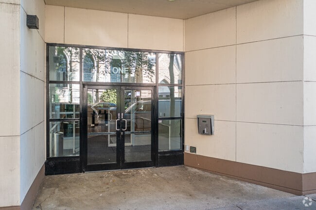

Current Lease Availabilities
Property Detail
9 E Superior St
17-10-103-002-0000
WEST75 FT N106 FT BLK48 S10 T39N R1 4E 3P
Apartment
Cook
PD 1042
Illinois
B and X Area of moderate flood hazard, usually the area between the limits of the 100-year and 500-year floods.
0.61 AC
2023
North Michigan Avenue
2025
Chicago
081500
Chicago-Naperville-Elgin, IL-IN
8,401 SF
NEARBY LISTINGS FOR SALE OR LEASE
DEMOGRAPHICS near 9 E Superior St
1 mile
3 mile
5 mile
2025 Total Population
138,988
418,653
812,261
2030 Population
144,152
428,337
815,293
Pop Growth 2025-2030
+ 3.72%
+ 2.31%
+ 0.37%
Average Age
40
37
37
2025 Total Households
86,727
230,720
408,676
HH Growth 2025-2030
+ 3.45%
+ 2.19%
+ 0.53%
Median Household Inc
$122,944
$121,827
$106,596
Avg Household Size
1.60
1.70
1.90
2025 Avg HH Vehicles
1.00
1.00
1.00
Median Home Value
$544,331
$560,722
$503,724
Median Year Built
1993
1986
1971
Nearby Places
Map Layers
Map Styles
 Street
 Aerial
Layers
 Traffic
 Biking
Places
Listings with unknown addresses are not visible on the map
- Restaurants
- Banks
- Shops
- Fitness
- Groceries
PUBLIC TRANSPORTATION
TRANSIT/SUBWAY
Chicago Avenue Station (Red Line) (Red Line - Chicago Transit Authority "L" Trains (The "L"))
Drive
Walk
Distance
Chicago Avenue Station (Red Line) (Red Line - Chicago Transit Authority "L" Trains (The "L"))
0 min
2 min
0.1 mi
Grand Avenue Station (Red Line) (Red Line - Chicago Transit Authority "L" Trains (The "L"))
Drive
Walk
Distance
Grand Avenue Station (Red Line) (Red Line - Chicago Transit Authority "L" Trains (The "L"))
0 min
5 min
0.3 mi
Chicago Avenue Station (Brown, Purple Lines) (Brown Line - Chicago Transit Authority "L" Trains (The "L"), Purple Line - Chicago Transit Authority "L" Trains (The "L"))
Drive
Walk
Distance
Chicago Avenue Station (Brown, Purple Lines) (Brown Line - Chicago Transit Authority "L" Trains (The "L"), Purple Line - Chicago Transit Authority "L" Trains (The "L"))
1 min
8 min
0.4 mi
Clark/Division Station (Red Line - Chicago Transit Authority "L" Trains (The "L"))
Drive
Walk
Distance
Clark/Division Station (Red Line - Chicago Transit Authority "L" Trains (The "L"))
2 min
14 min
0.8 mi
Merchandise Mart Station (Brown Line - Chicago Transit Authority "L" Trains (The "L"), Purple Line - Chicago Transit Authority "L" Trains (The "L"))
Drive
Walk
Distance
Merchandise Mart Station (Brown Line - Chicago Transit Authority "L" Trains (The "L"), Purple Line - Chicago Transit Authority "L" Trains (The "L"))
2 min
15 min
0.8 mi
COMMUTER RAIL
Chicago Millennium Station (Metra Electric Line - Northeast Illinois Regional Commuter Railroad (Metra), South Shore Line - Northeast Illinois Regional Commuter Railroad (Metra))
Drive
Walk
Distance
Chicago Millennium Station (Metra Electric Line - Northeast Illinois Regional Commuter Railroad (Metra), South Shore Line - Northeast Illinois Regional Commuter Railroad (Metra))
3 min
19 min
1.0 mi
Chicago Ogilvie Transportation Center (Union Pacific North Line - Northeast Illinois Regional Commuter Railroad (Metra), Union Pacific Northwest Line - Northeast Illinois Regional Commuter Railroad (Metra), Union Pacific West Line - Northeast Illinois Regional Commuter Railroad (Metra))
Drive
Walk
Distance
Chicago Ogilvie Transportation Center (Union Pacific North Line - Northeast Illinois Regional Commuter Railroad (Metra), Union Pacific Northwest Line - Northeast Illinois Regional Commuter Railroad (Metra), Union Pacific West Line - Northeast Illinois Regional Commuter Railroad (Metra))
4 min
1.5 mi
AIRPORT
Chicago Midway International
Drive
Walk
Distance
Chicago Midway International
21 min
12.1 mi
Chicago O'Hare International
Drive
Walk
Distance
Chicago O'Hare International
27 min
17.3 mi
Freight Ports
Port Milwaukee
Drive
Walk
Distance
Port Milwaukee
105 min
85.6 mi
Nearby Properties
Address
Land Use
TOTAL SIZE
Lot Size
Zoning
Address
Land Use
TOTAL SIZE
Lot Size
Zoning
4,667,723 SF
2.94 AC
DC-16
Address
Land Use
TOTAL SIZE
Lot Size
Zoning
3,457,865 SF
3.74 AC
PD 70
Address
Land Use
TOTAL SIZE
Lot Size
Zoning
1,546,909 SF
0.98 AC
PD 1369
Address
Land Use
TOTAL SIZE
Lot Size
Zoning
1,496,448 SF
2 AC
PD 376
Address
Land Use
TOTAL SIZE
Lot Size
Zoning
1,396,750 SF
4.09 AC
PD 98
Address
Land Use
TOTAL SIZE
Lot Size
Zoning
1,362,475 SF
1.97 AC
PD 1226
Address
Land Use
TOTAL SIZE
Lot Size
Zoning
2,343,906 SF
2.32 AC
PD 70
Address
Land Use
TOTAL SIZE
Lot Size
Zoning
4,296,046 SF
6.15 AC
DC-16
Address
Land Use
TOTAL SIZE
Lot Size
Zoning
3,914,400 SF
5.70 AC
DC-16
Address
Land Use
TOTAL SIZE
Lot Size
Zoning
1,810,145 SF
1.03 AC
PD 365
Address
Land Use
TOTAL SIZE
Lot Size
Zoning
3,090,691 SF
3.30 AC
PD 377,PD
Address
Land Use
TOTAL SIZE
Lot Size
Zoning
1,215,367 SF
3.76 AC
PD 675
Address
Land Use
TOTAL SIZE
Lot Size
Zoning
0.82 AC
PD 1115
Address
Land Use
TOTAL SIZE
Lot Size
Zoning
0.88 AC
DC-16,PD 9
Address
Land Use
TOTAL SIZE
Lot Size
Zoning
2,750,656 SF
6.29 AC
PD 1065
Address
Land Use
TOTAL SIZE
Lot Size
Zoning
831,084 SF
2.05 AC
PD 316
Address
Land Use
TOTAL SIZE
Lot Size
Zoning
1,888,207 SF
2.03 AC
PD 264
Address
Land Use
TOTAL SIZE
Lot Size
Zoning
1,600,546 SF
1.04 AC
PD 191
Address
Land Use
TOTAL SIZE
Lot Size
Zoning
1,231,710 SF
2.01 AC
PD 27
Address
Land Use
TOTAL SIZE
Lot Size
Zoning
2,429,909 SF
2.93 AC
PD 882
Address
Land Use
TOTAL SIZE
Lot Size
Zoning
2,456,900 SF
0.96 AC
PD 256
Address
Land Use
TOTAL SIZE
Lot Size
Zoning
2,612,517 SF
1.28 AC
PD 256
Address
Land Use
TOTAL SIZE
Lot Size
Zoning
2.06 AC
DX-16
Address
Land Use
TOTAL SIZE
Lot Size
Zoning
1,272,928 SF
2.33 AC
PD 368
Address
Land Use
TOTAL SIZE
Lot Size
Zoning
1.23 AC
PD 291
Address
Land Use
TOTAL SIZE
Lot Size
Zoning
1,502,279 SF
3.79 AC
PD 98
Address
Land Use
TOTAL SIZE
Lot Size
Zoning
1.54 AC
PD 743
Address
Land Use
TOTAL SIZE
Lot Size
Zoning
1,559,966 SF
1.38 AC
DC-12
Address
Land Use
TOTAL SIZE
Lot Size
Zoning
1,493,502 SF
1.31 AC
PD 70
Address
Land Use
TOTAL SIZE
Lot Size
Zoning
1,316,385 SF
0.76 AC
PD 381
The World's #1 Commercial Real Estate Marketplace
Connect with us
© 2026 CoStar Group
The information above has been obtained from sources believed reliable. While we do not doubt its accuracy we have not verified it and make no guarantee, warranty or representation about it. It is your responsibility to independently confirm its accuracy and completeness. Any projections, opinions, assumptions, or estimates used are for example only and do not represent the current or future performance of the property. The value of this transaction to you depends on tax and other factors which should be evaluated by your tax, financial, and legal advisors. You and your advisors should conduct a careful, independent investigation of the property to determine to your satisfaction the suitability of the property for your needs.